

KARBOUW
Tanker

Current Trip
| Trip Time | 4 h, 42 mins |
|---|---|
| Trip Distance | 39.13 nm |
| AVG Speed | 8.5 Knots |
| MAX Speed | 9.9 Knots |
| Dybgang | 0 m |
| AVG Wind | 7.6 knots |
| MAX Wind | 10 knots |
| MIN Temp | 5.4°C / 41.72°F |
| MAX Temp | 6.2°C / 43.16°F |
| Position Modtaget | 3 m siden |
Current Position
| Longitude | --- |
|---|---|
| Latitude | --- |
| Status | Moored |
| Fart | 0.1 Knots |
| Kurs | --- |
| Område | North Sea |
| Station | T-AIS |
| Position Modtaget | 3 m siden |
Information
The current position of KARBOUW is in North Sea with coordinates 52.41550° / 4.74418° as reported on 2025-04-02 07:13 by AIS to our vessel tracker app. The vessel's current speed is 0.1 Knots and is currently inside the port of AMSTERDAM.
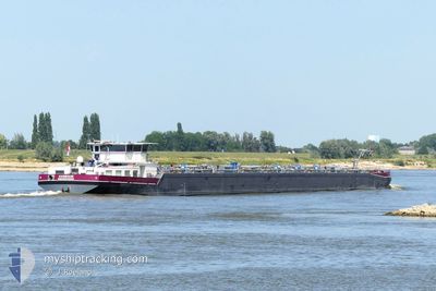
The vessel KARBOUW (MMSI: 244660086) is a Tanker It's sailing under the flag of [NL] Netherlands.
In this page you can find informations about the vessels current position, last detected port calls, and current voyage information. If the vessels is not in coverage by AIS you will find the latest position.
The current position of KARBOUW is detected by our AIS receivers and we are not responsible for the reliability of the data. The last position was recorded while the vessel was in Coverage by the Ais receivers of our vessel tracking app.
Weather
| Temperature | 7.1°C / 44.78°F |
|---|---|
| Wind Speed | 11 knots |
| Direction | 74° ENE |
| Pressure | 1026.5 hPa |
| Humidity | 75.2 % |
| Cloud Coverage | --- |


Featured Company
Last Port Calls
| Port | Arrival | Departure | Time In Port |
|---|---|---|---|
| 2025-04-02 06:32 | |||
| 2025-04-02 01:09 | 2025-04-02 01:50 | 40 m | |
| 2025-03-31 17:48 | 2025-04-01 12:04 | 18 h | |
| 2025-03-31 07:15 | 2025-03-31 16:46 | 9 h | |
| 2025-03-30 19:25 | 2025-03-31 06:07 | 10 h | |
| 2025-03-28 22:12 | 2025-03-30 17:52 | 1 d | |
| 2025-03-28 20:53 | 2025-03-28 21:39 | 45 m | |
| 2025-03-27 20:15 | 2025-03-27 20:41 | 25 m | |
| 2025-03-27 00:09 | 2025-03-27 12:10 | 12 h | |
| 2025-03-26 11:04 | 2025-03-26 22:54 | 11 h |
Last Trips
| Origin | Departure | Destination | Arrival | Distance | |
|---|---|---|---|---|---|
| 2025-04-02 01:50 | 2025-04-02 06:32 | 39.13 nm | |||
| 2025-04-01 12:04 | 2025-04-02 01:09 | 107.32 nm | |||
| 2025-03-31 16:46 | 2025-03-31 17:48 | 10.15 nm | |||
| 2025-03-31 06:07 | 2025-03-31 07:15 | 10.04 nm | |||
| 2025-03-30 17:52 | 2025-03-30 19:25 | 5.41 nm | |||
| 2025-03-28 21:39 | 2025-03-28 22:12 | 1.85 nm | |||
| 2025-03-27 20:41 | 2025-03-28 20:53 | 146.36 nm | |||
| 2025-03-27 12:10 | 2025-03-27 20:15 | 44.54 nm | |||
| 2025-03-26 22:54 | 2025-03-27 00:09 | 13.19 nm | |||
| 2025-03-26 09:32 | 2025-03-26 11:04 | 12.49 nm |
Events
| Tid | Hændelsen | Detaljer | Position / Dest | Info |
|---|---|---|---|---|
| 2025-04-02 04:52 | Status er ændret | Moored Under way using engine |
52.41550 / 4.74418
[NL] AMSTERDAM
|
Fart: Kurs: 511° |
| 2025-04-02 04:32 | STOP Sejllads |
52.41563 / 4.74412
[NL] AMSTERDAM
|
Fart: 0.3 kn Kurs: 511° |
|
| 2025-04-02 04:32 | Skibe i havn |
|
52.41563 / 4.74412
[NL] AMSTERDAM
|
Fart: 0.6 kn Kurs: 511° |
| 2025-04-01 23:50 | Afsejlet fra sidste havn |
|
51.97590 / 5.28958
WESSELING WESSELING
|
Fart: 8.7 kn Kurs: 294.7° |
| 2025-04-01 23:38 | START Sejllads |
51.96699 / 5.32036
[NL] WIJK BIJ DUURSTEDE
|
Fart: 3.4 kn Kurs: 296.3° |
|
| 2025-04-01 23:10 | STOP Sejllads |
51.96554 / 5.32515
[NL] WIJK BIJ DUURSTEDE
|
Fart: 0.2 kn Kurs: 511° |
|
| 2025-04-01 23:09 | Skibe i havn |
|
51.96554 / 5.32520
[NL] WIJK BIJ DUURSTEDE
|
Fart: 0.6 kn Kurs: 511° |
| 2025-04-01 22:17 | START Sejllads | 1.47 nm, North of TIEL |
51.91110 / 5.44868
WESSELING WESSELING
|
Fart: 6.6 kn Kurs: 332.7° |
| 2025-04-01 22:08 | STOP Sejllads | 1.38 nm, North of TIEL |
51.90943 / 5.45032
WESSELING WESSELING
|
Fart: 0.3 kn Kurs: 511° |
| 2025-04-01 18:14 | Indenfor Dækning |
51.82673 / 6.25138
North Sea
|
Fart: 9.3 kn Kurs: 290.2° |