

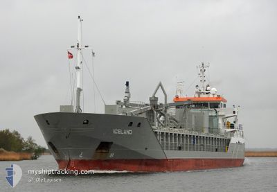
ICELAND
General Cargo

Current Trip
LVLPX
| Time Travelled | 6 h, 56 mins |
|---|---|
| Remaining Time | --- |
| Distance Travelled | 73.84 nm |
| Remaining Distance | --- |
| AVG Speed | 10.9 Knots |
| MAX Speed | 11.2 Knots |
| AVG Wind | 16.6 knots |
| MAX Wind | 18.5 knots |
| MIN Temp | 4.2°C / 39.56°F |
| MAX Temp | 4.5°C / 40.1°F |
| Dybgang | 4.2 m |
| Position Modtaget | 4 d siden |
Current Position
| Longitude | --- |
|---|---|
| Latitude | --- |
| Status | Under way using engine |
| Fart | 10.2 Knots |
| Kurs | 151.8° |
| Område | Baltic Sea |
| Station | T-AIS |
| Position Modtaget | 4 d siden |
Information
The current position of ICELAND is in Baltic Sea with coordinates 57.76796° / 19.72933° as reported on 2025-03-23 14:39 by AIS to our vessel tracker app. The vessel's current speed is 10.2 Knots
The vessel ICELAND (IMO: 9341782, MMSI: 246546000) is a General Cargo that was built in 2006 ( 19 år gamle ). It's sailing under the flag of [NL] Netherlands.
In this page you can find informations about the vessels current position, last detected port calls, and current voyage information. If the vessels is not in coverage by AIS you will find the latest position.
The current position of ICELAND is detected by our AIS receivers and we are not responsible for the reliability of the data. The last position was recorded while the vessel was in Coverage by the Ais receivers of our vessel tracking app.
The current draught of ICELAND as reported by AIS is 4.2 meters
Weather
| Temperature | 4.3°C / 39.74°F |
|---|---|
| Wind Speed | 16 knots |
| Direction | 234° SW |
| Pressure | 1014.1 hPa |
| Humidity | 93 % |
| Cloud Coverage | 9 % |


Featured Company
Last Port Calls
| Port | Arrival | Departure | Time In Port |
|---|---|---|---|
| 2025-03-26 17:46 | 2025-03-27 22:14 | 1 d | |
| 2025-03-25 10:34 | 2025-03-26 15:34 | 1 d | |
| 2025-03-23 04:28 | 2025-03-23 05:08 | 40 m | |
| 2025-03-22 01:42 | 2025-03-23 00:06 | 22 h | |
| 2025-03-21 21:00 | 2025-03-21 21:22 | 21 m | |
| 2025-03-19 03:34 | 2025-03-21 00:54 | 1 d | |
| 2025-03-17 03:36 | 2025-03-18 00:58 | 21 h | |
| 2025-03-14 12:54 | 2025-03-16 00:10 | 1 d | |
| 2025-03-13 19:15 | 2025-03-13 19:54 | 38 m | |
| 2025-03-12 13:14 | 2025-03-13 14:39 | 1 d |
Last Trips
| Origin | Departure | Destination | Arrival | Distance | |
|---|---|---|---|---|---|
| 2025-03-26 15:34 | 2025-03-26 17:46 | 7.89 nm | |||
| 2025-03-23 05:08 | 2025-03-25 10:34 | 202.40 nm | |||
| 2025-03-23 00:06 | 2025-03-23 04:28 | 49.09 nm | |||
| 2025-03-21 21:22 | 2025-03-22 01:42 | 48.73 nm | |||
| 2025-03-21 00:54 | 2025-03-21 21:00 | 203.21 nm | |||
| 2025-03-18 00:58 | 2025-03-19 03:34 | 337.03 nm | |||
| 2025-03-16 00:10 | 2025-03-17 03:36 | 334.66 nm | |||
| 2025-03-13 19:54 | 2025-03-14 12:54 | 196.44 nm | |||
| 2025-03-13 14:39 | 2025-03-13 19:15 | 48.93 nm | |||
| 2025-03-12 08:43 | 2025-03-12 13:14 | 49.00 nm |
Events
| Tid | Hændelsen | Detaljer | Position / Dest | Info |
|---|---|---|---|---|
| 2025-03-27 20:14 | Afsejlet fra sidste havn |
|
56.53011 / 20.96188
LVLPX
|
Fart: 7.8 kn Kurs: 293° |
| 2025-03-27 20:10 | START Sejllads |
56.52647 / 20.97722
[LV] LIEPAJA
|
Fart: 7.8 kn Kurs: 293° |
|
| 2025-03-26 15:50 | STOP Sejllads |
56.52291 / 20.99162
[LV] LIEPAJA
|
Fart: Kurs: 242° |
|
| 2025-03-26 15:46 | Skibe i havn |
|
56.52305 / 20.99189
[LV] LIEPAJA
|
Fart: 1.3 kn Kurs: 230° |
| 2025-03-26 14:58 | START Sejllads | 3.58 nm, West of LIEPAJA |
56.53451 / 20.88086
LVLPX
|
Fart: 3.1 kn Kurs: 133° |
| 2025-03-26 14:41 | STOP Sejllads | 3.72 nm, West of LIEPAJA |
56.53281 / 20.87640
LVLPX
|
Fart: 0.3 kn Kurs: 258° |
| 2025-03-26 13:34 | Afsejlet fra sidste havn |
|
56.53586 / 20.95790
LVLPX
|
Fart: 5.7 kn Kurs: 251° |
| 2025-03-26 12:58 | START Sejllads |
56.54229 / 21.03416
[LV] LIEPAJA
|
Fart: 4.9 kn Kurs: 234° |
|
| 2025-03-25 09:28 | STOP Sejllads |
56.54839 / 21.03616
[LV] LIEPAJA
|
Fart: Kurs: 305° |
|
| 2025-03-25 08:34 | Skibe i havn |
|
56.53825 / 20.97030
[LV] LIEPAJA
|
Fart: 9 kn Kurs: 68° |