
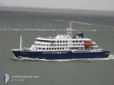
HONDIUS
Passenger
Current Trip
ORNE HARBOUR
| Time Travelled | 6 days |
|---|---|
| Remaining Time | --- |
| Distance Travelled | 942.38 nm |
| Remaining Distance | --- |
| AVG Speed | 8.4 Knots |
| MAX Speed | 13.9 Knots |
| AVG Wind | 7.9 knots |
| MAX Wind | 21.9 knots |
| MIN Temp | -6°C / 21.2°F |
| MAX Temp | 5.4°C / 41.72°F |
| Dybgang | 5.4 m |
| Position Modtaget | 1 m siden |
Current Position
| Longitude | --- |
|---|---|
| Latitude | --- |
| Status | Under way using engine |
| Fart | 2.4 Knots |
| Kurs | 19° |
| Område | Southern Ocean |
| Station | T-AIS |
| Position Modtaget | 1 m siden |
Info
Information
The current position of HONDIUS is in Southern Ocean with coordinates -64.85366° / -62.88786° as reported on 2024-12-12 05:19 by AIS to our vessel tracker app. The vessel's current speed is 2.4 Knots
The vessel HONDIUS (IMO: 9818709, MMSI: 244327000) is a Passenger It's sailing under the flag of [NL] Netherlands.
In this page you can find informations about the vessels current position, last detected port calls, and current voyage information. If the vessels is not in coverage by AIS you will find the latest position.
The current position of HONDIUS is detected by our AIS receivers and we are not responsible for the reliability of the data. The last position was recorded while the vessel was in Coverage by the Ais receivers of our vessel tracking app.
The current draught of HONDIUS as reported by AIS is 5.4 meters
Weather
| Temperature | -0.8°C / 30.56°F |
|---|---|
| Wind Speed | 11 knots |
| Direction | 45° NE |
| Pressure | 994.1 hPa |
| Humidity | 89.3 % |
| Cloud Coverage | 100 % |
Featured Company
Most Visited Ports (Last year)
| Port | Arrivals | |
|---|---|---|
| 11 | ||
| 2 | ||
| 1 | ||
| 1 | ||
| 1 | ||
| 1 |
Last Trips
| Origin | Departure | Destination | Arrival | Distance | |
|---|---|---|---|---|---|
| 2024-11-23 17:55 | 2024-12-05 01:22 | 1788.65 nm | |||
| 2024-11-13 21:04 | 2024-11-23 02:02 | 1830.94 nm | |||
| 2024-11-01 18:38 | 2024-11-12 23:50 | 1853.14 nm | |||
| 2024-10-25 18:13 | 2024-10-31 16:12 | 1429.02 nm | |||
| 2024-09-30 13:53 | 2024-10-25 06:41 | 6258.41 nm |
Events
| Tid | Hændelsen | Detaljer | Position / Dest | Info |
|---|---|---|---|---|
| 2024-12-12 05:03 | START Sejllads |
-64.85787 / -62.89388
ORNE HARBOUR
|
Fart: 3.2 kn Kurs: 266° |
|
| 2024-12-12 01:31 | STOP Sejllads |
-64.86002 / -62.85613
ORNE HARBOUR
|
Fart: 0.3 kn Kurs: 39° |
|
| 2024-12-12 01:15 | START Sejllads |
-64.86671 / -62.81962
ORNE HARBOUR
|
Fart: 3.2 kn Kurs: 293° |
|
| 2024-12-11 23:42 | STOP Sejllads |
-64.86743 / -62.81567
ORNE HARBOUR
|
Fart: 0.2 kn Kurs: 350° |
|
| 2024-12-11 20:20 | START Sejllads |
-64.62446 / -62.54329
ORNE HARBOUR
|
Fart: 3.1 kn Kurs: 350° |
|
| 2024-12-11 16:57 | STOP Sejllads |
-64.62860 / -62.54283
ORNE HARBOUR
|
Fart: 0.3 kn Kurs: 190° |
|
| 2024-12-11 15:22 | Destination er ændret | ORNE HARBOUR NEKO HARBOUR |
-64.81295 / -62.66559
ORNE HARBOUR
|
Fart: 9.6 kn Kurs: 322.5° |
| 2024-12-11 15:22 | ETA er ændret | 2024/12/11 17:30 2024/12/11 10:30 |
-64.81295 / -62.66559
ORNE HARBOUR
|
Fart: 9.6 kn Kurs: 322.5° |
| 2024-12-11 14:55 | START Sejllads |
-64.84342 / -62.54630
NEKO HARBOUR
|
Fart: 3.7 kn Kurs: 263° |
|
| 2024-12-11 10:48 | STOP Sejllads |
-64.84634 / -62.53881
NEKO HARBOUR
|
Fart: 0.2 kn Kurs: 151° |