
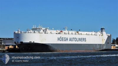
HOEGH ST.PETERSBURG
Vehicles Carrier
Current Trip
| Time Travelled | 16 days |
|---|---|
| Remaining Time | 1 day |
| Distance Travelled | 6233.20 nm |
| Remaining Distance | 554.63 nm |
| AVG Speed | 15.4 Knots |
| MAX Speed | 18.2 Knots |
| AVG Wind | 12.3 knots |
| MAX Wind | 22 knots |
| MIN Temp | 12.4°C / 54.32°F |
| MAX Temp | 28.2°C / 82.76°F |
| Dybgang | 9.3 m |
| Position Modtaget | 13 h, 24 m siden |
Current Position
| Longitude | --- |
|---|---|
| Latitude | --- |
| Status | Under way using engine |
| Fart | 16.4 Knots |
| Kurs | 114.7° |
| Område | South Atlantic Ocean |
| Station | T-AIS |
| Position Modtaget | 13 h, 24 m siden |
Info
Information
The current position of HOEGH ST.PETERSBURG is in South Atlantic Ocean with coordinates -34.59970° / 18.39354° as reported on 2025-03-03 02:42 by AIS to our vessel tracker app. The vessel's current speed is 16.4 Knots and is heading at the port of DURBAN. The estimated time of arrival as calculated by MyShipTracking vessel tracking app is 2025-03-05 03:27 LT
The vessel HOEGH ST.PETERSBURG (IMO: 9420045, MMSI: 257366000) is a Vehicles Carrier that was built in 2009 ( 16 år gamle ). It's sailing under the flag of [NO] Norway.
In this page you can find informations about the vessels current position, last detected port calls, and current voyage information. If the vessels is not in coverage by AIS you will find the latest position.
The current position of HOEGH ST.PETERSBURG is detected by our AIS receivers and we are not responsible for the reliability of the data. The last position was recorded while the vessel was in Coverage by the Ais receivers of our vessel tracking app.
The current draught of HOEGH ST.PETERSBURG as reported by AIS is 9.3 meters
Weather
| Temperature | 22.2°C / 71.96°F |
|---|---|
| Wind Speed | 4 knots |
| Direction | 46° NE |
| Pressure | 1006.9 hPa |
| Humidity | 83.2 % |
| Cloud Coverage | 29 % |
Featured Company
Last Port Calls
| Port | Arrival | Departure | Time In Port |
|---|---|---|---|
| 2025-02-14 05:51 | 2025-02-14 17:17 | 11 h | |
| 2025-02-12 04:09 | 2025-02-12 16:25 | 12 h | |
| 2025-02-09 22:39 | 2025-02-11 10:49 | 1 d | |
| 2025-02-07 02:58 | 2025-02-08 05:35 | 1 d | |
| 2025-02-04 03:53 | 2025-02-05 16:26 | 1 d | |
| 2025-01-12 19:18 | 2025-01-14 13:55 | 1 d | |
| 2025-01-02 03:35 | 2025-01-03 06:07 | 1 d |
Most Visited Ports (Last year)
| Port | Arrivals | |
|---|---|---|
| 4 | ||
| 3 | ||
| 3 | ||
| 3 | ||
| 2 | ||
| 2 |
Last Trips
| Origin | Departure | Destination | Arrival | Distance | |
|---|---|---|---|---|---|
| 2025-02-12 16:25 | 2025-02-14 05:51 | 593.51 nm | |||
| 2025-02-11 10:49 | 2025-02-12 04:09 | 252.60 nm | |||
| 2025-02-08 05:35 | 2025-02-09 22:39 | 594.35 nm | |||
| 2025-02-05 16:26 | 2025-02-07 02:58 | 388.24 nm | |||
| 2025-01-14 13:55 | 2025-02-04 03:53 | 6340.00 nm | |||
| 2025-01-03 06:07 | 2025-01-12 19:18 | 1974.04 nm | |||
| 2024-12-30 21:43 | 2025-01-02 03:35 | 573.56 nm |
Events
| Tid | Hændelsen | Detaljer | Position / Dest | Info |
|---|---|---|---|---|
| 2025-03-03 02:45 | Status er ændret | Default Under way using engine |
-34.60505 / 18.40766
ZADUR
|
Fart: 16.4 kn Kurs: 114.7° |
| 2025-03-03 02:42 | Status er ændret | Under way using engine Default |
-34.59970 / 18.39354
ZADUR
|
Fart: 16.4 kn Kurs: 116° |
| 2025-03-03 02:42 | Udenfor Dækning |
-34.59970 / 18.39354
South Atlantic Ocean
ZADUR
|
Fart: 16.4 kn Kurs: 114.7° |
|
| 2025-03-03 02:40 | Status er ændret | Default Under way using engine |
-34.59470 / 18.38060
ZADUR
|
Fart: 16.4 kn Kurs: 114.9° |
| 2025-03-03 01:59 | Status er ændret | Under way using engine Default |
-34.51163 / 18.18254
ZADUR
|
Fart: 15.9 kn Kurs: 120° |
| 2025-03-03 01:48 | Status er ændret | Default Under way using engine |
-34.48483 / 18.12722
ZADUR
|
Fart: 15.9 kn Kurs: 124.2° |
| 2025-03-03 01:40 | Status er ændret | Under way using engine Default |
-34.46670 / 18.09299
ZADUR
|
Fart: 15.9 kn Kurs: 124° |
| 2025-03-03 01:36 | Status er ændret | Default Under way using engine |
-34.45571 / 18.07351
ZADUR
|
Fart: 16 kn Kurs: 128.3° |
| 2025-03-03 00:48 | Status er ændret | Under way using engine Default |
-34.31095 / 17.88350
ZADUR
|
Fart: 16.4 kn Kurs: 137° |
| 2025-03-03 00:31 | Status er ændret | Default Under way using engine |
-34.25334 / 17.82254
ZADUR
|
Fart: 16.5 kn Kurs: 141.7° |