

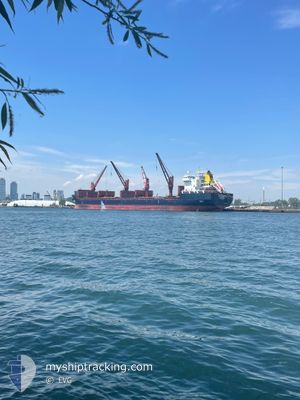
HELENA G
Bulk Carrier

Current Trip
| Time Travelled | 6 days |
|---|---|
| Remaining Time | 34 mins |
| Distance Travelled | 1451.51 nm |
| Remaining Distance | 9.47 nm |
| AVG Speed | 11.5 Knots |
| MAX Speed | 13.7 Knots |
| AVG Wind | 12.6 knots |
| MAX Wind | 29 knots |
| MIN Temp | 6.3°C / 43.34°F |
| MAX Temp | 20.8°C / 69.44°F |
| Dybgang | 9.5 m |
| Position Modtaget | 1 m siden |
Current Position
| Longitude | --- |
|---|---|
| Latitude | --- |
| Status | Under way using engine |
| Fart | 1.2 Knots |
| Kurs | 218° |
| Område | Mediterranean Sea - Eastern Basin |
| Station | T-AIS |
| Position Modtaget | 1 m siden |
Information
The current position of HELENA G is in Mediterranean Sea - Eastern Basin with coordinates 35.78733° / 14.70867° as reported on 2025-03-27 17:46 by AIS to our vessel tracker app. The vessel's current speed is 1.2 Knots and is heading at the port of VALLETTA. The estimated time of arrival as calculated by MyShipTracking vessel tracking app is 2025-03-27 19:21 LT
The vessel HELENA G (IMO: 9358383, MMSI: 255806030) is a Bulk Carrier that was built in 2007 ( 18 år gamle ). It's sailing under the flag of [PT] Portugal.
In this page you can find informations about the vessels current position, last detected port calls, and current voyage information. If the vessels is not in coverage by AIS you will find the latest position.
The current position of HELENA G is detected by our AIS receivers and we are not responsible for the reliability of the data. The last position was recorded while the vessel was in Coverage by the Ais receivers of our vessel tracking app.
The current draught of HELENA G as reported by AIS is 9.5 meters
Weather
| Temperature | 15.2°C / 59.36°F |
|---|---|
| Wind Speed | 22 knots |
| Direction | 287° WNW |
| Pressure | 1008.6 hPa |
| Humidity | 75.8 % |
| Cloud Coverage | 1 % |


Featured Company
Last Port Calls
| Port | Arrival | Departure | Time In Port |
|---|---|---|---|
| 2025-03-14 10:46 | 2025-03-21 14:13 | 7 d | |
| 2025-03-08 10:49 | 2025-03-12 20:52 | 4 d | |
| 2025-03-01 14:23 | 2025-03-05 20:41 | 4 d | |
| 2025-02-26 10:42 | 2025-02-27 15:34 | 1 d | |
| 2025-02-19 10:20 | 2025-02-22 11:22 | 3 d | |
| 2025-01-23 09:28 | 2025-01-28 07:43 | 4 d | |
| 2025-01-05 16:05 | 2025-01-10 23:07 | 5 d |
Most Visited Ports (Last year)
| Port | Arrivals | |
|---|---|---|
| 5 | ||
| 4 | ||
| 2 | ||
| 2 | ||
| 2 | ||
| 2 |
Last Trips
| Origin | Departure | Destination | Arrival | Distance | |
|---|---|---|---|---|---|
| 2025-03-12 20:52 | 2025-03-14 10:46 | 463.60 nm | |||
| 2025-03-05 20:41 | 2025-03-08 10:49 | 199.25 nm | |||
| 2025-02-27 15:34 | 2025-03-01 14:23 | 396.14 nm | |||
| 2025-02-22 11:22 | 2025-02-26 10:42 | 1022.59 nm | |||
| 2025-01-28 07:43 | 2025-02-19 10:20 | 5206.30 nm | |||
| 2025-01-10 23:07 | 2025-01-23 09:28 | 71.30 nm | |||
| 2024-12-15 00:00 | 2025-01-05 16:05 | 5153.35 nm |
Events
| Tid | Hændelsen | Detaljer | Position / Dest | Info |
|---|---|---|---|---|
| 2025-03-27 14:22 | Dybgangen er ændret | 9.5 9.7 |
35.86950 / 14.79633
MT MLA
|
Fart: 8.5 kn Kurs: 220° |
| 2025-03-27 13:57 | Status er ændret | Under way using engine Default |
35.93833 / 14.82150
MT MLA
|
Fart: 10.1 kn Kurs: 226° |
| 2025-03-27 13:54 | Status er ændret | Default Under way using engine |
35.94367 / 14.82800
MT MLA
|
Fart: 9.8 kn Kurs: 221° |
| 2025-03-27 13:41 | START Sejllads | 16.79 nm, East of VALLETTA |
35.96817 / 14.85667
MT MLA
|
Fart: 7 kn Kurs: 216° |
| 2025-03-27 13:34 | Status er ændret | Under way using engine Default |
35.97333 / 14.86233
MT MLA
|
Fart: 0.3 kn Kurs: 302° |
| 2025-03-27 12:54 | Status er ændret | Default At anchor |
35.97217 / 14.86417
MT MLA
|
Fart: 0.1 kn Kurs: 306° |
| 2025-03-27 12:48 | Status er ændret | At anchor Default |
35.97200 / 14.86417
MT MLA
|
Fart: 0.2 kn Kurs: 300° |
| 2025-03-27 12:45 | Indenfor Dækning |
35.97200 / 14.86417
Mediterranean Sea - Eastern Basin
|
Fart: 0.1 kn Kurs: 188° |
|
| 2025-03-27 10:48 | Status er ændret | Default At anchor |
35.97200 / 14.86400
MT MLA
|
Fart: Kurs: 308° |
| 2025-03-27 10:45 | Udenfor Dækning |
35.97183 / 14.86400
Mediterranean Sea - Eastern Basin
MT MLA
|
Fart: Kurs: 79° |