
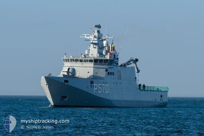
HDMS KNUD RASMUSSEN
Military ops
Current Trip
MILITARY OPS
| Time Travelled | 2 days |
|---|---|
| Remaining Time | --- |
| Distance Travelled | 248.27 nm |
| Remaining Distance | --- |
| AVG Speed | 7.2 Knots |
| MAX Speed | 14.4 Knots |
| AVG Wind | 13.6 knots |
| MAX Wind | 37 knots |
| MIN Temp | -11.4°C / 11.48°F |
| MAX Temp | 1°C / 33.8°F |
| Dybgang | 5.5 m |
| Position Modtaget | 2025-09-16 16:13 |
Current Position
| Longitude | --- |
|---|---|
| Latitude | --- |
| Status | Under way using engine |
| Fart | 11.8 Knots |
| Kurs | 151.1° |
| Område | Davis Strait |
| Station | T-AIS |
| Position Modtaget | 2025-09-16 16:13 |
Info
Information
The current position of HDMS KNUD RASMUSSEN is in Davis Strait with coordinates 64.10318° / -51.73876° as reported on 2025-09-16 16:13 by AIS to our vessel tracker app. The vessel's current speed is 11.8 Knots
The vessel HDMS KNUD RASMUSSEN (MMSI: 220428000) is a Military ops It's sailing under the flag of [DK] Denmark.
In this page you can find informations about the vessels current position, last detected port calls, and current voyage information. If the vessels is not in coverage by AIS you will find the latest position.
The current position of HDMS KNUD RASMUSSEN is detected by our AIS receivers and we are not responsible for the reliability of the data. The last position was recorded while the vessel was in Coverage by the Ais receivers of our vessel tracking app.
The current draught of HDMS KNUD RASMUSSEN as reported by AIS is 5.5 meters
Weather
| Temperature | -5.9°C / 21.38°F |
|---|---|
| Wind Speed | 8 knots |
| Direction | 99° E |
| Pressure | 1015.6 hPa |
| Humidity | 84.3 % |
| Cloud Coverage | 100 % |
Featured Company
Most Visited Ports (Last year)
| Port | Arrivals | |
|---|---|---|
| 15 | ||
| 10 | ||
| 6 | ||
| 4 | ||
| 4 | ||
| 4 |
Last Trips
| Origin | Departure | Destination | Arrival | Distance | |
|---|---|---|---|---|---|
| 2026-01-05 18:14 | 2026-01-06 08:30 | 4.46 nm | |||
| 2025-12-19 15:19 | 2026-01-04 08:02 | 943.12 nm | |||
| 2025-12-03 08:15 | 2025-12-17 08:00 | 707.56 nm | |||
| 2025-11-06 19:22 | 2025-12-02 07:34 | 853.33 nm | |||
| 2025-10-24 15:18 | 2025-11-04 13:50 | 658.60 nm |
Events
| Tid | Hændelsen | Detaljer | Position / Dest | Info |
|---|---|---|---|---|
| 2026-01-08 20:46 | STOP Sejllads |
62.99667 / -50.51500
MILITARY OPS
|
Fart: Kurs: -1° |
|
| 2026-01-07 18:33 | STOP Sejllads | 2.07 nm, South of NUUK |
64.13666 / -51.70334
MILITARY OPS
|
Fart: Kurs: -1° |
| 2026-01-06 18:14 | Afsejlet fra sidste havn |
|
64.15648 / -51.73995
MILITARY OPS
|
Fart: 8.6 kn Kurs: 198° |
| 2026-01-06 18:11 | START Sejllads |
64.16434 / -51.72257
[GL] NUUK
|
Fart: 8.6 kn Kurs: 198° |
|
| 2026-01-06 11:43 | STOP Sejllads |
64.17214 / -51.72082
[GL] NUUK
|
Fart: 0.2 kn Kurs: 106° |
|
| 2026-01-06 11:30 | Skibe i havn |
|
64.16605 / -51.72064
[GL] NUUK
|
Fart: 4 kn Kurs: 16° |
| 2026-01-06 11:07 | START Sejllads | 0.64 nm, South East of NUUK |
64.16623 / -51.69548
MILITARY OPS
|
Fart: 3.9 kn Kurs: 211° |
| 2026-01-05 22:11 | STOP Sejllads | 0.66 nm, East of NUUK |
64.16995 / -51.69261
MILITARY OPS
|
Fart: 0.2 kn Kurs: 190° |
| 2026-01-05 21:14 | Afsejlet fra sidste havn |
|
64.15817 / -51.71938
MILITARY OPS
|
Fart: 6.5 kn Kurs: 196° |
| 2026-01-05 21:10 | START Sejllads |
64.16522 / -51.72144
[GL] NUUK
|
Fart: 6.5 kn Kurs: 196° |