

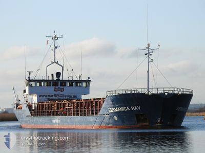
GERMANICA HAV
General Cargo

Current Trip
| Time Travelled | 20 h, 41 mins |
|---|---|
| Remaining Time | 1 h, 32 mins |
| Distance Travelled | 153.16 nm |
| Remaining Distance | 17.17 nm |
| AVG Speed | 7.5 Knots |
| MAX Speed | 9.9 Knots |
| AVG Wind | 5.1 knots |
| MAX Wind | 14.7 knots |
| MIN Temp | -1.7°C / 28.94°F |
| MAX Temp | 6.3°C / 43.34°F |
| Dybgang | 2.8 m |
| Position Modtaget | 1 m siden |
Current Position
| Longitude | --- |
|---|---|
| Latitude | --- |
| Status | Under way using engine |
| Fart | 9.3 Knots |
| Kurs | 131.4° |
| Område | Baltic Sea |
| Station | T-AIS |
| Position Modtaget | 1 m siden |
Information
The current position of GERMANICA HAV is in Baltic Sea with coordinates 54.37672° / 11.84766° as reported on 2025-03-18 11:56 by AIS to our vessel tracker app. The vessel's current speed is 9.3 Knots and is heading at the port of ROSTOCK. The estimated time of arrival as calculated by MyShipTracking vessel tracking app is 2025-03-18 14:30 LT
The vessel GERMANICA HAV (IMO: 8324672, MMSI: 304953000) is a General Cargo that was built in 1984 ( 41 år gamle ). It's sailing under the flag of [AG] Antigua Barbuda.
In this page you can find informations about the vessels current position, last detected port calls, and current voyage information. If the vessels is not in coverage by AIS you will find the latest position.
The current position of GERMANICA HAV is detected by our AIS receivers and we are not responsible for the reliability of the data. The last position was recorded while the vessel was in Coverage by the Ais receivers of our vessel tracking app.
The current draught of GERMANICA HAV as reported by AIS is 2.8 meters
Weather
| Temperature | 3.5°C / 38.3°F |
|---|---|
| Wind Speed | 15 knots |
| Direction | 275° W |
| Pressure | 1030.6 hPa |
| Humidity | 68.3 % |
| Cloud Coverage | --- |


Featured Company
Last Port Calls
| Port | Arrival | Departure | Time In Port |
|---|---|---|---|
| 2025-03-16 13:17 | 2025-03-17 16:17 | 1 d | |
| 2025-03-12 11:17 | 2025-03-13 20:33 | 1 d | |
| 2025-03-11 04:18 | 2025-03-11 13:07 | 8 h | |
| 2025-02-05 05:49 | 2025-03-10 20:49 | ||
| 2025-01-29 03:45 | 2025-02-02 21:25 | 4 d | |
| 2025-01-25 16:49 | 2025-01-28 13:31 | 2 d | |
| 2025-01-22 23:07 | 2025-01-25 05:21 | 2 d | |
| 2025-01-20 17:07 | 2025-01-22 04:39 | 1 d | |
| 2025-01-16 14:25 | 2025-01-19 15:12 | 3 d | |
| 2025-01-08 23:30 | 2025-01-10 18:10 | 1 d |
Last Trips
| Origin | Departure | Destination | Arrival | Distance | |
|---|---|---|---|---|---|
| 2025-03-13 20:33 | 2025-03-16 13:17 | 502.64 nm | |||
| 2025-03-11 13:07 | 2025-03-12 11:17 | 166.35 nm | |||
| 2025-03-10 20:49 | 2025-03-11 04:18 | 70.61 nm | |||
| 2025-02-02 21:25 | 2025-02-05 05:49 | 374.31 nm | |||
| 2025-01-28 13:31 | 2025-01-29 03:45 | 103.44 nm | |||
| 2025-01-25 05:21 | 2025-01-25 16:49 | 88.98 nm | |||
| 2025-01-22 04:39 | 2025-01-22 23:07 | 171.22 nm | |||
| 2025-01-19 15:12 | 2025-01-20 17:07 | 168.12 nm | |||
| 2025-01-10 18:10 | 2025-01-16 14:25 | 742.70 nm | |||
| 2025-01-07 20:01 | 2025-01-08 23:30 | 133.49 nm |
Events
| Tid | Hændelsen | Detaljer | Position / Dest | Info |
|---|---|---|---|---|
| 2025-03-18 10:07 | Fundet i havområde | Danish part of the Baltic Sea |
54.51550 / 11.41534
Baltic Sea
ROSTOCK
|
Fart: 9.9 kn Kurs: 116.3° |
| 2025-03-18 07:43 | Fundet i havområde | German part of the Baltic Sea |
54.57250 / 10.79220
Baltic Sea
ROSTOCK
|
Fart: 9.7 kn Kurs: 84.2° |
| 2025-03-18 07:01 | Ændre havområde | Danish part of the Baltic Sea German part of the Baltic Sea |
54.56185 / 10.59721
Baltic Sea
ROSTOCK
|
Fart: 9.3 kn Kurs: 72.2° |
| 2025-03-18 06:19 | ETA er ændret | 2025/03/18 15:00 2025/03/18 16:00 |
54.51938 / 10.42113
ROSTOCK
|
Fart: 9.7 kn Kurs: 64.8° |
| 2025-03-18 05:37 | Ændre havområde | German part of the Baltic Sea German part of the North Sea |
54.45819 / 10.26937
Baltic Sea
ROSTOCK
|
Fart: 9.4 kn Kurs: 38° |
| 2025-03-18 04:49 | START Sejllads | 1.33 nm, South West of STICKENHΟRN SPORT |
54.36495 / 10.14582
ROSTOCK
|
Fart: 5.2 kn Kurs: 103.2° |
| 2025-03-18 04:24 | STOP Sejllads | 1.36 nm, South West of STICKENHΟRN SPORT |
54.36555 / 10.14275
ROSTOCK
|
Fart: 0.2 kn Kurs: 105° |
| 2025-03-18 00:53 | START Sejllads | 3.62 nm, South West of RENDSBURG |
54.26860 / 9.62875
ROSTOCK
|
Fart: 3.6 kn Kurs: 17° |
| 2025-03-18 00:39 | STOP Sejllads | 3.84 nm, South West of RENDSBURG |
54.26479 / 9.62656
ROSTOCK
|
Fart: 0.3 kn Kurs: 18° |
| 2025-03-17 22:24 | Status er ændret | Under way using engine Default |
54.12464 / 9.32970
ROSTOCK
|
Fart: 7 kn Kurs: 4° |