
FALCON-UA
Reefer
Current Trip
| Time Travelled | 12 days |
|---|---|
| Remaining Time | --- |
| Distance Travelled | 927.12 nm |
| Remaining Distance | --- |
| AVG Speed | 9.2 Knots |
| MAX Speed | 12.7 Knots |
| AVG Wind | 10.8 knots |
| MAX Wind | 24.9 knots |
| MIN Temp | 7.2°C / 44.96°F |
| MAX Temp | 24.4°C / 75.92°F |
| Dybgang | 3.5 m |
| Position Modtaget | 10 h, 44 m siden |
Current Position
| Longitude | 29.20261° |
|---|---|
| Latitude | 41.32017° |
| Status | Under way using engine |
| Fart | 11 Knots |
| Kurs | 20.1° |
| Område | Black Sea |
| Station | T-AIS |
| Position Modtaget | 10 h, 44 m siden |
Info
Information
The current position of FALCON-UA is in Black Sea with coordinates 41.32017° / 29.20261° as reported on 2024-04-28 01:49 by AIS to our vessel tracker app. The vessel's current speed is 11 Knots and is heading at the port of SULINA. The estimated time of arrival as calculated by MyShipTracking vessel tracking app is 2024-04-29 06:00 LT
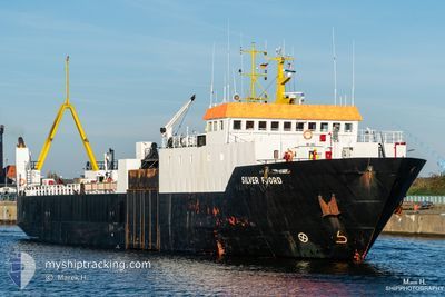
The vessel FALCON-UA (IMO: 8300327, MMSI: 511100982) is a Reefer that was built in 1984 ( 40 år gamle ). It's sailing under the flag of [PW] Palau.
In this page you can find informations about the vessels current position, last detected port calls, and current voyage information. If the vessels is not in coverage by AIS you will find the latest position.
The current position of FALCON-UA is detected by our AIS receivers and we are not responsible for the reliability of the data. The last position was recorded while the vessel was in Coverage by the Ais receivers of our vessel tracking app.
The current draught of FALCON-UA as reported by AIS is 3.5 meters
Weather
| Temperature | 14.7°C / 58.46°F |
|---|---|
| Wind Speed | 14 knots |
| Direction | 31° NNE |
| Pressure | 1022.2 hPa |
| Humidity | 81.9 % |
| Cloud Coverage | 100 % |
Featured Company
Last Port Calls
| Port | Arrival | Departure | Time In Port |
|---|---|---|---|
| 2024-04-13 04:53 | 2024-04-16 05:27 | 3 d | |
| 2024-04-04 21:41 | 2024-04-09 01:40 | 4 d | |
| 2024-03-15 11:30 | 2024-03-28 09:49 | 12 d | |
| 2024-03-13 21:33 | |||
| 2024-02-29 12:20 |
Most Visited Ports (Last year)
| Port | Arrivals | |
|---|---|---|
| 1 | ||
| 1 | ||
| 1 | ||
| 1 | ||
| 1 | ||
| 1 |
Last Trips
| Origin | Departure | Destination | Arrival | Distance | |
|---|---|---|---|---|---|
| 2024-04-09 03:40 | 2024-04-13 07:53 | 717.89 nm | |||
| 2024-03-28 11:49 | 2024-04-04 23:41 | 730.81 nm | |||
| 2024-03-13 23:33 | 2024-03-15 13:30 | 300.61 nm |
Events
| Tid | Hændelsen | Detaljer | Position / Dest | Info |
|---|---|---|---|---|
| 2024-04-28 01:58 | Status er ændret | Default Under way using engine |
41.34591 / 29.19737
RO SUL
|
Fart: 11 kn Kurs: 20.1° |
| 2024-04-28 01:49 | Udenfor Dækning |
41.32017 / 29.20261
Black Sea
RO SUL
|
Fart: 11 kn Kurs: 20.1° |
|
| 2024-04-28 01:16 | Ændre havområde | Turkish part of the Black Sea Turkish part of the Sea of Marmara |
41.23229 / 29.14162
Black Sea
RO SUL
|
Fart: 10.5 kn Kurs: 29.6° |
| 2024-04-28 01:04 | Status er ændret | Under way using engine Default |
41.20289 / 29.11699
RO SUL
|
Fart: 5.8 kn Kurs: 49° |
| 2024-04-28 00:55 | Status er ændret | Default Under way using engine |
41.19064 / 29.09989
RO SUL
|
Fart: 5 kn Kurs: 48.4° |
| 2024-04-27 21:08 | ETA er ændret | 2024/04/29 06:00 2024/04/23 12:00 |
40.82891 / 29.12087
RO SUL
|
Fart: 10 kn Kurs: 258.9° |
| 2024-04-27 20:43 | START Sejllads | 2.01 nm, South West of KARTAL |
40.85160 / 29.18445
RO SUL
|
Fart: 8.5 kn Kurs: 238.5° |
| 2024-04-27 20:38 | Status er ændret | Under way using engine At anchor |
40.85548 / 29.19303
RO SUL
|
Fart: 0.6 kn Kurs: 15° |
| 2024-04-27 17:56 | Status er ændret | At anchor Default |
40.85405 / 29.19248
RO SUL
|
Fart: 0.2 kn Kurs: 87° |
| 2024-04-27 17:50 | Status er ændret | Default At anchor |
40.85393 / 29.19250
RO SUL
|
Fart: 0.2 kn Kurs: 51° |