

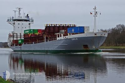
EMILIA
Container Ship

Current Trip
| Time Travelled | 1 day |
|---|---|
| Remaining Time | 6 h, 56 mins |
| Distance Travelled | 388.56 nm |
| Remaining Distance | 182.62 nm |
| AVG Speed | 12.8 Knots |
| MAX Speed | 14.8 Knots |
| AVG Wind | 8.2 knots |
| MAX Wind | 31 knots |
| MIN Temp | 10.6°C / 51.08°F |
| MAX Temp | 15.3°C / 59.54°F |
| Dybgang | 6.7 m |
| Position Modtaget | 5 h, 38 m siden |
Current Position
| Longitude | --- |
|---|---|
| Latitude | --- |
| Status | Under way using engine |
| Fart | 14.4 Knots |
| Kurs | 330° |
| Område | Ionian Sea |
| Station | T-AIS |
| Position Modtaget | 5 h, 38 m siden |
Information
The current position of EMILIA is in Ionian Sea with coordinates 38.47969° / 20.02369° as reported on 2025-03-23 05:13 by AIS to our vessel tracker app. The vessel's current speed is 14.4 Knots and is heading at the port of DURRES. The estimated time of arrival as calculated by MyShipTracking vessel tracking app is 2025-03-23 18:48 LT
The vessel EMILIA (IMO: 9197521, MMSI: 304846000) is a Container Ship that was built in 1999 ( 26 år gamle ). It's sailing under the flag of [AG] Antigua Barbuda.
In this page you can find informations about the vessels current position, last detected port calls, and current voyage information. If the vessels is not in coverage by AIS you will find the latest position.
The current position of EMILIA is detected by our AIS receivers and we are not responsible for the reliability of the data. The last position was recorded while the vessel was in Coverage by the Ais receivers of our vessel tracking app.
The current draught of EMILIA as reported by AIS is 6.7 meters
Weather
| Temperature | 15.2°C / 59.36°F |
|---|---|
| Wind Speed | 30 knots |
| Direction | 142° SE |
| Pressure | 1017.9 hPa |
| Humidity | 73.8 % |
| Cloud Coverage | 100 % |


Featured Company
Last Port Calls
| Port | Arrival | Departure | Time In Port |
|---|---|---|---|
| 2025-03-20 11:12 | 2025-03-22 07:53 | 1 d | |
| 2025-01-19 20:17 | 2025-03-07 15:29 | ||
| 2025-01-16 15:03 | 2025-01-17 23:01 | 1 d | |
| 2025-01-13 23:46 | 2025-01-15 18:13 | 1 d | |
| 2025-01-08 14:34 | 2025-01-10 01:46 | 1 d | |
| 2025-01-02 17:33 | 2025-01-03 11:10 | 17 h |
Most Visited Ports (Last year)
| Port | Arrivals | |
|---|---|---|
| 14 | ||
| 12 | ||
| 10 | ||
| 9 | ||
| 9 | ||
| 8 |
Last Trips
| Origin | Departure | Destination | Arrival | Distance | |
|---|---|---|---|---|---|
| 2025-03-07 15:29 | 2025-03-20 11:12 | 1180.45 nm | |||
| 2025-01-17 23:01 | 2025-01-19 20:17 | 124.85 nm | |||
| 2025-01-15 18:13 | 2025-01-16 15:03 | 243.20 nm | |||
| 2025-01-10 01:46 | 2025-01-13 23:46 | 251.74 nm | |||
| 2025-01-03 11:10 | 2025-01-08 14:34 | 521.74 nm | |||
| 2024-12-31 13:51 | 2025-01-02 17:33 | 394.04 nm |
Events
| Tid | Hændelsen | Detaljer | Position / Dest | Info |
|---|---|---|---|---|
| 2025-03-23 05:26 | Status er ændret | Default Under way using engine |
38.52768 / 19.99060
GRSKG>ALDRZ
|
Fart: 14.4 kn Kurs: 330° |
| 2025-03-23 05:13 | Udenfor Dækning |
38.47969 / 20.02369
Ionian Sea
GRSKG>ALDRZ
|
Fart: 14.4 kn Kurs: 330° |
|
| 2025-03-23 01:06 | Status er ændret | Under way using engine Default |
37.60279 / 20.58010
GRSKG>ALDRZ
|
Fart: 14.5 kn Kurs: 337° |
| 2025-03-23 00:55 | Status er ændret | Default Under way using engine |
37.56089 / 20.60273
GRSKG>ALDRZ
|
Fart: 14.2 kn Kurs: 338° |
| 2025-03-22 23:21 | Status er ændret | Under way using engine Default |
37.22935 / 20.79592
GRSKG>ALDRZ
|
Fart: 14 kn Kurs: 306° |
| 2025-03-22 23:21 | Indenfor Dækning |
37.23342 / 20.79310
Ionian Sea
GRSKG>ALDRZ
|
Fart: 14.1 kn Kurs: 331° |
|
| 2025-03-22 17:02 | Status er ændret | Default Under way using engine |
36.41082 / 22.28245
GRSKG>ALDRZ
|
Fart: 13.5 kn Kurs: 301° |
| 2025-03-22 17:00 | Status er ændret | Under way using engine Default |
36.40569 / 22.29318
GRSKG>ALDRZ
|
Fart: 13.5 kn Kurs: 297° |
| 2025-03-22 17:00 | Udenfor Dækning |
36.40569 / 22.29318
Ionian Sea
GRSKG>ALDRZ
|
Fart: 13.5 kn Kurs: 301° |
|
| 2025-03-22 17:00 | Ændre havområde | Greek part of the Ionian Sea Greek part of the Mediterranean Sea - Eastern Basin |
36.40569 / 22.29318
Ionian Sea
GRSKG>ALDRZ
|
Fart: 13.5 kn Kurs: 301° |