
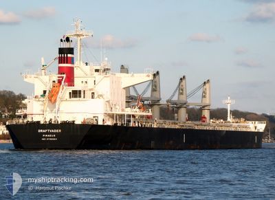
DRAFTVADER
Cargo
Current Trip
| Time Travelled | 7 days |
|---|---|
| Remaining Time | --- |
| Distance Travelled | 1845.04 nm |
| Remaining Distance | 0.49 nm |
| AVG Speed | 10 Knots |
| MAX Speed | 13.1 Knots |
| AVG Wind | 11.6 knots |
| MAX Wind | 25.9 knots |
| MIN Temp | 9.7°C / 49.46°F |
| MAX Temp | 16.6°C / 61.88°F |
| Dybgang | 8.7 m |
| Position Modtaget | 1 m siden |
Current Position
| Longitude | --- |
|---|---|
| Latitude | --- |
| Status | At anchor |
| Fart | 0.1 Knots |
| Kurs | 237° |
| Område | Strait of Gibraltar |
| Station | T-AIS |
| Position Modtaget | 1 m siden |
Info
Information
The current position of DRAFTVADER is in Strait of Gibraltar with coordinates 36.14695° / -5.37622° as reported on 2026-02-27 20:29 by AIS to our vessel tracker app. The vessel's current speed is 0.1 Knots and is heading at the port of GIBRALTAR. The estimated time of arrival as calculated by MyShipTracking vessel tracking app is 2026-02-27 08:00 LT
The vessel DRAFTVADER (IMO: 9736664, MMSI: 241375000) is a Cargo It's sailing under the flag of [GR] Greece.
In this page you can find informations about the vessels current position, last detected port calls, and current voyage information. If the vessels is not in coverage by AIS you will find the latest position.
The current position of DRAFTVADER is detected by our AIS receivers and we are not responsible for the reliability of the data. The last position was recorded while the vessel was in Coverage by the Ais receivers of our vessel tracking app.
The current draught of DRAFTVADER as reported by AIS is 8.7 meters
Weather
| Temperature | 9.7°C / 49.46°F |
|---|---|
| Wind Speed | 1 knots |
| Direction | 93° E |
| Pressure | 1021.5 hPa |
| Humidity | 88.4 % |
| Cloud Coverage | 94 % |
Featured Company
Last Port Calls
| Port | Arrival | Departure | Time In Port |
|---|---|---|---|
| 2026-02-14 22:17 | 2026-02-20 15:37 | 5 d | |
| 2026-01-02 11:38 | 2026-01-06 18:58 | 4 d |
Last Trips
| Origin | Departure | Destination | Arrival | Distance | |
|---|---|---|---|---|---|
| 2026-01-06 18:58 | 2026-02-14 22:17 | 7270.98 nm | |||
| 2025-11-22 18:10 | 2026-01-02 11:38 | 6781.10 nm |
Events
| Tid | Hændelsen | Detaljer | Position / Dest | Info |
|---|---|---|---|---|
| 2026-02-27 17:11 | Status er ændret | At anchor Under way using engine |
36.14439 / -5.37778
GIBRALTAR
|
Fart: 0.1 kn Kurs: 1° |
| 2026-02-27 16:55 | STOP Sejllads | --- |
36.14475 / -5.37809
GIBRALTAR
|
Fart: 0.3 kn Kurs: 353° |
| 2026-02-27 16:05 | Ændre havområde | Gibraltarian part of the Strait of Gibraltar Gibraltarian part of the Alboran Sea |
36.09032 / -5.33728
Strait of Gibraltar
|
Fart: 7.3 kn Kurs: 275.8° |
| 2026-02-27 15:16 | Destination er ændret | GIBRALTAR ALGECIRAS OPL |
36.12559 / -5.16941
GIBRALTAR
|
Fart: 11.7 kn Kurs: 237.7° |
| 2026-02-27 15:08 | Ændre havområde | Gibraltarian part of the Alboran Sea Spanish part of the Alboran Sea |
36.13908 / -5.14210
Alboran Sea
|
Fart: 11.4 kn Kurs: 242.7° |
| 2026-02-27 14:52 | START Sejllads | --- |
36.15721 / -5.10100
ALGECIRAS OPL
|
Fart: 3.1 kn Kurs: 240° |
| 2026-02-27 13:48 | STOP Sejllads | --- |
36.15258 / -5.08314
ALGECIRAS OPL
|
Fart: 0.3 kn Kurs: 48° |
| 2026-02-27 12:58 | Ændre havområde | Spanish part of the Alboran Sea Gibraltarian part of the Alboran Sea |
36.13430 / -5.09048
Alboran Sea
|
Fart: 3.9 kn Kurs: 43° |
| 2026-02-27 11:19 | Ændre havområde | Gibraltarian part of the Alboran Sea Gibraltarian part of the Strait of Gibraltar |
36.04205 / -5.32099
Alboran Sea
ALGECIRAS OPL
|
Fart: 10.2 kn Kurs: 73.3° |
| 2026-02-27 11:11 | Ændre havområde | Gibraltarian part of the Strait of Gibraltar Spanish part of the Strait of Gibraltar |
36.04028 / -5.34889
Strait of Gibraltar
ALGECIRAS OPL
|
Fart: 7.6 kn Kurs: 89.7° |