
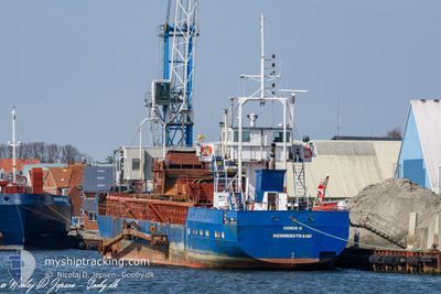
DORIS K
Suction Hopper Dredger
Current Trip
| Time Travelled | 1 day |
|---|---|
| Remaining Time | 3 h, 25 mins |
| Distance Travelled | 96.46 nm |
| Remaining Distance | 27.96 nm |
| AVG Speed | 6.2 Knots |
| MAX Speed | 9 Knots |
| AVG Wind | 10.3 knots |
| MAX Wind | 15.2 knots |
| MIN Temp | 7.5°C / 45.5°F |
| MAX Temp | 14.1°C / 57.38°F |
| Dybgang | 3.5 m |
| Position Modtaget | Nu |
Current Position
| Longitude | 12.50410° |
|---|---|
| Latitude | 55.27822° |
| Status | Under way using engine |
| Fart | 7.7 Knots |
| Kurs | 40.8° |
| Område | Baltic Sea |
| Station | T-AIS |
| Position Modtaget | Nu |
Info
Information
The current position of DORIS K is in Baltic Sea with coordinates 55.27822° / 12.50410° as reported on 2024-04-29 09:32 by AIS to our vessel tracker app. The vessel's current speed is 7.7 Knots and is heading at the port of COPENHAGEN. The estimated time of arrival as calculated by MyShipTracking vessel tracking app is 2024-04-29 12:58 LT
The vessel DORIS K (IMO: 8203531, MMSI: 219011491) is a Suction Hopper Dredger that was built in 1982 ( 42 år gamle ). It's sailing under the flag of [DK] Denmark.
In this page you can find informations about the vessels current position, last detected port calls, and current voyage information. If the vessels is not in coverage by AIS you will find the latest position.
The current position of DORIS K is detected by our AIS receivers and we are not responsible for the reliability of the data. The last position was recorded while the vessel was in Coverage by the Ais receivers of our vessel tracking app.
The current draught of DORIS K as reported by AIS is 3.5 meters
Weather
| Temperature | 9.2°C / 48.56°F |
|---|---|
| Wind Speed | 8 knots |
| Direction | 207° SSW |
| Pressure | 1022.5 hPa |
| Humidity | 82.4 % |
| Cloud Coverage | 86 % |
Featured Company
Last Port Calls
| Port | Arrival | Departure | Time In Port |
|---|---|---|---|
| 2024-04-27 17:01 | 2024-04-27 20:36 | 3 h | |
| 2024-04-26 23:12 | 2024-04-27 07:36 | 8 h | |
| 2024-04-26 04:52 | 2024-04-26 08:58 | 4 h | |
| 2024-04-25 16:35 | 2024-04-25 20:09 | 3 h | |
| 2024-04-25 03:12 | 2024-04-25 07:17 | 4 h | |
| 2024-04-24 11:23 | 2024-04-24 17:58 | 6 h | |
| 2024-04-23 20:06 | 2024-04-24 02:43 | 6 h | |
| 2024-04-23 06:45 | 2024-04-23 10:24 | 3 h | |
| 2024-04-22 16:15 | 2024-04-22 19:59 | 3 h | |
| 2024-04-21 22:55 | 2024-04-22 06:42 | 7 h |
Most Visited Ports (Last year)
| Port | Arrivals | |
|---|---|---|
| 56 | ||
| 31 | ||
| 19 | ||
| 12 | ||
| 9 | ||
| 3 |
Last Trips
| Origin | Departure | Destination | Arrival | Distance | |
|---|---|---|---|---|---|
| 2024-04-27 09:36 | 2024-04-27 19:01 | 36.56 nm | |||
| 2024-04-26 10:58 | 2024-04-27 01:12 | 43.61 nm | |||
| 2024-04-25 22:09 | 2024-04-26 06:52 | 36.38 nm | |||
| 2024-04-25 09:17 | 2024-04-25 18:35 | 37.02 nm | |||
| 2024-04-24 19:58 | 2024-04-25 05:12 | 36.85 nm | |||
| 2024-04-24 04:43 | 2024-04-24 13:23 | 36.62 nm | |||
| 2024-04-23 12:24 | 2024-04-23 22:06 | 36.82 nm | |||
| 2024-04-22 21:59 | 2024-04-23 08:45 | 38.05 nm | |||
| 2024-04-22 08:42 | 2024-04-22 18:15 | 37.36 nm | |||
| 2024-04-21 16:10 | 2024-04-22 00:55 | 36.65 nm |
Events
| Tid | Hændelsen | Detaljer | Position / Dest | Info |
|---|---|---|---|---|
| 2024-04-29 08:33 | START Sejllads | 8.74 nm, South of STERN |
55.18685 / 12.36107
PROEVESTENEN
|
Fart: 3.1 kn Kurs: 42° |
| 2024-04-29 07:26 | STOP Sejllads | 9.1 nm, South of STERN |
55.17827 / 12.37195
PROEVESTENEN
|
Fart: 0.3 kn Kurs: 316° |
| 2024-04-28 19:58 | Ændre havområde | Danish part of the Baltic Sea Danish part of the Kattegat |
54.83989 / 12.17530
Baltic Sea
PROEVESTENEN
|
Fart: 7.2 kn Kurs: 143.3° |
| 2024-04-28 17:26 | Destination er ændret | PROEVESTENEN MASNEDO |
55.00123 / 11.87259
PROEVESTENEN
|
Fart: 7.4 kn Kurs: 288.9° |
| 2024-04-28 17:26 | ETA er ændret | 2024/04/29 19:00 2024/04/28 07:00 |
55.00123 / 11.87259
PROEVESTENEN
|
Fart: 7.4 kn Kurs: 288.9° |
| 2024-04-28 17:24 | START Sejllads | 0.52 nm, North West of VORDINGBORG VESTHAVN |
54.99990 / 11.87693
MASNEDO
|
Fart: 5.9 kn Kurs: 335.4° |
| 2024-04-28 05:30 | STOP Sejllads | 0.47 nm, West of VORDINGBORG VESTHAVN |
54.99798 / 11.87743
MASNEDO
|
Fart: 0.3 kn Kurs: 80° |
| 2024-04-28 02:51 | Destination er ændret | MASNEDO KARREBEKSMINDE |
55.14756 / 11.56550
MASNEDO
|
Fart: 6.3 kn Kurs: 189.5° |
| 2024-04-28 02:51 | ETA er ændret | 2024/04/28 07:00 2024/04/28 01:00 |
55.14756 / 11.56550
MASNEDO
|
Fart: 6.3 kn Kurs: 189.5° |
| 2024-04-28 02:43 | START Sejllads | 7.49 nm, South West of NAESTVED HAVN |
55.16058 / 11.56891
KARREBEKSMINDE
|
Fart: 4.7 kn Kurs: 187° |