

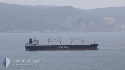
CS CAPRICE
Bulk Carrier

Current Trip
| Time Travelled | 5 days |
|---|---|
| Remaining Time | --- |
| Distance Travelled | 1402.24 nm |
| Remaining Distance | 205.48 nm |
| AVG Speed | 11.2 Knots |
| MAX Speed | 13.2 Knots |
| AVG Wind | 11.4 knots |
| MAX Wind | 24.3 knots |
| MIN Temp | 13.1°C / 55.58°F |
| MAX Temp | 16.6°C / 61.88°F |
| Dybgang | 6.1 m |
| Position Modtaget | 1 m siden |
Current Position
| Longitude | --- |
|---|---|
| Latitude | --- |
| Status | Under way using engine |
| Fart | 1.1 Knots |
| Kurs | 58° |
| Område | Aegean Sea |
| Station | T-AIS |
| Position Modtaget | 1 m siden |
Information
The current position of CS CAPRICE is in Aegean Sea with coordinates 39.55087° / 25.57760° as reported on 2025-03-29 05:10 by AIS to our vessel tracker app. The vessel's current speed is 1.1 Knots and is heading at the port of TUZLA. The estimated time of arrival as calculated by MyShipTracking vessel tracking app is 2025-03-30 04:00 LT
The vessel CS CAPRICE (IMO: 9406104, MMSI: 311016600) is a Bulk Carrier that was built in 2010 ( 15 år gamle ). It's sailing under the flag of [BS] Bahamas.
In this page you can find informations about the vessels current position, last detected port calls, and current voyage information. If the vessels is not in coverage by AIS you will find the latest position.
The current position of CS CAPRICE is detected by our AIS receivers and we are not responsible for the reliability of the data. The last position was recorded while the vessel was in Coverage by the Ais receivers of our vessel tracking app.
The current draught of CS CAPRICE as reported by AIS is 6.1 meters
Weather
| Temperature | 14.9°C / 58.82°F |
|---|---|
| Wind Speed | 11 knots |
| Direction | 134° SE |
| Pressure | 1002.8 hPa |
| Humidity | 79.8 % |
| Cloud Coverage | 72 % |


Featured Company
Last Port Calls
| Port | Arrival | Departure | Time In Port |
|---|---|---|---|
| 2025-03-20 09:27 | 2025-03-23 18:24 | 3 d | |
| 2025-03-05 09:15 | 2025-03-08 20:13 | 3 d | |
| 2025-02-17 08:53 | 2025-02-19 07:28 | 1 d | |
| 2025-02-08 11:13 | 2025-02-14 15:25 | 6 d | |
| 2025-02-04 14:17 | 2025-02-07 17:16 | 3 d | |
| 2025-01-02 09:21 | 2025-01-04 14:17 | 2 d |
Most Visited Ports (Last year)
| Port | Arrivals | |
|---|---|---|
| 2 | ||
| 2 | ||
| 1 | ||
| 1 | ||
| 1 | ||
| 1 |
Last Trips
| Origin | Departure | Destination | Arrival | Distance | |
|---|---|---|---|---|---|
| 2025-03-08 20:13 | 2025-03-20 09:27 | 1893.07 nm | |||
| 2025-02-19 07:28 | 2025-03-05 09:15 | 1210.35 nm | |||
| 2025-02-14 15:25 | 2025-02-17 08:53 | 723.67 nm | |||
| 2025-02-07 17:16 | 2025-02-08 11:13 | 180.87 nm | |||
| 2025-01-04 14:17 | 2025-02-04 14:17 | 7173.15 nm | |||
| 2024-12-17 08:56 | 2025-01-02 09:21 | 4370.55 nm |
Events
| Tid | Hændelsen | Detaljer | Position / Dest | Info |
|---|---|---|---|---|
| 2025-03-28 19:03 | STOP Sejllads | 19.73 nm, North West of SIGRI |
39.49113 / 25.62504
TR TUZ
|
Fart: 0.3 kn Kurs: 17° |
| 2025-03-28 17:54 | Status er ændret | Under way using engine Under way sailing |
39.47169 / 25.63310
TR TUZ
|
Fart: 2.5 kn Kurs: 352° |
| 2025-03-28 17:52 | Status er ændret | Under way sailing Under way using engine |
39.47073 / 25.63318
TR TUZ
|
Fart: 2.7 kn Kurs: 353° |
| 2025-03-28 15:09 | Status er ændret | Under way using engine Default |
39.02429 / 25.33522
TR TUZ
|
Fart: 11.5 kn Kurs: 29° |
| 2025-03-28 14:55 | Status er ændret | Default Under way using engine |
38.98517 / 25.30716
TR TUZ
|
Fart: 11.4 kn Kurs: 28.8° |
| 2025-03-28 14:45 | Status er ændret | Under way using engine Default |
38.95803 / 25.28802
TR TUZ
|
Fart: 11.6 kn Kurs: 28° |
| 2025-03-28 14:32 | Status er ændret | Default Under way using engine |
38.92094 / 25.26283
TR TUZ
|
Fart: 11.7 kn Kurs: 26.6° |
| 2025-03-28 14:27 | Status er ændret | Under way using engine Default |
38.90740 / 25.25402
TR TUZ
|
Fart: 11.6 kn Kurs: 26° |
| 2025-03-28 14:27 | Indenfor Dækning |
38.91124 / 25.25638
Aegean Sea
TR TUZ
|
Fart: 11.7 kn Kurs: 26.6° |
|
| 2025-03-28 13:13 | Udenfor Dækning |
38.69260 / 25.12169
Aegean Sea
TR TUZ
|
Fart: 11.5 kn Kurs: 27° |