
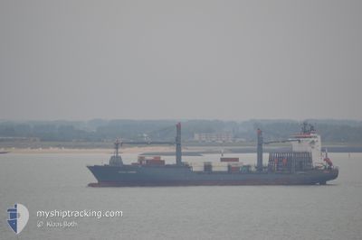
CMA CGM ABIDJAN
Container Ship
Current Trip
| Time Travelled | 1 day |
|---|---|
| Remaining Time | 7 h, 34 mins |
| Distance Travelled | 312.22 nm |
| Remaining Distance | 225.50 nm |
| AVG Speed | 14.9 Knots |
| MAX Speed | 15.9 Knots |
| AVG Wind | 6.5 knots |
| MAX Wind | 11.2 knots |
| MIN Temp | 11.9°C / 53.42°F |
| MAX Temp | 16.2°C / 61.16°F |
| Dybgang | 11.2 m |
| Position Modtaget | 7 h, 1 m siden |
Current Position
| Longitude | --- |
|---|---|
| Latitude | --- |
| Status | Under way using engine |
| Fart | 15.5 Knots |
| Kurs | 105.9° |
| Område | Mediterranean Sea - Eastern Basin |
| Station | T-AIS |
| Position Modtaget | 7 h, 1 m siden |
Info
Information
The current position of CMA CGM ABIDJAN is in Mediterranean Sea - Eastern Basin with coordinates 35.52732° / 28.83616° as reported on 2025-02-18 02:47 by AIS to our vessel tracker app. The vessel's current speed is 15.5 Knots and is heading at the port of LIMASSOL. The estimated time of arrival as calculated by MyShipTracking vessel tracking app is 2025-02-18 17:22 LT
The vessel CMA CGM ABIDJAN (IMO: 9323481, MMSI: 256022000) is a Container Ship that was built in 2006 ( 19 år gamle ). It's sailing under the flag of [MT] Malta.
In this page you can find informations about the vessels current position, last detected port calls, and current voyage information. If the vessels is not in coverage by AIS you will find the latest position.
The current position of CMA CGM ABIDJAN is detected by our AIS receivers and we are not responsible for the reliability of the data. The last position was recorded while the vessel was in Coverage by the Ais receivers of our vessel tracking app.
The current draught of CMA CGM ABIDJAN as reported by AIS is 11.2 meters
Weather
| Temperature | 15.2°C / 59.36°F |
|---|---|
| Wind Speed | 4 knots |
| Direction | 216° SW |
| Pressure | 1016.2 hPa |
| Humidity | 72.7 % |
| Cloud Coverage | 97 % |
Featured Company
Last Port Calls
| Port | Arrival | Departure | Time In Port |
|---|---|---|---|
| 2025-02-15 20:28 | 2025-02-17 06:08 | 1 d | |
| 2025-02-09 05:05 | 2025-02-10 17:04 | 1 d | |
| 2025-02-08 17:58 | 2025-02-08 18:02 | 4 m | |
| 2025-02-03 08:21 | 2025-02-05 17:36 | 2 d | |
| 2025-02-01 06:15 | 2025-02-02 17:30 | 1 d | |
| 2025-01-28 10:25 | 2025-01-28 17:20 | 6 h | |
| 2025-01-27 19:56 | 2025-01-28 04:41 | 8 h | |
| 2025-01-25 13:51 | 2025-01-27 06:41 | 1 d | |
| 2025-01-25 03:28 | 2025-01-25 13:37 | 10 h | |
| 2025-01-22 12:35 | 2025-01-23 06:08 | 17 h |
Most Visited Ports (Last year)
| Port | Arrivals | |
|---|---|---|
| 15 | ||
| 7 | ||
| 6 | ||
| 6 | ||
| 6 | ||
| 6 |
Last Trips
| Origin | Departure | Destination | Arrival | Distance | |
|---|---|---|---|---|---|
| 2025-02-10 19:04 | 2025-02-15 22:28 | 394.29 nm | |||
| 2025-02-08 20:02 | 2025-02-09 07:05 | 11.62 nm | |||
| 2025-02-05 19:36 | 2025-02-08 19:58 | 797.93 nm | |||
| 2025-02-02 18:30 | 2025-02-03 10:21 | 211.54 nm | |||
| 2025-01-28 19:20 | 2025-02-01 07:15 | 1055.74 nm | |||
| 2025-01-28 06:41 | 2025-01-28 12:25 | 48.32 nm | |||
| 2025-01-27 09:41 | 2025-01-27 21:56 | 198.93 nm | |||
| 2025-01-25 16:37 | 2025-01-25 16:51 | 4.53 nm | |||
| 2025-01-23 08:08 | 2025-01-25 06:28 | 396.55 nm | |||
| 2025-01-22 01:39 | 2025-01-22 14:35 | 208.56 nm |
Events
| Tid | Hændelsen | Detaljer | Position / Dest | Info |
|---|---|---|---|---|
| 2025-02-18 02:59 | Status er ændret | Default Under way using engine |
35.51252 / 28.89962
GR PIR>CY LMS
|
Fart: 15.5 kn Kurs: 105.9° |
| 2025-02-18 02:47 | Ændre havområde | Turkish part of the Mediterranean Sea - Eastern Basin Greek part of the Mediterranean Sea - Eastern Basin |
35.52732 / 28.83616
Mediterranean Sea - Eastern Basin
GR PIR>CY LMS
|
Fart: 15.5 kn Kurs: 105.9° |
| 2025-02-18 02:47 | Udenfor Dækning |
35.52732 / 28.83616
Mediterranean Sea - Eastern Basin
GR PIR>CY LMS
|
Fart: 15.5 kn Kurs: 105.9° |
|
| 2025-02-17 22:55 | Ændre havområde | Greek part of the Mediterranean Sea - Eastern Basin Greek part of the Aegean Sea |
35.83395 / 27.68365
Mediterranean Sea - Eastern Basin
GR PIR>CY LMS
|
Fart: 15.5 kn Kurs: 133.8° |
| 2025-02-17 10:56 | ETA er ændret | 2025/02/18 18:00 2025/02/19 04:00 |
37.27305 / 24.51486
GR PIR>CY LMS
|
Fart: 15.5 kn Kurs: 86.4° |
| 2025-02-17 09:39 | ETA er ændret | 2025/02/19 04:00 2025/02/19 03:00 |
37.30420 / 24.16601
GR PIR>CY LMS
|
Fart: 11.6 kn Kurs: 112.8° |
| 2025-02-17 09:23 | ETA er ændret | 2025/02/19 03:00 2025/02/18 18:00 |
37.32798 / 24.10490
GR PIR>CY LMS
|
Fart: 11.6 kn Kurs: 114.1° |
| 2025-02-17 07:35 | ETA er ændret | 2025/02/18 18:00 2026/01/01 18:00 |
37.62687 / 23.73077
GR PIR>CY LMS
|
Fart: 15.7 kn Kurs: 155° |
| 2025-02-17 07:23 | ETA er ændret | 2026/01/01 18:00 2025/02/18 18:00 |
37.67355 / 23.70165
GR PIR>CY LMS
|
Fart: 15.7 kn Kurs: 152.2° |
| 2025-02-17 06:08 | Afsejlet fra sidste havn |
|
37.94676 / 23.59739
GR PIR>CY LMS
|
Fart: 6.4 kn Kurs: 144° |