
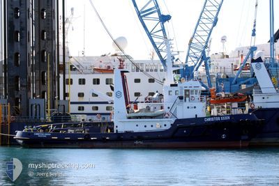
CHRISTOS XXXIV
Tug
Current Trip
| Time Travelled | 5 days |
|---|---|
| Remaining Time | 6 days |
| Distance Travelled | 674.20 nm |
| Remaining Distance | 828.61 nm |
| AVG Speed | 4.6 Knots |
| MAX Speed | 6.5 Knots |
| AVG Wind | 13.2 knots |
| MAX Wind | 22 knots |
| MIN Temp | 17.8°C / 64.04°F |
| MAX Temp | 20.3°C / 68.54°F |
| Dybgang | 5 m |
| Position Modtaget | 3 d siden |
Current Position
| Longitude | -0.22216° |
|---|---|
| Latitude | 36.67827° |
| Status | Restricted manoeuverability |
| Fart | 4.5 Knots |
| Kurs | 79° |
| Område | Mediterranean Sea - Western Basin |
| Station | T-AIS |
| Position Modtaget | 3 d siden |
Info
Information
The current position of CHRISTOS XXXIV is in Mediterranean Sea - Western Basin with coordinates 36.67827° / -0.22216° as reported on 2024-05-11 20:10 by AIS to our vessel tracker app. The vessel's current speed is 4.5 Knots and is heading at the port of PIRAEUS. The estimated time of arrival as calculated by MyShipTracking vessel tracking app is 2024-05-21 13:51 LT
The vessel CHRISTOS XXXIV (IMO: 7907415, MMSI: 376717000) is a Tug It's sailing under the flag of [VC] St Vincent Grenadines.
In this page you can find informations about the vessels current position, last detected port calls, and current voyage information. If the vessels is not in coverage by AIS you will find the latest position.
The current position of CHRISTOS XXXIV is detected by our AIS receivers and we are not responsible for the reliability of the data. The last position was recorded while the vessel was in Coverage by the Ais receivers of our vessel tracking app.
The current draught of CHRISTOS XXXIV as reported by AIS is 5 meters
Weather
| Temperature | 19.1°C / 66.38°F |
|---|---|
| Wind Speed | 4 knots |
| Direction | 227° SW |
| Pressure | 1006 hPa |
| Humidity | 81.3 % |
| Cloud Coverage | 96 % |
Featured Company
Events
| Tid | Hændelsen | Detaljer | Position / Dest | Info |
|---|---|---|---|---|
| 2024-05-11 20:26 | Status er ændret | Default Restricted manoeuverability |
36.68167 / -.19167
GRPIR
|
Fart: 4.5 kn Kurs: 79° |
| 2024-05-11 20:10 | Status er ændret | Restricted manoeuverability Default |
36.67827 / -.22216
GRPIR
|
Fart: 4 kn Kurs: -1° |
| 2024-05-11 20:10 | Udenfor Dækning |
36.67827 / -.22216
Mediterranean Sea - Western Basin
GRPIR
|
Fart: 4.5 kn Kurs: 79° |
|
| 2024-05-11 19:56 | Status er ændret | Default Restricted manoeuverability |
36.67500 / -.23833
GRPIR
|
Fart: 4.4 kn Kurs: 77.8° |
| 2024-05-11 18:50 | Status er ændret | Restricted manoeuverability Default |
36.65713 / -.33932
GRPIR
|
Fart: 4 kn Kurs: -1° |
| 2024-05-11 18:43 | Status er ændret | Default Restricted manoeuverability |
36.65617 / -.34401
GRPIR
|
Fart: 3.7 kn Kurs: 80° |
| 2024-05-11 18:01 | Status er ændret | Restricted manoeuverability Default |
36.64874 / -.40440
GRPIR
|
Fart: 4 kn Kurs: -1° |
| 2024-05-11 17:38 | Status er ændret | Default Restricted manoeuverability |
36.64500 / -.43167
GRPIR
|
Fart: 4.1 kn Kurs: 80.3° |
| 2024-05-11 17:32 | Status er ændret | Restricted manoeuverability Default |
36.64424 / -.44002
GRPIR
|
Fart: 4 kn Kurs: -1° |
| 2024-05-11 17:15 | Status er ændret | Default Restricted manoeuverability |
36.64046 / -.46381
GRPIR
|
Fart: 4.1 kn Kurs: 79.3° |