
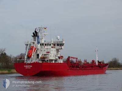
CHRISTINA
Oil/Chemical Tanker
Current Trip
| Trip Time | 2 days |
|---|---|
| Trip Distance | 282.67 nm |
| AVG Speed | 7.4 Knots |
| MAX Speed | 12.9 Knots |
| Dybgang | 5.6 m |
| AVG Wind | 7.7 knots |
| MAX Wind | 18 knots |
| MIN Temp | 13.3°C / 55.94°F |
| MAX Temp | 22.5°C / 72.5°F |
| Position Modtaget | 1 d siden |
Current Position
| Longitude | 9.20063° |
|---|---|
| Latitude | 53.91630° |
| Status | Under way using engine |
| Fart | 0.2 Knots |
| Kurs | 257° |
| Område | Baltic Sea |
| Station | T-AIS |
| Position Modtaget | 1 d siden |
Info
Information
The current position of CHRISTINA is in Baltic Sea with coordinates 53.91630° / 9.20063° as reported on 2024-08-30 07:35 by AIS to our vessel tracker app. The vessel's current speed is 0.2 Knots and is currently inside the port of OSTERMOOR.
The vessel CHRISTINA (IMO: 9118496, MMSI: 259372000) is a Oil/Chemical Tanker that was built in 1996 ( 28 år gamle ). It's sailing under the flag of [NO] Norway.
In this page you can find informations about the vessels current position, last detected port calls, and current voyage information. If the vessels is not in coverage by AIS you will find the latest position.
The current position of CHRISTINA is detected by our AIS receivers and we are not responsible for the reliability of the data. The last position was recorded while the vessel was in Coverage by the Ais receivers of our vessel tracking app.
The current draught of CHRISTINA as reported by AIS is 5.6 meters
Weather
| Temperature | 11.6°C / 52.88°F |
|---|---|
| Wind Speed | 6 knots |
| Direction | 69° ENE |
| Pressure | 1025 hPa |
| Humidity | 87.3 % |
| Cloud Coverage | 73 % |
Featured Company
Last Port Calls
| Port | Arrival | Departure | Time In Port |
|---|---|---|---|
| 2024-08-30 09:15 | |||
| 2024-08-27 12:20 | 2024-08-28 03:31 | 15 h | |
| 2024-08-25 07:43 | 2024-08-26 02:04 | 18 h | |
| 2024-08-18 02:54 | 2024-08-20 05:13 | 2 d | |
| 2024-08-13 03:53 | 2024-08-14 08:35 | 1 d | |
| 2024-08-06 20:36 | 2024-08-07 12:53 | 16 h | |
| 2024-08-05 05:54 | 2024-08-06 02:16 | 20 h | |
| 2024-08-03 09:48 | 2024-08-04 05:16 | 19 h | |
| 2024-07-27 19:44 | 2024-07-28 14:41 | 18 h | |
| 2024-07-24 20:00 | 2024-07-25 10:01 | 14 h |
Most Visited Ports (Last year)
| Port | Arrivals | |
|---|---|---|
| 12 | ||
| 8 | ||
| 7 | ||
| 7 | ||
| 6 | ||
| 5 |
Last Trips
| Origin | Departure | Destination | Arrival | Distance | |
|---|---|---|---|---|---|
| 2024-08-28 03:31 | 2024-08-30 09:15 | 282.67 nm | |||
| 2024-08-26 02:04 | 2024-08-27 12:20 | 382.90 nm | |||
| 2024-08-20 05:13 | 2024-08-25 07:43 | 1051.18 nm | |||
| 2024-08-14 08:35 | 2024-08-18 02:54 | 323.22 nm | |||
| 2024-08-07 12:53 | 2024-08-13 03:53 | 1177.62 nm | |||
| 2024-08-06 02:16 | 2024-08-06 20:36 | 136.35 nm | |||
| 2024-08-04 05:16 | 2024-08-05 05:54 | 293.75 nm | |||
| 2024-07-28 14:41 | 2024-08-03 09:48 | 1454.99 nm | |||
| 2024-07-25 10:01 | 2024-07-27 19:44 | 616.71 nm | |||
| 2024-07-23 19:27 | 2024-07-24 20:00 | 275.67 nm |
Events
| Tid | Hændelsen | Detaljer | Position / Dest | Info |
|---|---|---|---|---|
| 2024-08-30 07:50 | Status er ændret | Default Under way using engine |
53.91642 / 9.20120
[DE] OSTERMOOR
|
Fart: 0.2 kn Kurs: 257° |
| 2024-08-30 07:35 | Udenfor Dækning |
53.91630 / 9.20063
Baltic Sea
[DE] OSTERMOOR
|
Fart: 0.2 kn Kurs: 346.2° |
|
| 2024-08-30 07:31 | STOP Sejllads |
53.91618 / 9.20020
[DE] OSTERMOOR
|
Fart: 0.3 kn Kurs: 260° |
|
| 2024-08-30 07:15 | Skibe i havn |
|
53.91660 / 9.19432
[DE] OSTERMOOR
|
Fart: 0.6 kn Kurs: 271° |
| 2024-08-29 23:19 | START Sejllads | 1.41 nm, South West of STICKENHΟRN SPORT |
54.36655 / 10.13894
DE BRB
|
Fart: 3.1 kn Kurs: 284° |
| 2024-08-29 22:20 | STOP Sejllads | 1.33 nm, South West of STICKENHΟRN SPORT |
54.36578 / 10.14365
DE BRB
|
Fart: 0.3 kn Kurs: 283° |
| 2024-08-29 21:49 | START Sejllads | 0.9 nm, South of STICKENHΟRN SPORT |
54.36814 / 10.17163
DE BRB
|
Fart: 3.1 kn Kurs: 234° |
| 2024-08-29 21:26 | STOP Sejllads | 0.58 nm, West of MOELTENORT |
54.37333 / 10.17918
DE BRB
|
Fart: 0.3 kn Kurs: 220° |
| 2024-08-29 20:08 | START Sejllads | 8.09 nm, North of WENDTORF |
54.55207 / 10.31671
DE BRB
|
Fart: 3.1 kn Kurs: 190° |
| 2024-08-29 20:07 | Status er ændret | Under way using engine At anchor |
54.55289 / 10.31691
DE BRB
|
Fart: 1.7 kn Kurs: 129° |