
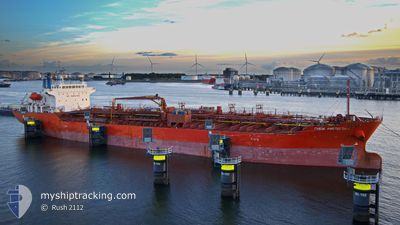
CHEM AMSTERDAM
Oil/Chemical Tanker
Current Trip
| Time Travelled | 11 days |
|---|---|
| Remaining Time | --- |
| Distance Travelled | 480.20 nm |
| Remaining Distance | --- |
| AVG Speed | 10.4 Knots |
| MAX Speed | 13.7 Knots |
| AVG Wind | 8.3 knots |
| MAX Wind | 18 knots |
| MIN Temp | 17.5°C / 63.5°F |
| MAX Temp | 27.4°C / 81.32°F |
| Dybgang | 6.4 m |
| Position Modtaget | 3 d siden |
Current Position
| Longitude | -48.27441° |
|---|---|
| Latitude | -25.75477° |
| Status | At anchor |
| Fart | 0.7 Knots |
| Kurs | 191° |
| Område | South Atlantic Ocean |
| Station | T-AIS |
| Position Modtaget | 3 d siden |
Info
Information
The current position of CHEM AMSTERDAM is in South Atlantic Ocean with coordinates -25.75477° / -48.27441° as reported on 2024-05-18 19:39 by AIS to our vessel tracker app. The vessel's current speed is 0.7 Knots
The vessel CHEM AMSTERDAM (IMO: 9640138, MMSI: 538005215) is a Oil/Chemical Tanker that was built in 2013 ( 11 år gamle ). It's sailing under the flag of [MH] Marshall Is.
In this page you can find informations about the vessels current position, last detected port calls, and current voyage information. If the vessels is not in coverage by AIS you will find the latest position.
The current position of CHEM AMSTERDAM is detected by our AIS receivers and we are not responsible for the reliability of the data. The last position was recorded while the vessel was in Coverage by the Ais receivers of our vessel tracking app.
The current draught of CHEM AMSTERDAM as reported by AIS is 6.4 meters
Weather
| Temperature | 25.3°C / 77.54°F |
|---|---|
| Wind Speed | 4 knots |
| Direction | 115° ESE |
| Pressure | 1015.6 hPa |
| Humidity | 68.4 % |
| Cloud Coverage | 68 % |
Featured Company
Last Port Calls
| Port | Arrival | Departure | Time In Port |
|---|---|---|---|
| 2024-05-11 10:45 | 2024-05-11 11:41 | 56 m | |
| 2024-04-19 06:25 | 2024-04-19 11:54 | 5 h | |
| 2024-04-19 05:49 | 2024-04-19 06:07 | 18 m | |
| 2024-04-19 04:43 | 2024-04-19 05:44 | 1 h | |
| 2024-04-19 03:04 | 2024-04-19 04:37 | 1 h | |
| 2024-04-18 06:56 | 2024-04-19 03:00 | 20 h | |
| 2024-04-11 17:55 | 2024-04-12 14:49 | 20 h | |
| 2024-04-08 07:29 | 2024-04-09 07:57 | 1 d | |
| 2024-04-03 08:00 | 2024-04-04 21:02 | 1 d | |
| 2024-03-27 14:00 | 2024-04-03 06:24 | 6 d |
Last Trips
| Origin | Departure | Destination | Arrival | Distance | |
|---|---|---|---|---|---|
| 2024-04-19 14:54 | 2024-05-11 07:45 | 6587.82 nm | |||
| 2024-04-19 09:07 | 2024-04-19 09:25 | 1.48 nm | |||
| 2024-04-19 08:44 | 2024-04-19 08:49 | 1.25 nm | |||
| 2024-04-19 07:37 | 2024-04-19 07:43 | --- | |||
| 2024-04-19 06:00 | 2024-04-19 06:04 | 1.46 nm | |||
| 2024-04-12 17:49 | 2024-04-18 09:56 | 272.06 nm | |||
| 2024-04-09 10:57 | 2024-04-11 20:55 | 19.84 nm | |||
| 2024-04-05 00:02 | 2024-04-08 10:29 | 922.99 nm | |||
| 2024-04-03 09:24 | 2024-04-03 11:00 | 1.13 nm | |||
| 2024-03-18 20:57 | 2024-03-27 17:00 | 932.70 nm |
Events
| Tid | Hændelsen | Detaljer | Position / Dest | Info |
|---|---|---|---|---|
| 2024-05-22 15:37 | STOP Sejllads | 0.71 nm, North of PARANAGUA |
-25.48890 / -48.52007
BRPNG
|
Fart: 0.3 kn Kurs: 85° |
| 2024-05-22 12:21 | START Sejllads | 12.13 nm, South of PONTAL DO SUL |
-25.75387 / -48.27477
BRPNG
|
Fart: 4.7 kn Kurs: 358° |
| 2024-05-18 19:44 | Status er ændret | Default At anchor |
-25.75488 / -48.27513
BRPNG
|
Fart: 0.7 kn Kurs: 191° |
| 2024-05-18 19:39 | Status er ændret | At anchor Default |
-25.75477 / -48.27441
BRPNG
|
Fart: 0.6 kn Kurs: 151° |
| 2024-05-18 19:39 | Udenfor Dækning |
-25.75477 / -48.27441
South Atlantic Ocean
|
Fart: 0.7 kn Kurs: 269.6° |
|
| 2024-05-18 19:21 | Indenfor Dækning |
-25.75477 / -48.27441
South Atlantic Ocean
|
Fart: 0.7 kn Kurs: 269.6° |
|
| 2024-05-18 15:47 | STOP Sejllads | 12.32 nm, South of PONTAL DO SUL |
-25.75678 / -48.27341
BRPNG
|
Fart: 0.3 kn Kurs: 211° |
| 2024-05-17 01:45 | Status er ændret | Default Under way using engine |
-24.11404 / -46.38150
BRPNG
|
Fart: 11 kn Kurs: 199.6° |
| 2024-05-17 01:42 | Udenfor Dækning |
-24.10400 / -46.37719
South Atlantic Ocean
BRPNG
|
Fart: 11 kn Kurs: 199.6° |
|
| 2024-05-17 01:41 | Status er ændret | Under way using engine Default |
-24.10358 / -46.37702
BRPNG
|
Fart: 10.9 kn Kurs: 202° |