
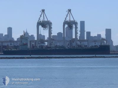
CELANDINE
Cargo
Current Trip
| Time Travelled | 1 day |
|---|---|
| Remaining Time | 4 days |
| Distance Travelled | 351.53 nm |
| Remaining Distance | 1395.21 nm |
| AVG Speed | 14 Knots |
| MAX Speed | 15.2 Knots |
| AVG Wind | 5.8 knots |
| MAX Wind | 13 knots |
| MIN Temp | 9.9°C / 49.82°F |
| MAX Temp | 19.7°C / 67.46°F |
| Dybgang | 7.1 m |
| Position Modtaget | 4 h, 41 m siden |
Current Position
| Longitude | --- |
|---|---|
| Latitude | --- |
| Status | Under way using engine |
| Fart | 15.1 Knots |
| Kurs | 270° |
| Område | South Pacific Ocean |
| Station | T-AIS |
| Position Modtaget | 4 h, 41 m siden |
Info
Information
The current position of CELANDINE is in South Pacific Ocean with coordinates -34.27120° / 172.82982° as reported on 2025-03-07 15:09 by AIS to our vessel tracker app. The vessel's current speed is 15.1 Knots and is heading at the port of MELBOURNE. The estimated time of arrival as calculated by MyShipTracking vessel tracking app is 2025-03-11 20:47 LT
The vessel CELANDINE (IMO: 9685774, MMSI: 232049845) is a Cargo It's sailing under the flag of [GB] United Kingdom.
In this page you can find informations about the vessels current position, last detected port calls, and current voyage information. If the vessels is not in coverage by AIS you will find the latest position.
The current position of CELANDINE is detected by our AIS receivers and we are not responsible for the reliability of the data. The last position was recorded while the vessel was in Coverage by the Ais receivers of our vessel tracking app.
The current draught of CELANDINE as reported by AIS is 7.1 meters
Weather
| Temperature | 19.4°C / 66.92°F |
|---|---|
| Wind Speed | 11 knots |
| Direction | 192° SSW |
| Pressure | 1019 hPa |
| Humidity | 66 % |
| Cloud Coverage | --- |
Featured Company
Last Port Calls
| Port | Arrival | Departure | Time In Port |
|---|---|---|---|
| 2025-03-06 05:25 | 2025-03-06 18:52 | 13 h | |
| 2025-03-03 04:53 | 2025-03-04 00:12 | 19 h | |
| 2025-02-24 09:04 | 2025-02-25 05:18 | 20 h | |
| 2025-02-21 19:40 | 2025-02-22 08:08 | 12 h | |
| 2025-02-19 22:40 | 2025-02-20 09:10 | 10 h | |
| 2025-02-11 17:59 | 2025-02-12 06:29 | 12 h | |
| 2025-02-10 08:51 | 2025-02-11 04:14 | 19 h | |
| 2025-02-03 15:39 | 2025-02-04 18:17 | 1 d | |
| 2025-01-30 21:48 | 2025-01-31 09:04 | 11 h | |
| 2025-01-29 06:11 | 2025-01-29 19:29 | 13 h |
Most Visited Ports (Last year)
| Port | Arrivals | |
|---|---|---|
| 10 | ||
| 10 | ||
| 9 | ||
| 9 | ||
| 7 | ||
| 6 |
Last Trips
| Origin | Departure | Destination | Arrival | Distance | |
|---|---|---|---|---|---|
| 2025-03-04 13:12 | 2025-03-06 18:25 | 154.21 nm | |||
| 2025-02-25 16:18 | 2025-03-03 17:53 | 1330.97 nm | |||
| 2025-02-22 19:08 | 2025-02-24 20:04 | 521.93 nm | |||
| 2025-02-20 20:10 | 2025-02-22 06:40 | 256.53 nm | |||
| 2025-02-12 19:29 | 2025-02-20 09:40 | 1993.22 nm | |||
| 2025-02-11 17:14 | 2025-02-12 06:59 | 144.71 nm | |||
| 2025-02-05 05:17 | 2025-02-10 21:51 | 1322.77 nm | |||
| 2025-01-31 20:04 | 2025-02-04 02:39 | 520.45 nm | |||
| 2025-01-30 06:29 | 2025-01-31 08:48 | 252.59 nm | |||
| 2025-01-22 18:17 | 2025-01-29 17:11 | 1810.13 nm |
Events
| Tid | Hændelsen | Detaljer | Position / Dest | Info |
|---|---|---|---|---|
| 2025-03-07 15:15 | Status er ændret | Default Under way using engine |
-34.27136 / 172.80377
AUMEL
|
Fart: 15.1 kn Kurs: 270° |
| 2025-03-07 15:09 | Udenfor Dækning |
-34.27120 / 172.82982
South Pacific Ocean
AUMEL
|
Fart: 15.1 kn Kurs: 270° |
|
| 2025-03-07 13:30 | Status er ændret | Under way using engine Default |
-34.31780 / 173.30549
AUMEL
|
Fart: 14.7 kn Kurs: 303° |
| 2025-03-07 13:14 | Indenfor Dækning |
-34.31780 / 173.30549
South Pacific Ocean
AUMEL
|
Fart: 14.6 kn Kurs: 301.8° |
|
| 2025-03-07 10:54 | Status er ændret | Default Under way using engine |
-34.67308 / 173.91176
AUMEL
|
Fart: 13.5 kn Kurs: 306.3° |
| 2025-03-07 10:51 | Udenfor Dækning |
-34.67947 / 173.92228
South Pacific Ocean
AUMEL
|
Fart: 13.5 kn Kurs: 306.3° |
|
| 2025-03-07 10:41 | Status er ændret | Under way using engine Default |
-34.70336 / 173.96273
AUMEL
|
Fart: 13.6 kn Kurs: 304° |
| 2025-03-07 10:34 | Status er ændret | Default Under way using engine |
-34.71821 / 173.98854
AUMEL
|
Fart: 13.6 kn Kurs: 304.9° |
| 2025-03-07 10:32 | Status er ændret | Under way using engine Default |
-34.72261 / 173.99608
AUMEL
|
Fart: 13.7 kn Kurs: 304° |
| 2025-03-07 10:24 | Status er ændret | Default Under way using engine |
-34.74019 / 174.02730
AUMEL
|
Fart: 13.6 kn Kurs: 304.2° |