
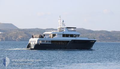
CAPE COD II
Pleasure Craft
Current Trip
| Time Travelled | 3 days |
|---|---|
| Remaining Time | --- |
| Distance Travelled | 304.06 nm |
| Remaining Distance | --- |
| AVG Speed | 10.2 Knots |
| MAX Speed | 10.9 Knots |
| AVG Wind | 12.7 knots |
| MAX Wind | 15 knots |
| MIN Temp | 16.3°C / 61.34°F |
| MAX Temp | 19.2°C / 66.56°F |
| Dybgang | 3 m |
| Position Modtaget | 1 d siden |
Current Position
| Longitude | 12.91491° |
|---|---|
| Latitude | 43.94403° |
| Status | Under way using engine |
| Fart | 10.2 Knots |
| Kurs | 226.1° |
| Område | Adriatic Sea |
| Station | T-AIS |
| Position Modtaget | 1 d siden |
Info
Information
The current position of CAPE COD II is in Adriatic Sea with coordinates 43.94403° / 12.91491° as reported on 2024-05-01 10:39 by AIS to our vessel tracker app. The vessel's current speed is 10.2 Knots
The vessel CAPE COD II (MMSI: 215388000) is a Pleasure Craft It's sailing under the flag of [MT] Malta.
In this page you can find informations about the vessels current position, last detected port calls, and current voyage information. If the vessels is not in coverage by AIS you will find the latest position.
The current position of CAPE COD II is detected by our AIS receivers and we are not responsible for the reliability of the data. The last position was recorded while the vessel was in Coverage by the Ais receivers of our vessel tracking app.
The current draught of CAPE COD II as reported by AIS is 3 meters
Weather
| Temperature | 16.4°C / 61.52°F |
|---|---|
| Wind Speed | 14 knots |
| Direction | 100° E |
| Pressure | 1008.5 hPa |
| Humidity | 89 % |
| Cloud Coverage | 100 % |
Featured Company
Last Port Calls
| Port | Arrival | Departure | Time In Port |
|---|---|---|---|
| 2024-04-30 05:13 | |||
| 2024-04-26 14:52 | 2024-04-29 02:18 | 2 d | |
| 2024-04-24 20:04 | |||
| 2024-04-17 08:54 | 2024-04-19 03:28 | 1 d | |
| 2024-04-10 12:30 | 2024-04-16 07:17 | 5 d | |
| 2024-03-23 13:08 | 2024-04-10 12:21 | 17 d | |
| 2024-03-23 08:27 |
Last Trips
| Origin | Departure | Destination | Arrival | Distance | |
|---|---|---|---|---|---|
| 2024-04-19 06:28 | 2024-04-26 17:52 | 530.76 nm | |||
| 2024-04-19 06:28 | 2024-04-24 23:04 | 404.43 nm | |||
| 2024-04-16 10:17 | 2024-04-17 11:54 | 270.21 nm | |||
| 2024-04-10 15:21 | 2024-04-10 15:30 | 1.59 nm | |||
| 2024-03-23 10:27 | 2024-03-23 15:08 | 35.38 nm |
Events
| Tid | Hændelsen | Detaljer | Position / Dest | Info |
|---|---|---|---|---|
| 2024-05-01 10:39 | Udenfor Dækning |
43.94403 / 12.91491
Adriatic Sea
PESARO
|
Fart: 10.2 kn Kurs: 226.1° |
|
| 2024-05-01 10:22 | ETA er ændret | 2024/05/01 11:00 2024/05/01 12:00 |
43.94698 / 12.98252
PESARO
|
Fart: 10.7 kn Kurs: 288° |
| 2024-05-01 08:53 | ETA er ændret | 2024/05/01 12:00 2024/05/01 14:30 |
43.86802 / 13.32766
PESARO
|
Fart: 10.4 kn Kurs: 286.2° |
| 2024-05-01 07:13 | Indenfor Dækning |
43.75119 / 13.67587
Adriatic Sea
PESARO
|
Fart: 10.3 kn Kurs: 312.3° |
|
| 2024-05-01 05:33 | Udenfor Dækning |
43.54909 / 13.96302
Adriatic Sea
PESARO
|
Fart: 10.2 kn Kurs: 314.2° |
|
| 2024-05-01 04:22 | Indenfor Dækning |
43.40262 / 14.17038
Adriatic Sea
PESARO
|
Fart: 10.7 kn Kurs: 315.5° |
|
| 2024-05-01 02:57 | Udenfor Dækning |
43.23023 / 14.41672
Adriatic Sea
PESARO
|
Fart: 10.3 kn Kurs: 310.7° |
|
| 2024-05-01 01:39 | Indenfor Dækning |
43.07632 / 14.63786
Adriatic Sea
PESARO
|
Fart: 10.5 kn Kurs: 313.5° |
|
| 2024-05-01 00:13 | Udenfor Dækning |
42.90284 / 14.88620
Adriatic Sea
PESARO
|
Fart: 10.5 kn Kurs: 312.3° |
|
| 2024-04-30 22:42 | Udenfor Dækning |
42.71916 / 15.14405
Adriatic Sea
PESARO
|
Fart: 10.5 kn Kurs: 316.1° |