
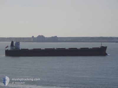
CAPE AKAMAS
Bulk Carrier
Current Trip
BUTANI,INDONESIA
| Time Travelled | 29 days |
|---|---|
| Remaining Time | --- |
| Distance Travelled | 4063.68 nm |
| Remaining Distance | --- |
| AVG Speed | 10.6 Knots |
| MAX Speed | 14.4 Knots |
| AVG Wind | 8.3 knots |
| MAX Wind | 20.5 knots |
| MIN Temp | 22.1°C / 71.78°F |
| MAX Temp | 30.8°C / 87.44°F |
| Dybgang | 7.4 m |
| Position Modtaget | 6 d siden |
Current Position
| Longitude | 104.31943° |
|---|---|
| Latitude | 1.27747° |
| Status | Under way using engine |
| Fart | 12 Knots |
| Kurs | 80° |
| Område | Singapore Strait |
| Station | T-AIS |
| Position Modtaget | 6 d siden |
Info
Information
The current position of CAPE AKAMAS is in Singapore Strait with coordinates 1.27747° / 104.31943° as reported on 2024-04-21 22:53 by AIS to our vessel tracker app. The vessel's current speed is 12 Knots
The vessel CAPE AKAMAS (IMO: 9481453, MMSI: 255802650) is a Bulk Carrier that was built in 2010 ( 14 år gamle ). It's sailing under the flag of [PT] Portugal.
In this page you can find informations about the vessels current position, last detected port calls, and current voyage information. If the vessels is not in coverage by AIS you will find the latest position.
The current position of CAPE AKAMAS is detected by our AIS receivers and we are not responsible for the reliability of the data. The last position was recorded while the vessel was in Coverage by the Ais receivers of our vessel tracking app.
The current draught of CAPE AKAMAS as reported by AIS is 7.4 meters
Weather
| Temperature | 29°C / 84.2°F |
|---|---|
| Wind Speed | 6 knots |
| Direction | 116° ESE |
| Pressure | 1006 hPa |
| Humidity | 77.6 % |
| Cloud Coverage | 100 % |
Featured Company
Events
| Tid | Hændelsen | Detaljer | Position / Dest | Info |
|---|---|---|---|---|
| 2024-04-24 21:04 | STOP Sejllads | 19.39 nm, West of MEKAR PUTIH |
-3.95380 / 115.72283
BUTANI,INDONESIA
|
Fart: 0.1 kn Kurs: 318° |
| 2024-04-21 23:00 | Status er ændret | Default Under way using engine |
1.28698 / 104.33975
BUTANI,INDONESIA
|
Fart: 12 kn Kurs: 80° |
| 2024-04-21 22:53 | Status er ændret | Under way using engine Default |
1.27747 / 104.31943
BUTANI,INDONESIA
|
Fart: 12 kn Kurs: 80° |
| 2024-04-21 22:53 | Udenfor Dækning |
1.27747 / 104.31943
Singapore Strait
BUTANI,INDONESIA
|
Fart: 12 kn Kurs: 80° |
|
| 2024-04-21 22:41 | Status er ændret | Default Under way using engine |
1.26973 / 104.27769
BUTANI,INDONESIA
|
Fart: 12.1 kn Kurs: 79° |
| 2024-04-21 22:25 | Fundet i havområde | Malaysian part of the Singapore Strait |
1.26018 / 104.22785
Singapore Strait
BUTANI,INDONESIA
|
Fart: 12 kn Kurs: 79° |
| 2024-04-21 18:25 | Dybgangen er ændret | 7.4 14.9 |
1.14493 / 103.47655
BUTANI,INDONESIA
|
Fart: 12.4 kn Kurs: 117° |
| 2024-04-21 18:25 | Destination er ændret | BUTANI,INDONESIA PORT DICKSON |
1.14493 / 103.47655
BUTANI,INDONESIA
|
Fart: 12.4 kn Kurs: 117° |
| 2024-04-21 18:25 | ETA er ændret | 2024/04/24 22:00 2024/04/15 03:50 |
1.14493 / 103.47655
BUTANI,INDONESIA
|
Fart: 12.4 kn Kurs: 117° |
| 2024-04-21 18:07 | Ændre havområde | Indonesian part of the Singapore Strait Indonesian part of the Malacca Strait |
1.17813 / 103.42248
Singapore Strait
|
Fart: 12.5 kn Kurs: 128° |