
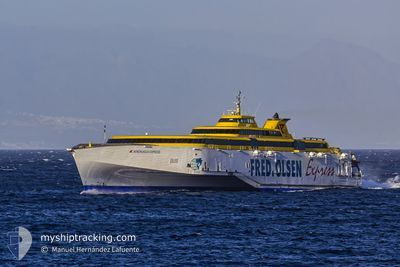
BENCHIJIGUA EXPRESS
Ro-Ro/Passenger Ship
Current Trip
| Trip Time | 2 h, 7 mins |
|---|---|
| Trip Distance | 48.63 nm |
| AVG Speed | 12.9 Knots |
| MAX Speed | 12.9 Knots |
| Dybgang | 4.1 m |
| AVG Wind | 13.7 knots |
| MAX Wind | 15 knots |
| MIN Temp | 18.3°C / 64.94°F |
| MAX Temp | 19.6°C / 67.28°F |
| Position Modtaget | 15 h, 52 m siden |
Current Position
| Longitude | --- |
|---|---|
| Latitude | --- |
| Status | Under way using engine |
| Fart | 0.1 Knots |
| Kurs | 16° |
| Område | North Atlantic Ocean |
| Station | T-AIS |
| Position Modtaget | 15 h, 52 m siden |
Info
Information
The current position of BENCHIJIGUA EXPRESS is in North Atlantic Ocean with coordinates 28.46064° / -16.24505° as reported on 2025-03-17 14:03 by AIS to our vessel tracker app. The vessel's current speed is 0.1 Knots and is currently inside the port of TENERIFE.
The vessel BENCHIJIGUA EXPRESS (IMO: 9299056, MMSI: 224441000) is a Ro-Ro/Passenger Ship that was built in 2005 ( 20 år gamle ). It's sailing under the flag of [ES] Spain.
In this page you can find informations about the vessels current position, last detected port calls, and current voyage information. If the vessels is not in coverage by AIS you will find the latest position.
The current position of BENCHIJIGUA EXPRESS is detected by our AIS receivers and we are not responsible for the reliability of the data. The last position was recorded while the vessel was in Coverage by the Ais receivers of our vessel tracking app.
The current draught of BENCHIJIGUA EXPRESS as reported by AIS is 4.1 meters
Weather
| Temperature | 18.4°C / 65.12°F |
|---|---|
| Wind Speed | 14 knots |
| Direction | 298° WNW |
| Pressure | 1022.1 hPa |
| Humidity | 58.6 % |
| Cloud Coverage | 1 % |
Featured Company
Last Port Calls
| Port | Arrival | Departure | Time In Port |
|---|---|---|---|
| 2025-03-17 13:42 | |||
| 2025-03-17 10:16 | 2025-03-17 11:35 | 1 h | |
| 2025-03-16 21:45 | |||
| 2025-03-16 18:24 | 2025-03-16 19:32 | 1 h | |
| 2025-03-16 16:52 | 2025-03-16 17:39 | 47 m | |
| 2025-03-16 15:23 | 2025-03-16 16:06 | 42 m | |
| 2025-03-16 13:56 | 2025-03-16 14:36 | 39 m | |
| 2025-03-16 12:28 | 2025-03-16 13:09 | 41 m | |
| 2025-03-15 21:22 | 2025-03-16 10:14 | 12 h | |
| 2025-03-15 18:24 | 2025-03-15 19:06 | 42 m |
Most Visited Ports (Last year)
| Port | Arrivals | |
|---|---|---|
| 1072 | ||
| 680 | ||
| 354 | ||
| 1 | ||
| 1 |
Last Trips
| Origin | Departure | Destination | Arrival | Distance | |
|---|---|---|---|---|---|
| 2025-03-17 11:35 | 2025-03-17 13:42 | 48.63 nm | |||
| 2025-03-17 11:35 | 2025-03-17 10:16 | 48.63 nm | |||
| 2025-03-16 19:32 | 2025-03-16 21:45 | 68.35 nm | |||
| 2025-03-16 17:39 | 2025-03-16 18:24 | 21.79 nm | |||
| 2025-03-16 16:06 | 2025-03-16 16:52 | 21.56 nm | |||
| 2025-03-16 14:36 | 2025-03-16 15:23 | 22.92 nm | |||
| 2025-03-16 13:09 | 2025-03-16 13:56 | 22.95 nm | |||
| 2025-03-16 10:14 | 2025-03-16 12:28 | 67.71 nm | |||
| 2025-03-15 19:06 | 2025-03-15 21:22 | 70.71 nm | |||
| 2025-03-15 17:35 | 2025-03-15 18:24 | 22.39 nm |
Events
| Tid | Hændelsen | Detaljer | Position / Dest | Info |
|---|---|---|---|---|
| 2025-03-17 14:03 | Udenfor Dækning |
28.46064 / -16.24505
North Atlantic Ocean
[ES] TENERIFE
|
Fart: 0.1 kn Kurs: 168.6° |
|
| 2025-03-17 13:49 | STOP Sejllads |
28.46066 / -16.24503
[ES] TENERIFE
|
Fart: 0.3 kn Kurs: 19° |
|
| 2025-03-17 13:42 | Skibe i havn |
|
28.45362 / -16.24676
[ES] TENERIFE
|
Fart: 9.2 kn Kurs: 320.5° |
| 2025-03-17 12:49 | Status er ændret | Under way using engine Default |
28.21981 / -16.33140
CRT_GMR_SPC
|
Fart: 29.2 kn Kurs: 19° |
| 2025-03-17 12:33 | Status er ændret | Default Under way using engine |
28.09566 / -16.38808
CRT_GMR_SPC
|
Fart: 24 kn Kurs: 125.9° |
| 2025-03-17 11:35 | Afsejlet fra sidste havn |
|
28.03562 / -16.71832
CRT_GMR_SPC
|
Fart: 5.2 kn Kurs: 230° |
| 2025-03-17 11:32 | Status er ændret | Under way using engine Default |
28.04066 / -16.71563
[ES] LOS CRISTIANOS
|
Fart: 3.6 kn Kurs: 116° |
| 2025-03-17 11:32 | START Sejllads |
28.04066 / -16.71563
[ES] LOS CRISTIANOS
|
Fart: 10.7 kn Kurs: 213° |
|
| 2025-03-17 11:28 | Indenfor Dækning |
28.03649 / -16.71784
North Atlantic Ocean
[ES] LOS CRISTIANOS
|
Fart: 3.9 kn Kurs: 195° |
|
| 2025-03-17 10:10 | Udenfor Dækning |
28.03583 / -16.72706
North Atlantic Ocean
[ES] LOS CRISTIANOS
|
Fart: 21.6 kn Kurs: 43.9° |