
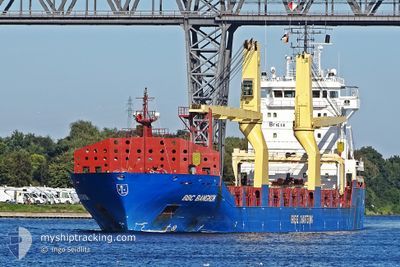
BBC BANGKOK
General Cargo
Current Trip
| Time Travelled | 5 days |
|---|---|
| Remaining Time | --- |
| Distance Travelled | 1238.25 nm |
| Remaining Distance | --- |
| AVG Speed | 10.3 Knots |
| MAX Speed | 13.2 Knots |
| AVG Wind | 13.2 knots |
| MAX Wind | 28 knots |
| MIN Temp | 14.2°C / 57.56°F |
| MAX Temp | 17.8°C / 64.04°F |
| Dybgang | 5 m |
| Position Modtaget | 3 d siden |
Current Position
| Longitude | --- |
|---|---|
| Latitude | --- |
| Status | Under way using engine |
| Fart | 11.2 Knots |
| Kurs | 284.8° |
| Område | Mediterranean Sea - Eastern Basin |
| Station | T-AIS |
| Position Modtaget | 3 d siden |
Info
Information
The current position of BBC BANGKOK is in Mediterranean Sea - Eastern Basin with coordinates 37.19282° / 12.18309° as reported on 2025-03-14 06:53 by AIS to our vessel tracker app. The vessel's current speed is 11.2 Knots and is heading at the port of DIEPPE. The estimated time of arrival as calculated by MyShipTracking vessel tracking app is 2025-03-22 17:00 LT
The vessel BBC BANGKOK (IMO: 9437165, MMSI: 305512000) is a General Cargo that was built in 2011 ( 14 år gamle ). It's sailing under the flag of [AG] Antigua Barbuda.
In this page you can find informations about the vessels current position, last detected port calls, and current voyage information. If the vessels is not in coverage by AIS you will find the latest position.
The current position of BBC BANGKOK is detected by our AIS receivers and we are not responsible for the reliability of the data. The last position was recorded while the vessel was in Coverage by the Ais receivers of our vessel tracking app.
The current draught of BBC BANGKOK as reported by AIS is 5 meters
Weather
| Temperature | 15.7°C / 60.26°F |
|---|---|
| Wind Speed | 14 knots |
| Direction | 108° ESE |
| Pressure | 1012.8 hPa |
| Humidity | 82.6 % |
| Cloud Coverage | 22 % |
Featured Company
Last Port Calls
| Port | Arrival | Departure | Time In Port |
|---|---|---|---|
| 2025-03-07 01:24 | 2025-03-12 17:28 | 5 d | |
| 2025-03-01 13:33 | 2025-03-03 22:00 | 2 d | |
| 2025-02-23 09:10 | 2025-02-24 20:32 | 1 d | |
| 2025-02-16 09:46 | 2025-02-20 07:31 | 3 d | |
| 2025-02-12 12:35 | 2025-02-14 14:19 | 2 d | |
| 2025-01-24 10:10 | 2025-01-25 11:25 | 1 d | |
| 2025-01-17 10:39 | 2025-01-17 17:12 | 6 h | |
| 2025-01-12 20:31 | 2025-01-14 03:07 | 1 d |
Last Trips
| Origin | Departure | Destination | Arrival | Distance | |
|---|---|---|---|---|---|
| 2025-03-03 22:00 | 2025-03-07 01:24 | 845.12 nm | |||
| 2025-02-24 20:32 | 2025-03-01 13:33 | 1228.25 nm | |||
| 2025-02-20 07:31 | 2025-02-23 09:10 | 849.58 nm | |||
| 2025-02-14 14:19 | 2025-02-16 09:46 | 293.16 nm | |||
| 2025-01-25 11:25 | 2025-02-12 12:35 | 1164.09 nm | |||
| 2025-01-17 17:12 | 2025-01-24 10:10 | 1652.88 nm | |||
| 2025-01-14 03:07 | 2025-01-17 10:39 | 807.51 nm | |||
| 2024-12-31 16:21 | 2025-01-12 20:31 | 435.14 nm |
Events
| Tid | Hændelsen | Detaljer | Position / Dest | Info |
|---|---|---|---|---|
| 2025-03-14 07:11 | Status er ændret | Default Under way using engine |
37.20805 / 12.11649
FRDPE
|
Fart: 11.2 kn Kurs: 284.8° |
| 2025-03-14 06:53 | Udenfor Dækning |
37.19282 / 12.18309
Mediterranean Sea - Eastern Basin
FRDPE
|
Fart: 11.2 kn Kurs: 284.8° |
|
| 2025-03-14 06:26 | Status er ændret | Under way using engine Default |
37.16803 / 12.28262
FRDPE
|
Fart: 11.3 kn Kurs: 288° |
| 2025-03-14 06:13 | Status er ændret | Default Under way using engine |
37.15556 / 12.33282
FRDPE
|
Fart: 11.3 kn Kurs: 286.1° |
| 2025-03-14 05:57 | Status er ændret | Under way using engine Default |
37.14033 / 12.39370
FRDPE
|
Fart: 11.5 kn Kurs: 293° |
| 2025-03-14 05:41 | Indenfor Dækning |
37.14050 / 12.39301
Mediterranean Sea - Eastern Basin
FRDPE
|
Fart: 11.4 kn Kurs: 285.4° |
|
| 2025-03-14 01:20 | Status er ændret | Default Under way using engine |
36.89347 / 13.44949
FRDPE
|
Fart: 11.7 kn Kurs: 287.5° |
| 2025-03-14 01:15 | Status er ændret | Under way using engine Default |
36.88907 / 13.46700
FRDPE
|
Fart: 11.7 kn Kurs: 288° |
| 2025-03-14 01:15 | Udenfor Dækning |
36.88907 / 13.46700
Mediterranean Sea - Eastern Basin
FRDPE
|
Fart: 11.7 kn Kurs: 287.5° |
|
| 2025-03-14 00:37 | Status er ændret | Default Under way using engine |
36.85183 / 13.61556
FRDPE
|
Fart: 11.7 kn Kurs: 282.5° |