
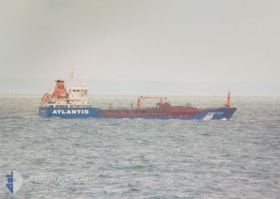
ATLANTIS ALICANTE
Tanker B
Current Trip
ITPMA>ITAUG
| Time Travelled | 15 days |
|---|---|
| Remaining Time | --- |
| Distance Travelled | 1440.73 nm |
| Remaining Distance | --- |
| AVG Speed | 9.7 Knots |
| MAX Speed | 14 Knots |
| AVG Wind | 12.5 knots |
| MAX Wind | 31 knots |
| MIN Temp | 9.4°C / 48.92°F |
| MAX Temp | 15.8°C / 60.44°F |
| Dybgang | 5.4 m |
| Position Modtaget | 7 h, 41 m siden |
Current Position
| Longitude | --- |
|---|---|
| Latitude | --- |
| Status | Under way using engine |
| Fart | 8.8 Knots |
| Kurs | 302.5° |
| Område | Mediterranean Sea - Eastern Basin |
| Station | T-AIS |
| Position Modtaget | 7 h, 41 m siden |
Info
Information
The current position of ATLANTIS ALICANTE is in Mediterranean Sea - Eastern Basin with coordinates 37.60471° / 12.17084° as reported on 2025-02-16 16:13 by AIS to our vessel tracker app. The vessel's current speed is 8.8 Knots
The vessel ATLANTIS ALICANTE (IMO: 9390874, MMSI: 248295000) is a Tanker B It's sailing under the flag of [MT] Malta.
In this page you can find informations about the vessels current position, last detected port calls, and current voyage information. If the vessels is not in coverage by AIS you will find the latest position.
The current position of ATLANTIS ALICANTE is detected by our AIS receivers and we are not responsible for the reliability of the data. The last position was recorded while the vessel was in Coverage by the Ais receivers of our vessel tracking app.
The current draught of ATLANTIS ALICANTE as reported by AIS is 5.4 meters
Weather
| Temperature | 13.6°C / 56.48°F |
|---|---|
| Wind Speed | 7 knots |
| Direction | 186° S |
| Pressure | 1014.9 hPa |
| Humidity | 68.7 % |
| Cloud Coverage | 63 % |
Featured Company
Last Port Calls
| Port | Arrival | Departure | Time In Port |
|---|---|---|---|
| 2025-01-31 14:33 | 2025-02-01 15:00 | 1 d | |
| 2025-01-24 00:01 | 2025-01-25 14:16 | 1 d | |
| 2025-01-21 13:39 | 2025-01-22 09:06 | 19 h | |
| 2025-01-19 11:56 | 2025-01-20 03:11 | 15 h | |
| 2025-01-16 11:24 | 2025-01-17 12:54 | 1 d | |
| 2025-01-09 18:20 | 2025-01-11 02:25 | 1 d | |
| 2025-01-03 15:47 | 2025-01-04 05:39 | 13 h | |
| 2025-01-02 09:19 | 2025-01-02 16:15 | 6 h | |
| 2025-01-01 09:09 | 2025-01-02 05:02 | 19 h | |
| 2024-12-25 18:07 | 2024-12-26 16:12 | 22 h |
Most Visited Ports (Last year)
| Port | Arrivals | |
|---|---|---|
| 6 | ||
| 3 | ||
| 3 | ||
| 3 | ||
| 2 | ||
| 2 |
Last Trips
| Origin | Departure | Destination | Arrival | Distance | |
|---|---|---|---|---|---|
| 2025-01-25 15:16 | 2025-01-31 15:33 | 1447.44 nm | |||
| 2025-01-22 10:06 | 2025-01-24 01:01 | 277.94 nm | |||
| 2025-01-20 04:11 | 2025-01-21 14:39 | 269.52 nm | |||
| 2025-01-17 13:54 | 2025-01-19 12:56 | 8.91 nm | |||
| 2025-01-11 03:25 | 2025-01-16 12:24 | 1402.34 nm | |||
| 2025-01-04 06:39 | 2025-01-09 19:20 | 1501.49 nm | |||
| 2025-01-02 17:15 | 2025-01-03 16:47 | 248.23 nm | |||
| 2025-01-02 06:02 | 2025-01-02 10:19 | 28.52 nm | |||
| 2024-12-26 17:12 | 2025-01-01 10:09 | 329.97 nm | |||
| 2024-12-20 21:34 | 2024-12-25 19:07 | 893.35 nm |
Events
| Tid | Hændelsen | Detaljer | Position / Dest | Info |
|---|---|---|---|---|
| 2025-02-16 16:27 | Status er ændret | Default Under way using engine |
37.62389 / 12.13448
ITPMA>ITAUG
|
Fart: 8.8 kn Kurs: 302.5° |
| 2025-02-16 16:13 | Udenfor Dækning |
37.60471 / 12.17084
Mediterranean Sea - Eastern Basin
|
Fart: 8.8 kn Kurs: 302.5° |
|
| 2025-02-16 16:03 | Status er ændret | Under way using engine Default |
37.59253 / 12.19483
ITPMA>ITAUG
|
Fart: 8.7 kn Kurs: 303° |
| 2025-02-16 15:53 | Indenfor Dækning |
37.59253 / 12.19483
Mediterranean Sea - Eastern Basin
|
Fart: 8.6 kn Kurs: 303.5° |
|
| 2025-02-16 03:37 | Status er ændret | Default Under way using engine |
36.73790 / 14.00682
ITPMA>ITAUG
|
Fart: 6.3 kn Kurs: 293.4° |
| 2025-02-16 03:35 | Udenfor Dækning |
36.73586 / 14.01173
Mediterranean Sea - Eastern Basin
|
Fart: 6.3 kn Kurs: 293.4° |
|
| 2025-02-16 02:50 | Status er ændret | Under way using engine Default |
36.70746 / 14.08072
ITPMA>ITAUG
|
Fart: 3.7 kn Kurs: 299° |
| 2025-02-16 02:18 | Status er ændret | Default Under way using engine |
36.68604 / 14.12805
ITPMA>ITAUG
|
Fart: 4.7 kn Kurs: 299° |
| 2025-02-16 01:56 | Status er ændret | Under way using engine Default |
36.67177 / 14.16054
ITPMA>ITAUG
|
Fart: 3.8 kn Kurs: 300° |
| 2025-02-16 01:47 | Status er ændret | Default Under way using engine |
36.66588 / 14.17419
ITPMA>ITAUG
|
Fart: 5.4 kn Kurs: 299.2° |