
AMARO
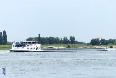
Cargo
Current Trip
| Time Travelled | 2 days |
|---|---|
| Remaining Time | --- |
| Distance Travelled | 108.06 nm |
| Remaining Distance | --- |
| AVG Speed | 8.4 Knots |
| MAX Speed | 10.1 Knots |
| AVG Wind | 10.3 knots |
| MAX Wind | 14 knots |
| MIN Temp | 8.1°C / 46.58°F |
| MAX Temp | 11.7°C / 53.06°F |
| Dybgang | 2.4 m |
| Position Modtaget | 10 h, 43 m siden |
Current Position
| Longitude | --- |
|---|---|
| Latitude | --- |
| Status | Moored |
| Fart | |
| Kurs | --- |
| Område | North Sea |
| Station | T-AIS |
| Position Modtaget | 10 h, 43 m siden |
Info
Information
The current position of AMARO is in North Sea with coordinates 52.33601° / 8.60659° as reported on 2025-12-11 09:36 by AIS to our vessel tracker app. The vessel's current speed is 0 Knots and is heading at the port of ZWARTSLUIS. The estimated time of arrival as calculated by MyShipTracking vessel tracking app is 2025-12-11 15:03 LT
The vessel AMARO (MMSI: 244700115) is a Cargo It's sailing under the flag of [NL] Netherlands.
In this page you can find informations about the vessels current position, last detected port calls, and current voyage information. If the vessels is not in coverage by AIS you will find the latest position.
The current position of AMARO is detected by our AIS receivers and we are not responsible for the reliability of the data. The last position was recorded while the vessel was in Coverage by the Ais receivers of our vessel tracking app.
The current draught of AMARO as reported by AIS is 2.4 meters
Weather
| Temperature | 7.8°C / 46.04°F |
|---|---|
| Wind Speed | 10 knots |
| Direction | 233° SW |
| Pressure | 1023.4 hPa |
| Humidity | 92.4 % |
| Cloud Coverage | 85 % |
Featured Company
Last Port Calls
| Port | Arrival | Departure | Time In Port |
|---|---|---|---|
| 2025-12-08 14:48 | 2025-12-09 09:02 | 18 h | |
| 2025-12-08 09:08 | 2025-12-08 13:14 | 4 h | |
| 2025-12-06 15:27 | 2025-12-08 07:48 | 1 d | |
| 2025-12-03 15:18 | 2025-12-04 05:35 | 14 h | |
| 2025-12-03 12:18 | 2025-12-03 13:04 | 46 m | |
| 2025-11-28 19:04 | 2025-12-01 20:21 | 3 d | |
| 2025-11-24 17:11 | 2025-11-24 18:00 | 48 m | |
| 2025-11-12 13:20 | 2025-11-12 13:57 | 37 m | |
| 2025-11-11 12:44 | 2025-11-12 10:24 | 21 h | |
| 2025-11-10 17:16 | 2025-11-11 11:14 | 17 h |
Last Trips
| Origin | Departure | Destination | Arrival | Distance | |
|---|---|---|---|---|---|
| 2025-12-08 13:14 | 2025-12-08 14:48 | 13.14 nm | |||
| 2025-12-08 07:48 | 2025-12-08 09:08 | 12.46 nm | |||
| 2025-12-04 05:35 | 2025-12-06 15:27 | 83.36 nm | |||
| 2025-12-03 13:04 | 2025-12-03 15:18 | 11.38 nm | |||
| 2025-12-01 20:21 | 2025-12-03 12:18 | 91.50 nm | |||
| 2025-11-24 18:00 | 2025-11-28 19:04 | 96.50 nm | |||
| 2025-11-12 13:57 | 2025-11-24 17:11 | 302.63 nm | |||
| 2025-11-12 10:24 | 2025-11-12 13:20 | 20.21 nm | |||
| 2025-11-11 11:14 | 2025-11-11 12:44 | 11.40 nm | |||
| 2025-11-10 11:40 | 2025-11-10 17:16 | 1.15 nm |
Events
| Tid | Hændelsen | Detaljer | Position / Dest | Info |
|---|---|---|---|---|
| 2025-12-11 09:36 | Udenfor Dækning |
52.33601 / 8.60659
North Sea
ZWARTSLUIS
|
Fart: Kurs: 511° |
|
| 2025-12-11 08:45 | Status er ændret | Moored Under way using engine |
52.33599 / 8.60659
ZWARTSLUIS
|
Fart: Kurs: 511° |
| 2025-12-11 08:31 | STOP Sejllads | 11.72 nm, West of MINDEN |
52.33607 / 8.60663
ZWARTSLUIS
|
Fart: Kurs: 511° |
| 2025-12-11 08:01 | Indenfor Dækning |
52.34502 / 8.55273
North Sea
ZWARTSLUIS
|
Fart: 5.2 kn Kurs: 105.7° |
|
| 2025-12-09 18:47 | Udenfor Dækning |
52.75444 / 7.25960
North Sea
ZWARTSLUIS
|
Fart: 3.6 kn Kurs: 170.5° |
|
| 2025-12-09 18:47 | START Sejllads | 2.44 nm, South of HAREN |
52.75494 / 7.25949
ZWARTSLUIS
|
Fart: 3.2 kn Kurs: 166.4° |
| 2025-12-09 18:39 | STOP Sejllads | 2.31 nm, South of HAREN |
52.75704 / 7.25871
ZWARTSLUIS
|
Fart: Kurs: 511° |
| 2025-12-09 17:40 | Indenfor Dækning |
52.80601 / 7.25849
North Sea
ZWARTSLUIS
|
Fart: 4.8 kn Kurs: 137.2° |
|
| 2025-12-09 12:00 | Udenfor Dækning |
53.09945 / 7.30085
North Sea
ZWARTSLUIS
|
Fart: 7 kn Kurs: 229.4° |
|
| 2025-12-09 09:36 | Destination er ændret | ZWARTSLUIS HAFEN LUBBECKE |
53.32352 / 7.26837
ZWARTSLUIS
|
Fart: 9 kn Kurs: 94.7° |