
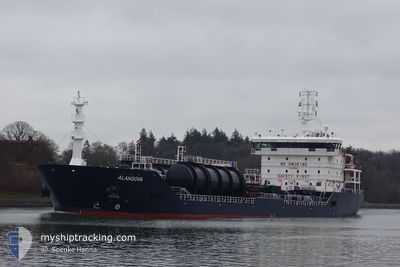
ALANGOVA
Oil/Chemical Tanker
Current Trip
| Time Travelled | 18 days |
|---|---|
| Remaining Time | --- |
| Distance Travelled | 4443.74 nm |
| Remaining Distance | --- |
| AVG Speed | 10.1 Knots |
| MAX Speed | 12.7 Knots |
| AVG Wind | 13 knots |
| MAX Wind | 22 knots |
| MIN Temp | 15.9°C / 60.62°F |
| MAX Temp | 26.3°C / 79.34°F |
| Dybgang | 7.9 m |
| Position Modtaget | 1 d siden |
Current Position
| Longitude | -24.18928° |
|---|---|
| Latitude | 36.56552° |
| Status | Under way using engine |
| Fart | 10.8 Knots |
| Kurs | 90.8° |
| Område | North Atlantic Ocean |
| Station | T-AIS |
| Position Modtaget | 1 d siden |
Info
Information
The current position of ALANGOVA is in North Atlantic Ocean with coordinates 36.56552° / -24.18928° as reported on 2024-05-01 11:04 by AIS to our vessel tracker app. The vessel's current speed is 10.8 Knots and is heading at the port of VENEZIA. The estimated time of arrival as calculated by MyShipTracking vessel tracking app is 2024-05-09 16:00 LT
The vessel ALANGOVA (IMO: 9411927, MMSI: 271002559) is a Oil/Chemical Tanker that was built in 2008 ( 16 år gamle ). It's sailing under the flag of [TR] Turkey.
In this page you can find informations about the vessels current position, last detected port calls, and current voyage information. If the vessels is not in coverage by AIS you will find the latest position.
The current position of ALANGOVA is detected by our AIS receivers and we are not responsible for the reliability of the data. The last position was recorded while the vessel was in Coverage by the Ais receivers of our vessel tracking app.
The current draught of ALANGOVA as reported by AIS is 7.9 meters
Weather
| Temperature | 16.9°C / 62.42°F |
|---|---|
| Wind Speed | 10 knots |
| Direction | 224° SW |
| Pressure | 1020.6 hPa |
| Humidity | 78 % |
| Cloud Coverage | 6 % |
Featured Company
Last Port Calls
| Port | Arrival | Departure | Time In Port |
|---|---|---|---|
| 2024-04-14 11:40 | 2024-04-14 12:16 | 36 m | |
| 2024-04-10 01:17 | 2024-04-11 20:28 | 1 d | |
| 2024-04-09 23:51 | 2024-04-10 00:44 | 53 m | |
| 2024-04-07 09:50 | 2024-04-08 17:52 | 1 d | |
| 2024-03-13 16:09 | 2024-03-15 13:56 | 1 d | |
| 2024-03-01 14:00 | 2024-03-06 12:42 | 4 d |
Most Visited Ports (Last year)
| Port | Arrivals | |
|---|---|---|
| 4 | ||
| 3 | ||
| 2 | ||
| 2 | ||
| 2 | ||
| 2 |
Last Trips
| Origin | Departure | Destination | Arrival | Distance | |
|---|---|---|---|---|---|
| 2024-04-11 15:28 | 2024-04-14 06:40 | 249.72 nm | |||
| 2024-04-09 19:44 | 2024-04-09 20:17 | 0.78 nm | |||
| 2024-04-08 12:52 | 2024-04-09 18:51 | 96.91 nm | |||
| 2024-03-15 14:56 | 2024-04-07 04:50 | 5084.77 nm | |||
| 2024-03-06 13:42 | 2024-03-13 17:09 | 994.61 nm | |||
| 2024-02-29 14:44 | 2024-03-01 15:00 | 213.37 nm |
Events
| Tid | Hændelsen | Detaljer | Position / Dest | Info |
|---|---|---|---|---|
| 2024-05-01 11:36 | Status er ændret | Default Under way using engine |
36.56546 / -24.06690
ITVCE
|
Fart: 10.8 kn Kurs: 90.8° |
| 2024-05-01 11:04 | Udenfor Dækning |
36.56552 / -24.18928
North Atlantic Ocean
ITVCE
|
Fart: 10.8 kn Kurs: 90.8° |
|
| 2024-05-01 05:40 | Dybgangen er ændret | 7.9 6.9 |
36.56083 / -25.38012
ITVCE
|
Fart: 10.6 kn Kurs: 91.1° |
| 2024-05-01 05:40 | Destination er ændret | ITVCE USCRP |
36.56083 / -25.38012
ITVCE
|
Fart: 10.6 kn Kurs: 91.1° |
| 2024-05-01 05:40 | ETA er ændret | 2024/05/09 16:00 2024/04/12 17:00 |
36.56083 / -25.38012
ITVCE
|
Fart: 10.6 kn Kurs: 91.1° |
| 2024-05-01 05:19 | Fundet i havområde | Portuguese (Azores) part of the North Atlantic Ocean |
36.56147 / -25.45541
North Atlantic Ocean
|
Fart: 10.4 kn Kurs: 91° |
| 2024-05-01 05:19 | Status er ændret | Under way using engine Default |
36.56148 / -25.45594
USCRP
|
Fart: 10.7 kn Kurs: 91° |
| 2024-05-01 05:19 | Indenfor Dækning |
36.56147 / -25.45541
North Atlantic Ocean
|
Fart: 10.4 kn Kurs: 91° |