
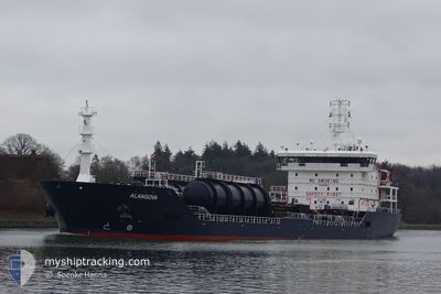
ALANGOVA
Oil/Chemical Tanker
Current Trip
USCRP
| Time Travelled | 11 days |
|---|---|
| Remaining Time | --- |
| Distance Travelled | 2569.11 nm |
| Remaining Distance | --- |
| AVG Speed | 10 Noeuds |
| MAX Speed | 12.7 Noeuds |
| AVG Wind | 13.8 knots |
| MAX Wind | 22 knots |
| MIN Temp | 19.5°C / 67.1°F |
| MAX Temp | 26.3°C / 79.34°F |
| Tirant d eau | 6.9 m |
| Position reçue | 5 d depuis |
Current Position
| Longitude | -76.84284° |
|---|---|
| Latitude | 25.76316° |
| Etat | Under way using engine |
| Vitesse | 10.2 Noeuds |
| Parcours | 63.2° |
| Zone | North Atlantic Ocean |
| Station | T-AIS |
| Position reçue | 5 d depuis |
Info
Information
The current position of ALANGOVA is in North Atlantic Ocean with coordinates 25.76316° / -76.84284° as reported on 2024-04-20 12:48 by AIS to our vessel tracker app. The vessel's current speed is 10.2 Noeuds
The vessel ALANGOVA (IMO: 9411927, MMSI: 271002559) is a Oil/Chemical Tanker that was built in 2008 ( 16 Age ). It's sailing under the flag of [TR] Turkey.
In this page you can find informations about the vessels current position, last detected port calls, and current voyage information. If the vessels is not in coverage by AIS you will find the latest position.
The current position of ALANGOVA is detected by our AIS receivers and we are not responsible for the reliability of the data. The last position was recorded while the vessel was in Coverage by the Ais receivers of our vessel tracking app.
The current draught of ALANGOVA as reported by AIS is 6.9 meters
Weather
| Temperature | 19.6°C / 67.28°F |
|---|---|
| Wind Speed | 12 knots |
| Direction | 163° SSE |
| Pressure | 1024.6 hPa |
| Humidity | 87.5 % |
| Cloud Coverage | 77 % |
Featured Company
Last Port Calls
| Port | Arrival | Departure | Time In Port |
|---|---|---|---|
| 2024-04-14 11:40 | 2024-04-14 12:16 | 36 m | |
| 2024-04-10 01:17 | 2024-04-11 20:28 | 1 d | |
| 2024-04-09 23:51 | 2024-04-10 00:44 | 53 m | |
| 2024-04-07 09:50 | 2024-04-08 17:52 | 1 d | |
| 2024-03-13 16:09 | 2024-03-15 13:56 | 1 d | |
| 2024-03-01 14:00 | 2024-03-06 12:42 | 4 d | |
| 2024-02-29 03:42 | 2024-02-29 13:44 | 10 h | |
| 2024-02-17 13:18 | |||
| 2024-02-09 05:31 | 2024-02-09 17:23 | 11 h | |
| 2024-02-08 15:07 | 2024-02-08 23:08 | 8 h |
Most Visited Ports (Last year)
| Port | Arrivals | |
|---|---|---|
| 4 | ||
| 3 | ||
| 2 | ||
| 2 | ||
| 2 | ||
| 2 |
Last Trips
| Origin | Departure | Destination | Arrival | Distance | |
|---|---|---|---|---|---|
| 2024-04-11 15:28 | 2024-04-14 06:40 | 249.72 nm | |||
| 2024-04-09 19:44 | 2024-04-09 20:17 | 0.78 nm | |||
| 2024-04-08 12:52 | 2024-04-09 18:51 | 96.91 nm | |||
| 2024-03-15 14:56 | 2024-04-07 04:50 | 5084.77 nm | |||
| 2024-03-06 13:42 | 2024-03-13 17:09 | 994.61 nm | |||
| 2024-02-29 14:44 | 2024-03-01 15:00 | 213.37 nm | |||
| 2024-02-09 20:23 | 2024-02-17 15:18 | 785.48 nm | |||
| 2024-02-09 02:08 | 2024-02-09 08:31 | 13.64 nm | |||
| 2024-02-08 17:49 | 2024-02-08 18:07 | 0.47 nm | |||
| 2024-02-06 07:25 | 2024-02-07 18:22 | 388.17 nm |
Events
| Heure | Evenement | Détails | Position/ Destination | Info |
|---|---|---|---|---|
| 2024-04-20 12:48 | Hors de la zone couverte |
25.76316 / -76.84284
North Atlantic Ocean
|
Vitesse: 10.2 kn Parcours: 63.2° |
|
| 2024-04-20 11:32 | Changement de zone | Bahamas part of the North Atlantic Ocean United States part of the Gulf of Mexico |
25.69155 / -77.07673
North Atlantic Ocean
|
Vitesse: 10.9 kn Parcours: 86.4° |
| 2024-04-20 11:31 | Etat Changé | Under way using engine Default |
25.69136 / -77.08011
USCRP
|
Vitesse: 10.7 kn Parcours: 91° |
| 2024-04-20 11:31 | Dans la zone couverte |
25.69155 / -77.07673
North Atlantic Ocean
|
Vitesse: 10.9 kn Parcours: 86.4° |
|
| 2024-04-15 21:41 | Etat Changé | Default Under way using engine |
27.01240 / -95.68388
USCRP
|
Vitesse: 9.7 kn Parcours: 129.4° |
| 2024-04-15 21:34 | Etat Changé | Under way using engine Default |
27.02515 / -95.70136
USCRP
|
Vitesse: 9.8 kn Parcours: 130° |
| 2024-04-15 21:34 | Hors de la zone couverte |
27.02515 / -95.70136
Gulf of Mexico
|
Vitesse: 9.7 kn Parcours: 129.4° |
|
| 2024-04-15 21:25 | Etat Changé | Default Under way using engine |
27.04041 / -95.72188
USCRP
|
Vitesse: 9.9 kn Parcours: 130° |
| 2024-04-15 21:04 | Etat Changé | Under way using engine Default |
27.07823 / -95.77233
USCRP
|
Vitesse: 9.8 kn Parcours: 129° |
| 2024-04-15 20:29 | Etat Changé | Default Under way using engine |
27.13998 / -95.85462
USCRP
|
Vitesse: 10 kn Parcours: 129.4° |