
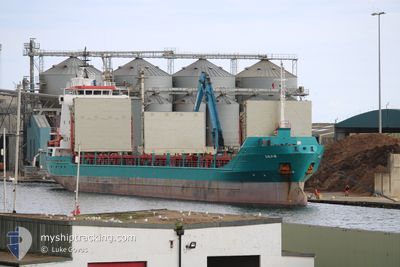
AGATTU
General Cargo
Current Trip
| Trip Time | 19 h, 12 mins |
|---|---|
| Trip Distance | 172.48 nm |
| AVG Speed | 9.1 Knots |
| MAX Speed | 10.8 Knots |
| Dybgang | 5.8 m |
| AVG Wind | 10.3 knots |
| MAX Wind | 14.9 knots |
| MIN Temp | 2°C / 35.6°F |
| MAX Temp | 5.3°C / 41.54°F |
| Position Modtaget | 2 h, 56 m siden |
Current Position
| Longitude | 27.73325° |
|---|---|
| Latitude | 59.41876° |
| Status | Moored |
| Fart | |
| Kurs | 273° |
| Område | Gulf of Finland |
| Station | T-AIS |
| Position Modtaget | 2 h, 56 m siden |
Info
Information
The current position of AGATTU is in Gulf of Finland with coordinates 59.41876° / 27.73325° as reported on 2024-05-06 08:51 by AIS to our vessel tracker app. The vessel's current speed is 0 Knots and is currently inside the port of SILLAMAE.
The vessel AGATTU (IMO: 9125097, MMSI: 629009234) is a General Cargo that was built in 1997 ( 27 år gamle ). It's sailing under the flag of [GM] Gambia.
In this page you can find informations about the vessels current position, last detected port calls, and current voyage information. If the vessels is not in coverage by AIS you will find the latest position.
The current position of AGATTU is detected by our AIS receivers and we are not responsible for the reliability of the data. The last position was recorded while the vessel was in Coverage by the Ais receivers of our vessel tracking app.
The current draught of AGATTU as reported by AIS is 5.8 meters
Weather
| Temperature | 3.9°C / 39.02°F |
|---|---|
| Wind Speed | 9 knots |
| Direction | 24° NNE |
| Pressure | 1014 hPa |
| Humidity | 63 % |
| Cloud Coverage | 11 % |
Featured Company
Last Port Calls
| Port | Arrival | Departure | Time In Port |
|---|---|---|---|
| 2024-05-06 04:56 | |||
| 2024-05-03 04:05 | 2024-05-05 09:44 | 2 d | |
| 2024-04-29 15:50 | 2024-04-30 10:20 | 18 h | |
| 2024-04-24 12:03 | |||
| 2024-04-13 23:44 | 2024-04-15 15:11 | 1 d | |
| 2024-04-10 18:27 | |||
| 2024-03-29 06:35 | |||
| 2024-03-24 20:44 | 2024-03-25 20:19 | 23 h | |
| 2024-03-19 22:00 |
Most Visited Ports (Last year)
| Port | Arrivals | |
|---|---|---|
| 4 | ||
| 2 | ||
| 1 | ||
| 1 |
Last Trips
| Origin | Departure | Destination | Arrival | Distance | |
|---|---|---|---|---|---|
| 2024-05-05 12:44 | 2024-05-06 07:56 | 172.48 nm | |||
| 2024-04-30 13:20 | 2024-05-03 07:05 | 172.53 nm | |||
| 2024-04-24 15:03 | 2024-04-29 18:50 | 385.44 nm | |||
| 2024-04-10 21:27 | 2024-04-14 01:44 | 707.52 nm | |||
| 2024-03-20 01:00 | 2024-03-24 21:44 | 625.32 nm |
Events
| Tid | Hændelsen | Detaljer | Position / Dest | Info |
|---|---|---|---|---|
| 2024-05-06 08:51 | Udenfor Dækning |
59.41876 / 27.73325
Gulf of Finland
[EE] SILLAMAE
|
Fart: Kurs: 283.7° |
|
| 2024-05-06 08:51 | Indenfor Dækning |
59.41876 / 27.73325
Gulf of Finland
[EE] SILLAMAE
|
Fart: Kurs: 283.7° |
|
| 2024-05-06 07:33 | Udenfor Dækning |
59.41877 / 27.73326
Gulf of Finland
[EE] SILLAMAE
|
Fart: Kurs: 322.7° |
|
| 2024-05-06 07:33 | Indenfor Dækning |
59.41877 / 27.73326
Gulf of Finland
[EE] SILLAMAE
|
Fart: Kurs: 322.7° |
|
| 2024-05-06 05:05 | Udenfor Dækning |
59.42077 / 27.73581
Gulf of Finland
[EE] SILLAMAE
|
Fart: 1.7 kn Kurs: 170.2° |
|
| 2024-05-06 04:56 | Skibe i havn |
|
59.42674 / 27.73137
[EE] SILLAMAE
|
Fart: 3.4 kn Kurs: 149° |
| 2024-05-06 04:20 | Indenfor Dækning |
59.47560 / 27.66201
Gulf of Finland
EESLM
|
Fart: 6.8 kn Kurs: 129.2° |
|
| 2024-05-06 03:15 | Udenfor Dækning |
59.52777 / 27.44452
Gulf of Finland
EESLM
|
Fart: 6.8 kn Kurs: 113.9° |
|
| 2024-05-06 03:10 | Indenfor Dækning |
59.53146 / 27.42780
Gulf of Finland
EESLM
|
Fart: 6.8 kn Kurs: 112.4° |
|
| 2024-05-06 02:01 | Udenfor Dækning |
59.58343 / 27.18957
Gulf of Finland
EESLM
|
Fart: 6.9 kn Kurs: 115.6° |