
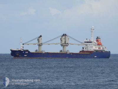
A LINE
Bulk Carrier
Current Trip
| Trip Time | 11 days |
|---|---|
| Trip Distance | 1491.36 nm |
| AVG Speed | 9.8 Knots |
| MAX Speed | 9.8 Knots |
| Dybgang | 4.6 m |
| AVG Wind | 10.8 knots |
| MAX Wind | 24.8 knots |
| MIN Temp | 10°C / 50°F |
| MAX Temp | 22.1°C / 71.78°F |
| Position Modtaget | 20 h, 45 m siden |
Current Position
| Longitude | 38.95775° |
|---|---|
| Latitude | 43.97875° |
| Status | Under way using engine |
| Fart | 11.7 Knots |
| Kurs | 70° |
| Område | Black Sea |
| Station | T-AIS |
| Position Modtaget | 20 h, 45 m siden |
Info
Information
The current position of A LINE is in Black Sea with coordinates 43.97875° / 38.95775° as reported on 2024-05-11 03:38 by AIS to our vessel tracker app. The vessel's current speed is 11.7 Knots and is currently inside the port of TUAPSE.
The vessel A LINE (IMO: 9246920, MMSI: 314715000) is a Bulk Carrier that was built in 2001 ( 23 år gamle ). It's sailing under the flag of [BB] Barbados.
In this page you can find informations about the vessels current position, last detected port calls, and current voyage information. If the vessels is not in coverage by AIS you will find the latest position.
The current position of A LINE is detected by our AIS receivers and we are not responsible for the reliability of the data. The last position was recorded while the vessel was in Coverage by the Ais receivers of our vessel tracking app.
The current draught of A LINE as reported by AIS is 4.6 meters
Weather
| Temperature | 16.3°C / 61.34°F |
|---|---|
| Wind Speed | 4 knots |
| Direction | 105° ESE |
| Pressure | 1007.9 hPa |
| Humidity | 88.5 % |
| Cloud Coverage | 99 % |
Featured Company
Last Port Calls
| Port | Arrival | Departure | Time In Port |
|---|---|---|---|
| 2024-05-11 19:36 | |||
| 2024-04-24 06:31 | 2024-04-30 17:24 | 6 d | |
| 2024-04-09 10:41 | 2024-04-16 08:45 | 6 d | |
| 2024-03-29 23:28 | 2024-04-04 18:12 | 5 d | |
| 2024-03-22 05:07 | 2024-03-24 13:57 | 2 d | |
| 2024-03-18 10:51 | |||
| 2024-03-01 08:07 |
Last Trips
| Origin | Departure | Destination | Arrival | Distance | |
|---|---|---|---|---|---|
| 2024-04-30 19:24 | 2024-05-11 22:36 | 1491.36 nm | |||
| 2024-04-16 11:45 | 2024-04-24 08:31 | 807.66 nm | |||
| 2024-04-04 20:12 | 2024-04-09 13:41 | 986.70 nm | |||
| 2024-03-24 15:57 | 2024-03-30 00:28 | 1266.58 nm | |||
| 2024-03-18 12:51 | 2024-03-22 07:07 | 101.61 nm |
Events
| Tid | Hændelsen | Detaljer | Position / Dest | Info |
|---|---|---|---|---|
| 2024-05-11 19:56 | STOP Sejllads |
44.09363 / 39.06635
[RU] TUAPSE
|
Fart: Kurs: 139° |
|
| 2024-05-11 19:36 | Skibe i havn |
|
44.08728 / 39.06783
[RU] TUAPSE
|
Fart: 5.9 kn Kurs: 5° |
| 2024-05-11 19:20 | START Sejllads | 1.45 nm, South of TUAPSE |
44.06480 / 39.07198
TUAPSE
|
Fart: 6.7 kn Kurs: 306° |
| 2024-05-11 13:13 | STOP Sejllads | 2.07 nm, South East of TUAPSE |
44.05775 / 39.08843
TUAPSE
|
Fart: Kurs: 23° |
| 2024-05-11 12:40 | START Sejllads | 2.17 nm, South East of TUAPSE |
44.05557 / 39.08718
TUAPSE
|
Fart: 6.6 kn Kurs: 193° |
| 2024-05-11 11:08 | START Sejllads | 2.25 nm, South East of TUAPSE |
44.05440 / 39.08833
TUAPSE
|
Fart: 7.4 kn Kurs: 175° |
| 2024-05-11 04:36 | STOP Sejllads | 2.04 nm, South East of TUAPSE |
44.05845 / 39.08892
TUAPSE
|
Fart: 0.2 kn Kurs: 46° |
| 2024-05-11 03:44 | Status er ændret | Default Under way using engine |
43.98678 / 38.98300
TUAPSE
|
Fart: 11.7 kn Kurs: 70° |
| 2024-05-11 03:38 | Ændre havområde | Russian part of the Black Sea Turkish part of the Black Sea |
43.97875 / 38.95775
Black Sea
|
Fart: 11.7 kn Kurs: 70° |
| 2024-05-11 03:38 | Udenfor Dækning |
43.97875 / 38.95775
Black Sea
|
Fart: 11.7 kn Kurs: 70° |