
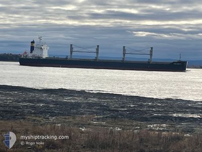
ZY DONGSHA
Cargo
Current Trip
| Time Travelled | 27 days |
|---|---|
| Remaining Time | --- |
| Distance Travelled | 5547.31 nm |
| Remaining Distance | --- |
| AVG Speed | 11.4 Knots |
| MAX Speed | 11.4 Knots |
| AVG Wind | 18.2 knots |
| MAX Wind | 35 knots |
| MIN Temp | 1.5°C / 34.7°F |
| MAX Temp | 22.6°C / 72.68°F |
| Draught | 12.6 m |
| Position Received | 4 m ago |
Current Position
| Longitude | --- |
|---|---|
| Latitude | --- |
| Status | At anchor |
| Speed | 0.1 Knots |
| Course | 245° |
| Area | Kattegat |
| Station | T-AIS |
| Position Received | 4 m ago |
Info
Information
The current position of ZY DONGSHA is in Kattegat with coordinates 57.63732° / 10.62058° as reported on 2025-12-11 19:22 by AIS to our vessel tracker app. The vessel's current speed is 0.1 Knots
The vessel ZY DONGSHA (IMO: 9832640, MMSI: 538008033) is a Cargo It's sailing under the flag of [MH] Marshall Is.
In this page you can find informations about the vessels current position, last detected port calls, and current voyage information. If the vessels is not in coverage by AIS you will find the latest position.
The current position of ZY DONGSHA is detected by our AIS receivers and we are not responsible for the reliability of the data. The last position was recorded while the vessel was in Coverage by the Ais receivers of our vessel tracking app.
The current draught of ZY DONGSHA as reported by AIS is 12.6 meters
Weather
| Temperature | 8.9°C / 48.02°F |
|---|---|
| Wind Speed | 25 knots |
| Direction | 257° WSW |
| Pressure | 1010.4 hPa |
| Humidity | 86.8 % |
| Cloud Coverage | 86 % |
Featured Company
Last Port Calls
| Port | Arrival | Departure | Time In Port |
|---|---|---|---|
| 2025-10-30 17:48 | 2025-11-13 23:36 | 14 d | |
| 2025-10-24 08:02 | 2025-10-24 17:21 | 9 h |
Last Trips
| Origin | Departure | Destination | Arrival | Distance | |
|---|---|---|---|---|---|
| 2025-09-21 13:59 | 2025-10-30 17:48 | 8409.05 nm | |||
| 2025-09-21 13:59 | 2025-10-24 08:02 | 8257.03 nm |
Events
| Time | Event | Details | Position / Dest | Info |
|---|---|---|---|---|
| 2025-12-11 17:40 | Status Changed | At anchor Default |
57.63780 / 10.62002
DJ JIB
|
Speed: Course: 236° |
| 2025-12-11 17:37 | Status Changed | Default At anchor |
57.63779 / 10.62010
DJ JIB
|
Speed: 0.1 kn Course: 232° |
| 2025-12-11 16:55 | Status Changed | At anchor Default |
57.63768 / 10.62023
DJ JIB
|
Speed: 0.2 kn Course: 237° |
| 2025-12-11 16:52 | Status Changed | Default At anchor |
57.63776 / 10.62011
DJ JIB
|
Speed: 0.1 kn Course: 234° |
| 2025-12-11 16:25 | Status Changed | At anchor Default |
57.63794 / 10.61968
DJ JIB
|
Speed: 0.1 kn Course: 232° |
| 2025-12-11 16:19 | Status Changed | Default At anchor |
57.63803 / 10.61956
DJ JIB
|
Speed: 0.2 kn Course: 230° |
| 2025-12-11 15:43 | Status Changed | At anchor Default |
57.63811 / 10.61943
DJ JIB
|
Speed: 0.1 kn Course: 232° |
| 2025-12-11 15:40 | Status Changed | Default At anchor |
57.63811 / 10.61950
DJ JIB
|
Speed: 0.1 kn Course: 228° |
| 2025-12-11 14:52 | Status Changed | At anchor Default |
57.63817 / 10.61931
DJ JIB
|
Speed: Course: 229° |
| 2025-12-11 14:49 | Status Changed | Default At anchor |
57.63820 / 10.61927
DJ JIB
|
Speed: 0.1 kn Course: 233° |