
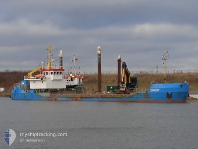
ZINGST
Trailing Suction Hopper Dredger
Current Trip
DEKEL
| Time Travelled | 1 day |
|---|---|
| Remaining Time | --- |
| Distance Travelled | 82.37 nm |
| Remaining Distance | --- |
| AVG Speed | 6.5 Knots |
| MAX Speed | 8.7 Knots |
| AVG Wind | 16.3 knots |
| MAX Wind | 28.7 knots |
| MIN Temp | 4.6°C / 40.28°F |
| MAX Temp | 15.3°C / 59.54°F |
| Draught | 2 m |
| Position Received | 1 m ago |
Current Position
| Longitude | --- |
|---|---|
| Latitude | --- |
| Status | At anchor |
| Speed | |
| Course | 101° |
| Area | Baltic Sea |
| Station | T-AIS |
| Position Received | 1 m ago |
Information
The current position of ZINGST is in Baltic Sea with coordinates 54.38351° / 10.17692° as reported on 2025-03-23 02:48 by AIS to our vessel tracker app. The vessel's current speed is 0 Knots
The vessel ZINGST (IMO: 9124562, MMSI: 211228710) is a Trailing Suction Hopper Dredger that was built in 1995 ( 30 years old ). It's sailing under the flag of [DE] Germany.
In this page you can find informations about the vessels current position, last detected port calls, and current voyage information. If the vessels is not in coverage by AIS you will find the latest position.
The current position of ZINGST is detected by our AIS receivers and we are not responsible for the reliability of the data. The last position was recorded while the vessel was in Coverage by the Ais receivers of our vessel tracking app.
The current draught of ZINGST as reported by AIS is 2 meters
Weather
| Temperature | 5.3°C / 41.54°F |
|---|---|
| Wind Speed | 19 knots |
| Direction | 105° ESE |
| Pressure | 1009.7 hPa |
| Humidity | 84.6 % |
| Cloud Coverage | 6 % |
Featured Company
Last Port Calls
| Port | Arrival | Departure | Time In Port |
|---|---|---|---|
| 2025-03-21 05:15 | 2025-03-21 05:45 | 29 m | |
| 2025-03-15 15:46 | 2025-03-15 15:47 | 1 m | |
| 2025-03-15 03:31 | 2025-03-15 04:13 | 42 m | |
| 2025-03-14 12:24 | 2025-03-14 12:26 | 2 m | |
| 2025-03-12 15:59 | 2025-03-12 16:03 | 4 m | |
| 2025-03-11 17:54 | 2025-03-11 17:59 | 5 m | |
| 2025-03-10 02:00 | 2025-03-10 02:43 | 43 m | |
| 2025-01-26 06:50 | 2025-03-08 15:28 | ||
| 2025-01-24 17:38 | 2025-01-24 17:43 | 4 m | |
| 2025-01-22 18:13 | 2025-01-22 18:18 | 5 m |
Most Visited Ports (Last year)
| Port | Arrivals | |
|---|---|---|
| 133 | ||
| 4 | ||
| 3 | ||
| 1 | ||
| 1 |
Last Trips
| Origin | Departure | Destination | Arrival | Distance | |
|---|---|---|---|---|---|
| 2025-03-15 16:47 | 2025-03-21 06:15 | 186.07 nm | |||
| 2025-03-15 05:13 | 2025-03-15 16:46 | 20.89 nm | |||
| 2025-03-14 13:26 | 2025-03-15 04:31 | 28.47 nm | |||
| 2025-03-12 17:03 | 2025-03-14 13:24 | 95.71 nm | |||
| 2025-03-11 18:59 | 2025-03-12 16:59 | 48.84 nm | |||
| 2025-03-10 03:43 | 2025-03-11 18:54 | 24.30 nm | |||
| 2025-03-08 16:28 | 2025-03-10 03:00 | 191.20 nm | |||
| 2025-01-24 18:43 | 2025-01-26 07:50 | 228.12 nm | |||
| 2025-01-22 19:18 | 2025-01-24 18:38 | 95.76 nm | |||
| 2025-01-20 19:38 | 2025-01-22 19:13 | 51.66 nm |
Events
| Time | Event | Details | Position / Dest | Info |
|---|---|---|---|---|
| 2025-03-22 13:28 | STOP Moving | 0.33 nm, East of STICKENHΟRN SPORT |
54.38371 / 10.17704
DEKEL
|
Speed: 0.3 kn Course: 91° |
| 2025-03-22 13:27 | Status Changed | At anchor Under way using engine |
54.38375 / 10.17702
DEKEL
|
Speed: 0.4 kn Course: 96° |
| 2025-03-22 09:33 | START Moving | 1.31 nm, South West of STICKENHΟRN SPORT |
54.36552 / 10.14536
DEKEL
|
Speed: 3.9 kn Course: 100° |
| 2025-03-22 09:05 | STOP Moving | 1.36 nm, South West of STICKENHΟRN SPORT |
54.36599 / 10.14197
DEKEL
|
Speed: 0.1 kn Course: 105° |
| 2025-03-22 07:39 | Status Changed | Under way using engine Moored |
54.34432 / 9.91897
DEKEL
|
Speed: 5.3 kn Course: 120.3° |
| 2025-03-22 07:33 | START Moving | 6.82 nm, East of BORGSTEDT |
54.34788 / 9.90905
DEKEL
|
Speed: 3.2 kn Course: 127° |
| 2025-03-22 06:54 | Status Changed | Moored Under way using engine |
54.34854 / 9.90772
DEKEL
|
Speed: Course: 114° |
| 2025-03-22 06:07 | STOP Moving | 6.58 nm, East of BORGSTEDT |
54.35022 / 9.90144
DEKEL
|
Speed: 0.3 kn Course: 124° |
| 2025-03-22 05:49 | START Moving | 7.51 nm, West of KIEL |
54.34095 / 9.94653
DEKEL
|
Speed: 4.8 kn Course: 266° |
| 2025-03-22 05:44 | STOP Moving | 7.39 nm, West of KIEL |
54.34127 / 9.94974
DEKEL
|
Speed: 0.3 kn Course: 264° |