
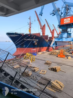
ZEYNEP KIRAN
Bulk Carrier
Current Trip
| Time Travelled | 11 days |
|---|---|
| Remaining Time | --- |
| Distance Travelled | 1850.89 nm |
| Remaining Distance | --- |
| AVG Speed | 11.8 Knots |
| MAX Speed | 11.8 Knots |
| AVG Wind | 10.5 knots |
| MAX Wind | 23 knots |
| MIN Temp | 22.9°C / 73.22°F |
| MAX Temp | 30.2°C / 86.36°F |
| Draught | 6.5 m |
| Position Received | 5 d ago |
Current Position
| Longitude | 35.85187° |
|---|---|
| Latitude | 36.48597° |
| Status | Under way using engine |
| Speed | 12.2 Knots |
| Course | 44.9° |
| Area | Mediterranean Sea - Eastern Basin |
| Station | T-AIS |
| Position Received | 5 d ago |
Info
Information
The current position of ZEYNEP KIRAN is in Mediterranean Sea - Eastern Basin with coordinates 36.48597° / 35.85187° as reported on 2024-08-02 11:24 by AIS to our vessel tracker app. The vessel's current speed is 12.2 Knots
The vessel ZEYNEP KIRAN (IMO: 9015577, MMSI: 271000642) is a Bulk Carrier that was built in 2001 ( 23 years old ). It's sailing under the flag of [TR] Turkey.
In this page you can find informations about the vessels current position, last detected port calls, and current voyage information. If the vessels is not in coverage by AIS you will find the latest position.
The current position of ZEYNEP KIRAN is detected by our AIS receivers and we are not responsible for the reliability of the data. The last position was recorded while the vessel was in Coverage by the Ais receivers of our vessel tracking app.
The current draught of ZEYNEP KIRAN as reported by AIS is 6.5 meters
Weather
| Temperature | 24.5°C / 76.1°F |
|---|---|
| Wind Speed | 5 knots |
| Direction | 264° W |
| Pressure | 1006.3 hPa |
| Humidity | 81.8 % |
| Cloud Coverage | --- |
Featured Company
Last Port Calls
| Port | Arrival | Departure | Time In Port |
|---|---|---|---|
| 2024-07-25 22:49 | 2024-07-26 20:21 | 21 h | |
| 2024-07-21 17:21 | 2024-07-24 21:34 | 3 d | |
| 2024-07-05 23:21 | 2024-07-11 19:30 | 5 d | |
| 2024-07-01 04:25 | 2024-07-04 12:05 | 3 d | |
| 2024-06-10 10:53 | 2024-06-14 09:13 | 3 d | |
| 2024-06-05 23:05 |
Last Trips
| Origin | Departure | Destination | Arrival | Distance | |
|---|---|---|---|---|---|
| 2024-07-24 21:34 | 2024-07-25 22:49 | 173.67 nm | |||
| 2024-07-11 19:30 | 2024-07-21 17:21 | 1819.85 nm | |||
| 2024-07-04 12:05 | 2024-07-05 23:21 | 414.12 nm | |||
| 2024-06-14 09:13 | 2024-07-01 04:25 | 1537.40 nm | |||
| 2024-06-05 23:05 | 2024-06-10 10:53 | 967.94 nm |
Events
| Time | Event | Details | Position / Dest | Info |
|---|---|---|---|---|
| 2024-08-02 13:51 | STOP Moving | 4.88 nm, South of DORTYOL |
36.75607 / 36.13890
TRISK
|
Speed: 0.1 kn Course: 222° |
| 2024-08-02 11:33 | Status Changed | Default Under way using engine |
36.50684 / 35.87686
TRISK
|
Speed: 12.2 kn Course: 44.9° |
| 2024-08-02 11:24 | OUT of Coverage |
36.48597 / 35.85187
Mediterranean Sea - Eastern Basin
TRISK
|
Speed: 12.2 kn Course: 44.9° |
|
| 2024-08-02 09:45 | Status Changed | Under way using engine Default |
36.33276 / 35.51035
TRISK
|
Speed: 11.2 kn Course: 77° |
| 2024-08-02 09:45 | IN Coverage |
36.33276 / 35.51035
Mediterranean Sea - Eastern Basin
TRISK
|
Speed: 11.2 kn Course: 69.6° |
|
| 2024-08-02 06:25 | START Moving |
36.22255 / 34.74070
TRISK
|
Speed: 10.9 kn Course: 80° |
|
| 2024-08-02 06:03 | Status Changed | Default Under way using engine |
36.20319 / 34.66568
TRISK
|
Speed: 6.3 kn Course: 83.6° |
| 2024-08-02 06:03 | STOP Moving |
36.20319 / 34.66568
TRISK
|
Speed: Course: 84° |
|
| 2024-08-02 06:01 | OUT of Coverage |
36.20359 / 34.66134
Mediterranean Sea - Eastern Basin
TRISK
|
Speed: 6.3 kn Course: 83.6° |
|
| 2024-08-02 06:01 | IN Coverage |
36.20294 / 34.65785
Mediterranean Sea - Eastern Basin
TRISK
|
Speed: 10.4 kn Course: 77.4° |