
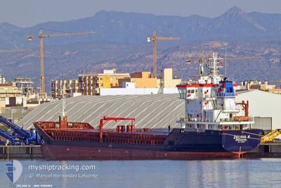
ZELIHA K
General Cargo
Current Trip
| Time Travelled | 4 days |
|---|---|
| Remaining Time | --- |
| Distance Travelled | 314.40 nm |
| Remaining Distance | --- |
| AVG Speed | 9 Knots |
| MAX Speed | 13.8 Knots |
| AVG Wind | 10.6 knots |
| MAX Wind | 21.5 knots |
| MIN Temp | 10.3°C / 50.54°F |
| MAX Temp | 18°C / 64.4°F |
| Draught | 6.6 m |
| Position Received | 2 m ago |
Current Position
| Longitude | 29.10764° |
|---|---|
| Latitude | 40.44477° |
| Status | At anchor |
| Speed | |
| Course | 42° |
| Area | Sea of Marmara |
| Station | T-AIS |
| Position Received | 2 m ago |
Info
Information
The current position of ZELIHA K is in Sea of Marmara with coordinates 40.44477° / 29.10764° as reported on 2024-04-29 16:37 by AIS to our vessel tracker app. The vessel's current speed is 0 Knots
The vessel ZELIHA K (IMO: 9395185, MMSI: 353427000) is a General Cargo that was built in 2007 ( 17 years old ). It's sailing under the flag of [PA] Panama.
In this page you can find informations about the vessels current position, last detected port calls, and current voyage information. If the vessels is not in coverage by AIS you will find the latest position.
The current position of ZELIHA K is detected by our AIS receivers and we are not responsible for the reliability of the data. The last position was recorded while the vessel was in Coverage by the Ais receivers of our vessel tracking app.
The current draught of ZELIHA K as reported by AIS is 6.6 meters
Weather
| Temperature | 13.2°C / 55.76°F |
|---|---|
| Wind Speed | 5 knots |
| Direction | 30° NNE |
| Pressure | 1020.3 hPa |
| Humidity | 87.5 % |
| Cloud Coverage | 92 % |
Featured Company
Last Port Calls
| Port | Arrival | Departure | Time In Port |
|---|---|---|---|
| 2024-04-25 13:36 | 2024-04-25 14:11 | 34 m | |
| 2024-04-25 04:59 | |||
| 2024-04-17 13:50 | |||
| 2024-04-13 09:37 | 2024-04-13 10:02 | 24 m | |
| 2024-04-03 10:19 | 2024-04-06 08:22 | 2 d | |
| 2024-03-28 06:31 | 2024-04-01 13:45 | 4 d | |
| 2024-03-19 08:52 | |||
| 2024-03-14 17:28 | |||
| 2024-03-02 11:13 | 2024-03-04 00:29 | 1 d | |
| 2024-03-01 03:44 |
Last Trips
| Origin | Departure | Destination | Arrival | Distance | |
|---|---|---|---|---|---|
| 2024-04-25 07:59 | 2024-04-25 16:36 | 64.88 nm | |||
| 2024-04-06 10:22 | 2024-04-13 12:37 | 1021.61 nm | |||
| 2024-04-01 15:45 | 2024-04-03 12:19 | 106.04 nm | |||
| 2024-03-19 09:52 | 2024-03-28 08:31 | 1289.50 nm | |||
| 2024-03-01 05:44 | 2024-03-02 13:13 | 135.99 nm | |||
| 2024-02-10 13:54 | 2024-02-12 17:58 | 456.39 nm | |||
| 2024-02-02 13:13 | 2024-02-08 07:34 | 1199.83 nm |
Events
| Time | Event | Details | Position / Dest | Info |
|---|---|---|---|---|
| 2024-04-29 16:37 | Status Changed | At anchor Default |
40.44477 / 29.10764
TRGEM
|
Speed: Course: 44° |
| 2024-04-29 16:34 | Status Changed | Default At anchor |
40.44472 / 29.10758
TRGEM
|
Speed: Course: 45° |
| 2024-04-29 16:13 | Status Changed | At anchor Default |
40.44453 / 29.10786
TRGEM
|
Speed: Course: 23° |
| 2024-04-29 16:10 | Status Changed | Default At anchor |
40.44450 / 29.10792
TRGEM
|
Speed: Course: 20° |
| 2024-04-29 15:13 | Status Changed | At anchor Default |
40.44441 / 29.10822
TRGEM
|
Speed: Course: 10° |
| 2024-04-29 15:07 | Status Changed | Default At anchor |
40.44441 / 29.10829
TRGEM
|
Speed: Course: 8° |
| 2024-04-29 15:01 | Status Changed | At anchor Default |
40.44440 / 29.10835
TRGEM
|
Speed: Course: 6° |
| 2024-04-29 14:58 | Status Changed | Default At anchor |
40.44441 / 29.10835
TRGEM
|
Speed: Course: 5° |
| 2024-04-29 14:13 | Status Changed | At anchor Default |
40.44438 / 29.10840
TRGEM
|
Speed: Course: 4° |
| 2024-04-29 14:10 | Status Changed | Default At anchor |
40.44437 / 29.10841
TRGEM
|
Speed: Course: 3° |