
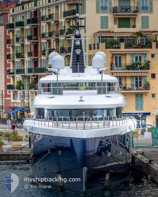
ZAZOU
Pleasure Craft
Current Trip
| Trip Time | 7 h, 9 mins |
|---|---|
| Trip Distance | 94.25 nm |
| AVG Speed | 12.5 Knots |
| MAX Speed | 15.1 Knots |
| Draught | 3.3 m |
| AVG Wind | 3.7 knots |
| MAX Wind | 5 knots |
| MIN Temp | 10.2°C / 50.36°F |
| MAX Temp | 12°C / 53.6°F |
| Position Received | 8 m ago |
Current Position
| Longitude | --- |
|---|---|
| Latitude | --- |
| Status | Moored |
| Speed | |
| Course | 221° |
| Area | Mediterranean Sea - Western Basin |
| Station | T-AIS |
| Position Received | 8 m ago |
Info
Information
The current position of ZAZOU is in Mediterranean Sea - Western Basin with coordinates 43.16919° / 5.61403° as reported on 2025-03-02 19:19 by AIS to our vessel tracker app. The vessel's current speed is 0 Knots and is currently inside the port of LA CIOTAT.
The vessel ZAZOU (IMO: 9799965, MMSI: 319211480) is a Pleasure Craft It's sailing under the flag of [KY] Cayman Is.
In this page you can find informations about the vessels current position, last detected port calls, and current voyage information. If the vessels is not in coverage by AIS you will find the latest position.
The current position of ZAZOU is detected by our AIS receivers and we are not responsible for the reliability of the data. The last position was recorded while the vessel was in Coverage by the Ais receivers of our vessel tracking app.
The current draught of ZAZOU as reported by AIS is 3.3 meters
Weather
| Temperature | 12.5°C / 54.5°F |
|---|---|
| Wind Speed | 2 knots |
| Direction | 336° NNW |
| Pressure | 1025 hPa |
| Humidity | 60.2 % |
| Cloud Coverage | 83 % |
Featured Company
Events
| Time | Event | Details | Position / Dest | Info |
|---|---|---|---|---|
| 2025-02-28 11:28 | IN Coverage |
43.16920 / 5.61404
Mediterranean Sea - Western Basin
[FR] LA CIOTAT
|
Speed: Course: 184.8° |
|
| 2025-02-28 10:22 | OUT of Coverage |
43.16921 / 5.61403
Mediterranean Sea - Western Basin
[FR] LA CIOTAT
|
Speed: Course: 184.8° |
|
| 2025-02-26 16:13 | IN Coverage |
43.16918 / 5.61407
Mediterranean Sea - Western Basin
[FR] LA CIOTAT
|
Speed: Course: 184.8° |
|
| 2025-02-26 14:46 | OUT of Coverage |
43.16918 / 5.61404
Mediterranean Sea - Western Basin
[FR] LA CIOTAT
|
Speed: Course: 184.8° |
|
| 2025-02-26 13:40 | IN Coverage |
43.16917 / 5.61406
Mediterranean Sea - Western Basin
[FR] LA CIOTAT
|
Speed: Course: 184.8° |
|
| 2025-02-26 12:28 | OUT of Coverage |
43.16917 / 5.61405
Mediterranean Sea - Western Basin
[FR] LA CIOTAT
|
Speed: Course: 184.8° |
|
| 2025-02-26 10:34 | IN Coverage |
43.16918 / 5.61405
Mediterranean Sea - Western Basin
[FR] LA CIOTAT
|
Speed: Course: 184.8° |
|
| 2025-02-26 09:25 | OUT of Coverage |
43.16918 / 5.61403
Mediterranean Sea - Western Basin
[FR] LA CIOTAT
|
Speed: Course: 184.8° |
|
| 2025-02-23 05:09 | IN Coverage |
43.16919 / 5.61403
Mediterranean Sea - Western Basin
[FR] LA CIOTAT
|
Speed: Course: 184.8° |
|
| 2025-02-23 03:45 | OUT of Coverage |
43.16918 / 5.61404
Mediterranean Sea - Western Basin
[FR] LA CIOTAT
|
Speed: Course: 184.8° |