
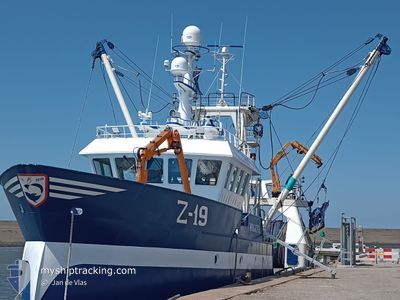
Z19 BRIGITTE
Fishing
Current Trip
| Trip Time | 16 days |
|---|---|
| Trip Distance | 1482.71 nm |
| AVG Speed | 4.6 Knots |
| MAX Speed | 4.6 Knots |
| Draught | 5.2 m |
| AVG Wind | 18.3 knots |
| MAX Wind | 33 knots |
| MIN Temp | 4.5°C / 40.1°F |
| MAX Temp | 14.9°C / 58.82°F |
| Position Received | 1 m ago |
Current Position
| Longitude | --- |
|---|---|
| Latitude | --- |
| Status | Under way using engine |
| Speed | |
| Course | 139° |
| Area | North Sea |
| Station | T-AIS |
| Position Received | 1 m ago |
Info
Information
The current position of Z19 BRIGITTE is in North Sea with coordinates 51.23172° / 2.93393° as reported on 2024-11-22 07:49 by AIS to our vessel tracker app. The vessel's current speed is 0 Knots and is currently inside the port of OOSTENDE.
The vessel Z19 BRIGITTE (IMO: 9898668, MMSI: 205096000) is a Fishing It's sailing under the flag of [BE] Belgium.
In this page you can find informations about the vessels current position, last detected port calls, and current voyage information. If the vessels is not in coverage by AIS you will find the latest position.
The current position of Z19 BRIGITTE is detected by our AIS receivers and we are not responsible for the reliability of the data. The last position was recorded while the vessel was in Coverage by the Ais receivers of our vessel tracking app.
The current draught of Z19 BRIGITTE as reported by AIS is 5.2 meters
Weather
| Temperature | 5.6°C / 42.08°F |
|---|---|
| Wind Speed | 29 knots |
| Direction | 278° W |
| Pressure | 1001.4 hPa |
| Humidity | 77.3 % |
| Cloud Coverage | 100 % |
Featured Company
Last Port Calls
| Port | Arrival | Departure | Time In Port |
|---|---|---|---|
| 2024-11-21 06:55 | |||
| 2024-11-03 10:00 | 2024-11-04 15:55 | 1 d | |
| 2024-10-28 09:18 | 2024-10-28 15:13 | 5 h | |
| 2024-10-28 08:59 | 2024-10-28 09:09 | 10 m | |
| 2024-10-19 23:23 | 2024-10-21 08:58 | 1 d | |
| 2024-10-19 23:08 | 2024-10-19 23:19 | 10 m | |
| 2024-10-10 14:12 | 2024-10-10 22:34 | 8 h | |
| 2024-09-29 14:32 | 2024-10-02 23:54 | 3 d | |
| 2024-09-27 01:05 | 2024-09-29 12:16 | 2 d | |
| 2024-09-20 03:44 | 2024-09-20 17:41 | 13 h |
Last Trips
| Origin | Departure | Destination | Arrival | Distance | |
|---|---|---|---|---|---|
| 2024-11-04 15:55 | 2024-11-21 06:55 | 1482.71 nm | |||
| 2024-10-28 15:13 | 2024-11-03 10:00 | 628.28 nm | |||
| 2024-10-28 09:09 | 2024-10-28 09:18 | 1.46 nm | |||
| 2024-10-21 08:58 | 2024-10-28 08:59 | 463.59 nm | |||
| 2024-10-19 23:19 | 2024-10-19 23:23 | 0.99 nm | |||
| 2024-10-10 22:34 | 2024-10-19 23:08 | 719.17 nm | |||
| 2024-10-02 23:54 | 2024-10-10 14:12 | 309.81 nm | |||
| 2024-09-29 12:16 | 2024-09-29 14:32 | 16.98 nm | |||
| 2024-09-20 17:41 | 2024-09-27 01:05 | 336.83 nm | |||
| 2024-09-13 04:49 | 2024-09-20 03:44 | 425.95 nm |
Events
| Time | Event | Details | Position / Dest | Info |
|---|---|---|---|---|
| 2024-11-21 06:12 | STOP Moving |
51.23198 / 2.93407
[BE] OOSTENDE
|
Speed: 0.3 kn Course: 121° |
|
| 2024-11-21 06:08 | START Moving |
51.23443 / 2.93116
[BE] OOSTENDE
|
Speed: 3.1 kn Course: 145° |
|
| 2024-11-21 05:55 | STOP Moving |
51.23484 / 2.92812
[BE] OOSTENDE
|
Speed: 0.1 kn Course: 71° |
|
| 2024-11-21 05:55 | PORT ARRIVAL |
|
51.23486 / 2.92820
[BE] OOSTENDE
|
Speed: 1 kn Course: 83° |
| 2024-11-21 04:10 | Change Sea Area | Belgian part of the North Sea French part of the North Sea |
51.19520 / 2.48333
North Sea
|
Speed: 11.3 kn Course: 65° |
| 2024-11-21 01:04 | Detected in Sea | French part of the North Sea |
50.98323 / 1.68544
North Sea
|
Speed: 9.2 kn Course: 46° |
| 2024-11-20 22:02 | Change Sea Area | French part of the English Channel United Kingdom part of the English Channel |
50.66592 / 1.34697
English Channel
|
Speed: 7.3 kn Course: 44° |
| 2024-11-20 22:02 | IN Coverage |
50.66592 / 1.34697
English Channel
|
Speed: 7.3 kn Course: 44° |
|
| 2024-11-20 11:22 | OUT of Coverage |
50.53243 / .46793
English Channel
|
Speed: 4.2 kn Course: 68° |
|
| 2024-11-20 07:25 | START Moving | 17.98 nm, South of NEWHAVEN |
50.48816 / .02538
LE HAVRE
|
Speed: 4.7 kn Course: 78° |