
YM TUTORIAL
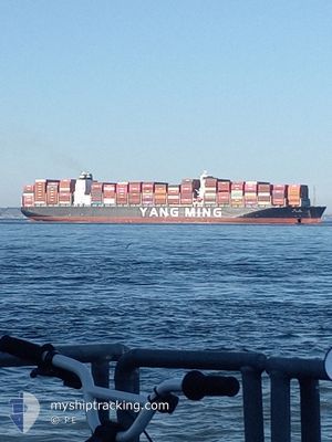
Cargo A
Current Trip
| Time Travelled | 32 days |
|---|---|
| Remaining Time | 35 mins |
| Distance Travelled | 11789.56 nm |
| Remaining Distance | 10.30 nm |
| AVG Speed | 14.8 Knots |
| MAX Speed | 22.3 Knots |
| AVG Wind | 13.4 knots |
| MAX Wind | 25.3 knots |
| MIN Temp | 9.7°C / 49.46°F |
| MAX Temp | 28.6°C / 83.48°F |
| Draught | 14 m |
| Position Received | Now |
Current Position
| Longitude | --- |
|---|---|
| Latitude | --- |
| Status | Constrained by her draught |
| Speed | 8.7 Knots |
| Course | 264.6° |
| Area | English Channel |
| Station | T-AIS |
| Position Received | Now |
Info
Information
The current position of YM TUTORIAL is in English Channel with coordinates 50.77717° / -1.28742° as reported on 2026-02-24 01:12 by AIS to our vessel tracker app. The vessel's current speed is 8.7 Knots and is heading at the port of SOUTHAMPTON. The estimated time of arrival as calculated by MyShipTracking vessel tracking app is 2026-02-24 01:48 LT
The vessel YM TUTORIAL (IMO: 9792618, MMSI: 636021690) is a Cargo A It's sailing under the flag of [LR] Liberia.
In this page you can find informations about the vessels current position, last detected port calls, and current voyage information. If the vessels is not in coverage by AIS you will find the latest position.
The current position of YM TUTORIAL is detected by our AIS receivers and we are not responsible for the reliability of the data. The last position was recorded while the vessel was in Coverage by the Ais receivers of our vessel tracking app.
The current draught of YM TUTORIAL as reported by AIS is 14 meters
Weather
| Temperature | 9.9°C / 49.82°F |
|---|---|
| Wind Speed | 11 knots |
| Direction | 243° WSW |
| Pressure | 1018.1 hPa |
| Humidity | 98.7 % |
| Cloud Coverage | 100 % |
Featured Company
Last Port Calls
| Port | Arrival | Departure | Time In Port |
|---|---|---|---|
| 2026-01-21 08:43 | 2026-01-22 16:52 | 1 d | |
| 2026-01-15 07:56 | 2026-01-16 04:52 | 20 h | |
| 2026-01-05 06:54 | 2026-01-05 16:42 | 9 h | |
| 2026-01-02 08:09 | 2026-01-03 17:19 | 1 d | |
| 2025-12-14 21:28 | 2025-12-18 19:06 | 3 d | |
| 2025-12-10 13:42 | 2025-12-14 08:36 | 3 d |
Most Visited Ports (Last year)
| Port | Arrivals | |
|---|---|---|
| 5 | ||
| 5 | ||
| 2 | ||
| 2 | ||
| 2 | ||
| 2 |
Last Trips
| Origin | Departure | Destination | Arrival | Distance | |
|---|---|---|---|---|---|
| 2026-01-16 04:52 | 2026-01-21 08:43 | 1493.56 nm | |||
| 2026-01-05 16:42 | 2026-01-15 07:56 | 1802.16 nm | |||
| 2026-01-03 17:19 | 2026-01-05 06:54 | 390.58 nm | |||
| 2025-12-18 19:06 | 2026-01-02 08:09 | 4399.66 nm | |||
| 2025-12-14 08:36 | 2025-12-14 21:28 | 154.34 nm | |||
| 2025-11-26 19:57 | 2025-12-10 13:42 | 4941.69 nm |
Events
| Time | Event | Details | Position / Dest | Info |
|---|---|---|---|---|
| 2026-02-23 23:37 | Status Changed | Constrained by her draught Under way using engine |
50.63237 / -.95649
GBSOU
|
Speed: 9 kn Course: 0.4° |
| 2026-02-23 20:57 | ETA Changed | 2026/02/24 03:00 2026/02/23 13:07 |
50.44328 / -1.17460
GBSOU
|
Speed: 1.1 kn Course: 164° |
| 2026-02-23 20:25 | Status Changed | Under way using engine Default |
50.44134 / -1.18573
GBSOU
|
Speed: 0.6 kn Course: 174° |
| 2026-02-23 20:23 | Status Changed | Default Under way using engine |
50.44136 / -1.18614
GBSOU
|
Speed: 0.5 kn Course: 179° |
| 2026-02-23 20:06 | Status Changed | Under way using engine Default |
50.44264 / -1.18823
GBSOU
|
Speed: 0.7 kn Course: 186° |
| 2026-02-23 20:03 | Status Changed | Default Under way using engine |
50.44319 / -1.18813
GBSOU
|
Speed: 1 kn Course: 173° |
| 2026-02-23 19:56 | Status Changed | Under way using engine Default |
50.44476 / -1.18766
GBSOU
|
Speed: 1.1 kn Course: 169° |
| 2026-02-23 19:51 | Status Changed | Default Under way using engine |
50.44652 / -1.18755
GBSOU
|
Speed: 1.8 kn Course: 137° |
| 2026-02-23 19:31 | Status Changed | Under way using engine Default |
50.45162 / -1.20552
GBSOU
|
Speed: 5.4 kn Course: 90° |
| 2026-02-23 19:27 | Status Changed | Default Under way using engine |
50.45168 / -1.21403
GBSOU
|
Speed: 5.9 kn Course: 91.9° |