
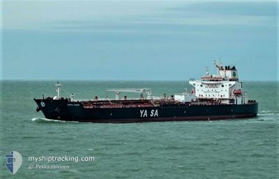
YASA SWAN
Tanker
Current Trip
MYTBI
| Time Travelled | 5 days |
|---|---|
| Remaining Time | --- |
| Distance Travelled | 1426.39 nm |
| Remaining Distance | --- |
| AVG Speed | 12 Knots |
| MAX Speed | 15.3 Knots |
| AVG Wind | 8.8 knots |
| MAX Wind | 20.3 knots |
| MIN Temp | 24°C / 75.2°F |
| MAX Temp | 29.6°C / 85.28°F |
| Draught | 10.2 m |
| Position Received | 4 d ago |
Current Position
| Longitude | --- |
|---|---|
| Latitude | --- |
| Status | Under way using engine |
| Speed | 10 Knots |
| Course | 202.7° |
| Area | Singapore Strait |
| Station | T-AIS |
| Position Received | 4 d ago |
Info
Information
The current position of YASA SWAN is in Singapore Strait with coordinates 1.24613° / 103.53846° as reported on 2025-03-02 04:26 by AIS to our vessel tracker app. The vessel's current speed is 10 Knots
The vessel YASA SWAN (IMO: 9857248, MMSI: 538008271) is a Tanker It's sailing under the flag of [MH] Marshall Is.
In this page you can find informations about the vessels current position, last detected port calls, and current voyage information. If the vessels is not in coverage by AIS you will find the latest position.
The current position of YASA SWAN is detected by our AIS receivers and we are not responsible for the reliability of the data. The last position was recorded while the vessel was in Coverage by the Ais receivers of our vessel tracking app.
The current draught of YASA SWAN as reported by AIS is 10.2 meters
Weather
| Temperature | 28.1°C / 82.58°F |
|---|---|
| Wind Speed | 17 knots |
| Direction | 312° NW |
| Pressure | 1011.1 hPa |
| Humidity | 79.2 % |
| Cloud Coverage | 100 % |
Featured Company
Last Port Calls
| Port | Arrival | Departure | Time In Port |
|---|---|---|---|
| 2025-03-01 05:17 | 2025-03-02 03:52 | 22 h | |
| 2025-02-27 05:06 | 2025-02-28 06:08 | 1 d | |
| 2025-01-29 13:33 | 2025-01-31 11:40 | 1 d | |
| 2025-01-13 02:57 | 2025-01-15 07:33 | 2 d |
Last Trips
| Origin | Departure | Destination | Arrival | Distance | |
|---|---|---|---|---|---|
| 2025-02-28 14:08 | 2025-03-01 13:17 | 36.99 nm | |||
| 2025-01-31 22:40 | 2025-02-27 13:06 | 7375.06 nm | |||
| 2025-01-15 15:33 | 2025-01-30 00:33 | 4110.71 nm | |||
| 2024-12-28 17:21 | 2025-01-13 10:57 | 3811.50 nm |
Events
| Time | Event | Details | Position / Dest | Info |
|---|---|---|---|---|
| 2025-03-02 04:29 | Status Changed | Default Under way using engine |
1.23946 / 103.53471
MYTBI
|
Speed: 10 kn Course: 202.7° |
| 2025-03-02 04:26 | OUT of Coverage |
1.24613 / 103.53846
Singapore Strait
|
Speed: 10 kn Course: 202.7° |
|
| 2025-03-02 04:26 | Status Changed | Under way using engine Default |
1.24785 / 103.53916
MYTBI
|
Speed: 8.6 kn Course: 192° |
| 2025-03-02 04:19 | Status Changed | Default Under way using engine |
1.26447 / 103.54366
MYTBI
|
Speed: 8 kn Course: 191.5° |
| 2025-03-02 03:52 | PORT DEPARTURE |
|
1.32711 / 103.55385
MYTBI
|
Speed: 8 kn Course: 158° |
| 2025-03-02 03:48 | Status Changed | Under way using engine Default |
1.33685 / 103.54979
[MY] TANJUNG PELEPAS
|
Speed: 5.9 kn Course: 160° |
| 2025-03-02 03:45 | Status Changed | Default Under way using engine |
1.34094 / 103.54836
[MY] TANJUNG PELEPAS
|
Speed: 1.3 kn Course: 158° |
| 2025-03-02 03:45 | START Moving |
1.34094 / 103.54836
[MY] TANJUNG PELEPAS
|
Speed: 5.9 kn Course: 160° |
|
| 2025-03-02 03:29 | Status Changed | Under way using engine Default |
1.35036 / 103.54486
[MY] TANJUNG PELEPAS
|
Speed: 2.6 kn Course: 296° |
| 2025-03-02 03:25 | IN Coverage |
1.35036 / 103.54486
Singapore Strait
[MY] TANJUNG PELEPAS
|
Speed: 2 kn Course: 335.5° |