

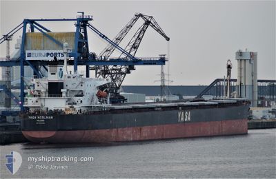
YASA NESLIHAN
Bulk Carrier

Current Trip
| Time Travelled | --- |
|---|---|
| Remaining Time | --- |
| Distance Travelled | 10182.38 nm |
| Remaining Distance | --- |
| AVG Speed | 10.7 Knots |
| MAX Speed | 15.9 Knots |
| AVG Wind | 11 knots |
| MAX Wind | 25 knots |
| MIN Temp | 17.8°C / 64.04°F |
| MAX Temp | 31.5°C / 88.7°F |
| Draught | 8.6 m |
| Position Received | 2025-02-15 13:07 |
Current Position
| Longitude | --- |
|---|---|
| Latitude | --- |
| Status | Under way using engine |
| Speed | 12.9 Knots |
| Course | 283° |
| Area | Singapore Strait |
| Station | T-AIS |
| Position Received | 2025-02-15 13:07 |
Information
The current position of YASA NESLIHAN is in Singapore Strait with coordinates 1.22000° / 103.48747° as reported on 2025-02-15 13:07 by AIS to our vessel tracker app. The vessel's current speed is 12.9 Knots and is heading at the port of PORT ELIZABETH.
The vessel YASA NESLIHAN (IMO: 9286566, MMSI: 538002459) is a Bulk Carrier that was built in 2005 ( 20 years old ). It's sailing under the flag of [MH] Marshall Is.
In this page you can find informations about the vessels current position, last detected port calls, and current voyage information. If the vessels is not in coverage by AIS you will find the latest position.
The current position of YASA NESLIHAN is detected by our AIS receivers and we are not responsible for the reliability of the data. The last position was recorded while the vessel was in Coverage by the Ais receivers of our vessel tracking app.
The current draught of YASA NESLIHAN as reported by AIS is 8.6 meters
Weather
| Temperature | 25.6°C / 78.08°F |
|---|---|
| Wind Speed | 9 knots |
| Direction | 59° ENE |
| Pressure | 1012.1 hPa |
| Humidity | 82.5 % |
| Cloud Coverage | 40 % |


Featured Company
Events
| Time | Event | Details | Position / Dest | Info |
|---|---|---|---|---|
| 2025-03-24 19:10 | STOP Moving | 10.08 nm, South of SANTOS |
-24.12723 / -46.26541
ZAPLZ
|
Speed: Course: 204° |
| 2025-03-24 17:38 | START Moving | 6.32 nm, South of SANTOS |
-24.07263 / -46.31437
ZAPLZ
|
Speed: 4.1 kn Course: 120° |
| 2025-03-24 11:01 | STOP Moving | 6.18 nm, South of SANTOS |
-24.07073 / -46.32058
ZAPLZ
|
Speed: 0.2 kn Course: 28° |
| 2025-03-24 09:47 | START Moving | 11.23 nm, South of SANTOS |
-24.15430 / -46.30365
ZAPLZ
|
Speed: 4.2 kn Course: 349° |
| 2025-03-22 04:42 | STOP Moving | 11.44 nm, South of SANTOS |
-24.15792 / -46.30575
ZAPLZ
|
Speed: 0.1 kn Course: 122° |