

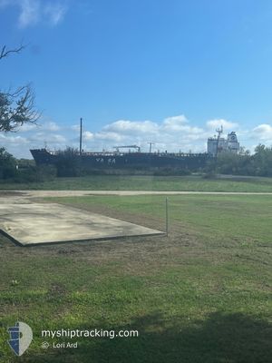
YASA HAWK
Tanker

Current Trip
JPSKK
| Time Travelled | 8 days |
|---|---|
| Remaining Time | --- |
| Distance Travelled | 1435.36 nm |
| Remaining Distance | --- |
| AVG Speed | 11.6 Knots |
| MAX Speed | 14 Knots |
| AVG Wind | 13.4 knots |
| MAX Wind | 29 knots |
| MIN Temp | -1°C / 30.2°F |
| MAX Temp | 28.1°C / 82.58°F |
| Draught | 8.3 m |
| Position Received | 14 d ago |
Current Position
| Longitude | --- |
|---|---|
| Latitude | --- |
| Status | Not under command |
| Speed | 1.1 Knots |
| Course | 310° |
| Area | Philippine Sea |
| Station | T-AIS |
| Position Received | 14 d ago |
Information
The current position of YASA HAWK is in Philippine Sea with coordinates 33.32843° / 135.03611° as reported on 2025-02-04 07:24 by AIS to our vessel tracker app. The vessel's current speed is 1.1 Knots
The vessel YASA HAWK (IMO: 9619531, MMSI: 538006946) is a Tanker It's sailing under the flag of [MH] Marshall Is.
In this page you can find informations about the vessels current position, last detected port calls, and current voyage information. If the vessels is not in coverage by AIS you will find the latest position.
The current position of YASA HAWK is detected by our AIS receivers and we are not responsible for the reliability of the data. The last position was recorded while the vessel was in Coverage by the Ais receivers of our vessel tracking app.
The current draught of YASA HAWK as reported by AIS is 8.3 meters
Weather
| Temperature | 25.7°C / 78.26°F |
|---|---|
| Wind Speed | 9 knots |
| Direction | 85° E |
| Pressure | 1012.2 hPa |
| Humidity | 81.6 % |
| Cloud Coverage | 61 % |


Featured Company
Most Visited Ports (Last year)
| Port | Arrivals | |
|---|---|---|
| 3 | ||
| 3 | ||
| 2 | ||
| 1 | ||
| 1 | ||
| 1 |
Last Trips
Events
| Time | Event | Details | Position / Dest | Info |
|---|---|---|---|---|
| 2025-02-17 02:06 | STOP Moving | 2.15 nm, South East of BATANGAS |
13.72288 / 121.05665
JPSKK
|
Speed: 0.2 kn Course: 348° |
| 2025-02-17 01:36 | START Moving | 1.93 nm, South of BATANGAS |
13.72058 / 121.03243
JPSKK
|
Speed: 5.1 kn Course: 118° |
| 2025-02-16 23:05 | STOP Moving | 1.99 nm, South West of BATANGAS |
13.72761 / 121.01369
JPSKK
|
Speed: 0.3 kn Course: 78° |
| 2025-02-11 05:57 | START Moving | 7.05 nm, East of YEOSU |
34.74726 / 127.80632
JPSKK
|
Speed: 4.3 kn Course: 142° |
| 2025-02-10 23:47 | STOP Moving | 6.78 nm, East of YEOSU |
34.74818 / 127.80061
JPSKK
|
Speed: 0.3 kn Course: 4° |
| 2025-02-10 23:25 | START Moving | 7.21 nm, East of YEOSU |
34.73056 / 127.81020
JPSKK
|
Speed: 3.3 kn Course: 340° |
| 2025-02-10 13:21 | STOP Moving | 7.34 nm, East of YEOSU |
34.72841 / 127.81267
JPSKK
|
Speed: 0.3 kn Course: 280° |
| 2025-02-10 12:01 | PORT DEPARTURE |
|
34.86304 / 127.77855
JPSKK
|
Speed: 3.4 kn Course: 81° |
| 2025-02-10 11:50 | START Moving |
34.86658 / 127.75474
[KR] GWANGYANG
|
Speed: 3.4 kn Course: 81° |
|
| 2025-02-09 03:23 | STOP Moving |
34.86234 / 127.75224
[KR] GWANGYANG
|
Speed: Course: 254° |