
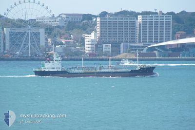
YAMATO MARU
Tanker
Current Trip
JP NMX OFF /WS
| Time Travelled | 6 h, 48 mins |
|---|---|
| Remaining Time | --- |
| Distance Travelled | 73.24 nm |
| Remaining Distance | --- |
| AVG Speed | 12.8 Knots |
| MAX Speed | 13.6 Knots |
| AVG Wind | 4.3 knots |
| MAX Wind | 6 knots |
| MIN Temp | 16.4°C / 61.52°F |
| MAX Temp | 19.8°C / 67.64°F |
| Draught | 4.8 m |
| Position Received | 3 d ago |
Current Position
| Longitude | 134.14148° |
|---|---|
| Latitude | 34.43507° |
| Status | Under way using engine |
| Speed | 13.9 Knots |
| Course | 287.5° |
| Area | Inland Sea |
| Station | T-AIS |
| Position Received | 3 d ago |
Info
Information
The current position of YAMATO MARU is in Inland Sea with coordinates 34.43507° / 134.14148° as reported on 2024-05-11 11:41 by AIS to our vessel tracker app. The vessel's current speed is 13.9 Knots
The vessel YAMATO MARU (IMO: 9424742, MMSI: 431000080) is a Tanker It's sailing under the flag of [JP] Japan.
In this page you can find informations about the vessels current position, last detected port calls, and current voyage information. If the vessels is not in coverage by AIS you will find the latest position.
The current position of YAMATO MARU is detected by our AIS receivers and we are not responsible for the reliability of the data. The last position was recorded while the vessel was in Coverage by the Ais receivers of our vessel tracking app.
The current draught of YAMATO MARU as reported by AIS is 4.8 meters
Weather
| Temperature | 19.6°C / 67.28°F |
|---|---|
| Wind Speed | 4 knots |
| Direction | 157° SSE |
| Pressure | 1011 hPa |
| Humidity | 65.8 % |
| Cloud Coverage | 97 % |
Featured Company
Last Port Calls
| Port | Arrival | Departure | Time In Port |
|---|---|---|---|
| 2024-05-14 22:28 | 2024-05-14 23:56 | 1 h | |
| 2024-05-13 22:51 | 2024-05-14 20:54 | 22 h | |
| 2024-05-12 13:54 | 2024-05-13 03:28 | 13 h | |
| 2024-05-11 03:40 | 2024-05-11 05:39 | 1 h | |
| 2024-05-10 22:46 | 2024-05-11 02:57 | 4 h | |
| 2024-05-09 07:20 | 2024-05-10 03:33 | 20 h | |
| 2024-05-07 06:59 | 2024-05-08 22:15 | 1 d | |
| 2024-05-05 02:39 | 2024-05-05 06:00 | 3 h | |
| 2024-04-28 22:59 | 2024-04-29 02:16 | 3 h | |
| 2024-04-28 00:04 | 2024-04-28 21:56 | 21 h |
Last Trips
| Origin | Departure | Destination | Arrival | Distance | |
|---|---|---|---|---|---|
| 2024-05-15 05:54 | 2024-05-15 07:28 | 9.30 nm | |||
| 2024-05-13 12:28 | 2024-05-14 07:51 | 207.44 nm | |||
| 2024-05-11 14:39 | 2024-05-12 22:54 | 387.33 nm | |||
| 2024-05-11 11:57 | 2024-05-11 12:40 | 5.95 nm | |||
| 2024-05-10 12:33 | 2024-05-11 07:46 | 225.91 nm | |||
| 2024-05-09 07:15 | 2024-05-09 16:20 | 121.48 nm | |||
| 2024-05-05 15:00 | 2024-05-07 15:59 | 594.92 nm | |||
| 2024-04-29 11:16 | 2024-05-05 11:39 | 1355.51 nm | |||
| 2024-04-29 06:56 | 2024-04-29 07:59 | 9.14 nm | |||
| 2024-04-27 12:12 | 2024-04-28 09:04 | 211.00 nm |
Events
| Time | Event | Details | Position / Dest | Info |
|---|---|---|---|---|
| 2024-05-15 05:43 | STOP Moving | 1.9 nm, South West of ATATA |
34.17022 / 132.29393
JP NMX OFF /WS
|
Speed: 0.2 kn Course: 276° |
| 2024-05-14 23:56 | PORT DEPARTURE |
|
33.29735 / 131.69501
JP NMX OFF /WS
|
Speed: 12.6 kn Course: 41° |
| 2024-05-14 23:48 | START Moving |
33.27579 / 131.68039
[JP] OITA
|
Speed: 8.7 kn Course: 340° |
|
| 2024-05-14 22:28 | STOP Moving |
33.27278 / 131.68304
[JP] OITA
|
Speed: Course: 342° |
|
| 2024-05-14 22:28 | PORT ARRIVAL |
|
33.27278 / 131.68304
[JP] OITA
|
Speed: 3.3 kn Course: 113° |
| 2024-05-14 20:54 | PORT DEPARTURE |
|
33.29666 / 131.51167
JP NMX OFF /WS
|
Speed: 8.7 kn Course: 127° |
| 2024-05-14 20:53 | START Moving |
33.29849 / 131.50807
[JP] BEPPU
|
Speed: 8.7 kn Course: 127° |
|
| 2024-05-13 22:57 | STOP Moving |
33.30167 / 131.50333
[JP] BEPPU
|
Speed: Course: -1° |
|
| 2024-05-13 22:51 | PORT ARRIVAL |
|
33.30333 / 131.50501
[JP] BEPPU
|
Speed: 7.9 kn Course: 191° |
| 2024-05-13 22:08 | START Moving | 3.14 nm, South of MORIE |
33.35833 / 131.65649
JP NMX OFF /WS
|
Speed: 9.4 kn Course: 242° |