

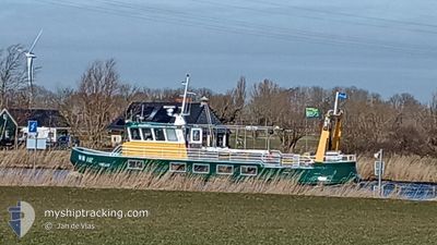
WR117 JOMAR
Passenger

Current Trip
| Trip Time | 1 h, 40 mins |
|---|---|
| Trip Distance | 5.76 nm |
| AVG Speed | 4.4 Knots |
| MAX Speed | 6.6 Knots |
| Draught | 1.5 m |
| AVG Wind | 10.2 knots |
| MAX Wind | 10.8 knots |
| MIN Temp | 6.9°C / 44.42°F |
| MAX Temp | 7°C / 44.6°F |
| Position Received | 1 m ago |
Current Position
| Longitude | --- |
|---|---|
| Latitude | --- |
| Status | Engaged in Fishing |
| Speed | |
| Course | --- |
| Area | North Sea |
| Station | T-AIS |
| Position Received | 1 m ago |
Information
The current position of WR117 JOMAR is in North Sea with coordinates 52.93465° / 5.03871° as reported on 2025-04-01 05:54 by AIS to our vessel tracker app. The vessel's current speed is 0 Knots and is currently inside the port of DEN OEVER.
The vessel WR117 JOMAR (MMSI: 244010315) is a Passenger It's sailing under the flag of [NL] Netherlands.
In this page you can find informations about the vessels current position, last detected port calls, and current voyage information. If the vessels is not in coverage by AIS you will find the latest position.
The current position of WR117 JOMAR is detected by our AIS receivers and we are not responsible for the reliability of the data. The last position was recorded while the vessel was in Coverage by the Ais receivers of our vessel tracking app.
The current draught of WR117 JOMAR as reported by AIS is 1.5 meters
Weather
| Temperature | 6.4°C / 43.52°F |
|---|---|
| Wind Speed | 9 knots |
| Direction | 74° ENE |
| Pressure | 1029.2 hPa |
| Humidity | 81.4 % |
| Cloud Coverage | --- |


Featured Company
Last Port Calls
Most Visited Ports (Last year)
| Port | Arrivals | |
|---|---|---|
| 185 | ||
| 3 | ||
| 2 | ||
| 1 |
Last Trips
| Origin | Departure | Destination | Arrival | Distance | |
|---|---|---|---|---|---|
| 2025-03-29 10:24 | 2025-03-29 12:04 | 5.76 nm | |||
| 2025-03-10 08:27 | 2025-03-10 10:56 | 20.94 nm | |||
| 2025-03-07 16:57 | 2025-03-10 08:06 | 3.71 nm | |||
| 2025-02-27 15:35 | 2025-02-27 16:06 | 2.45 nm | |||
| 2025-02-27 11:43 | 2025-02-27 15:09 | 21.16 nm |
Events
| Time | Event | Details | Position / Dest | Info |
|---|---|---|---|---|
| 2025-03-29 11:04 | STOP Moving |
52.93463 / 5.03876
[NL] DEN OEVER
|
Speed: 0.3 kn Course: 511° |
|
| 2025-03-29 11:04 | PORT ARRIVAL |
|
52.93463 / 5.03876
[NL] DEN OEVER
|
Speed: 0.8 kn Course: 511° |
| 2025-03-29 10:32 | START Moving | 0.89 nm, North West of DEN OEVER |
52.95025 / 5.02534
FISHING GROUNDS
|
Speed: 3.8 kn Course: 122.2° |
| 2025-03-29 10:30 | STOP Moving | 1 nm, North West of DEN OEVER |
52.95138 / 5.02240
FISHING GROUNDS
|
Speed: 0.3 kn Course: 511° |
| 2025-03-29 09:24 | PORT DEPARTURE |
|
52.93761 / 5.04339
FISHING GROUNDS
|
Speed: 5.5 kn Course: 95.2° |
| 2025-03-29 09:15 | START Moving |
52.93557 / 5.03580
[NL] DEN OEVER
|
Speed: 3.6 kn Course: 314.8° |
|
| 2025-03-27 15:19 | Status Changed | Engaged in Fishing Default |
52.93464 / 5.03877
[NL] DEN OEVER
|
Speed: Course: -1° |
| 2025-03-27 15:12 | Status Changed | Default Engaged in Fishing |
52.93465 / 5.03876
[NL] DEN OEVER
|
Speed: Course: 511° |
| 2025-03-24 15:19 | Status Changed | Engaged in Fishing Default |
52.93464 / 5.03876
[NL] DEN OEVER
|
Speed: Course: -1° |
| 2025-03-24 15:11 | Status Changed | Default Engaged in Fishing |
52.93465 / 5.03876
[NL] DEN OEVER
|
Speed: Course: 511° |