
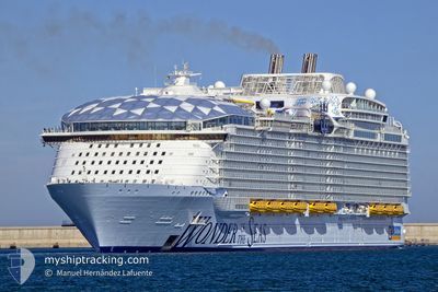
WONDER OF THE SEAS
Passenger
Current Trip
| Time Travelled | 2 days |
|---|---|
| Remaining Time | 8 h, 12 mins |
| Distance Travelled | 691.24 nm |
| Remaining Distance | 185.37 nm |
| AVG Speed | 15.2 Knots |
| MAX Speed | 19.3 Knots |
| AVG Wind | 13.9 knots |
| MAX Wind | 22 knots |
| MIN Temp | 18.6°C / 65.48°F |
| MAX Temp | 24.1°C / 75.38°F |
| Draught | 9.3 m |
| Position Received | 16 h, 4 m ago |
Current Position
| Longitude | --- |
|---|---|
| Latitude | --- |
| Status | Under way using engine |
| Speed | 15.9 Knots |
| Course | 244.1° |
| Area | North Atlantic Ocean |
| Station | T-AIS |
| Position Received | 16 h, 4 m ago |
Info
Information
The current position of WONDER OF THE SEAS is in North Atlantic Ocean with coordinates 24.50826° / -80.74696° as reported on 2025-02-25 10:36 by AIS to our vessel tracker app. The vessel's current speed is 15.9 Knots and is heading at the port of COZUMEL. The estimated time of arrival as calculated by MyShipTracking vessel tracking app is 2025-02-26 05:53 LT
The vessel WONDER OF THE SEAS (IMO: 9838345, MMSI: 311001033) is a Passenger It's sailing under the flag of [BS] Bahamas.
In this page you can find informations about the vessels current position, last detected port calls, and current voyage information. If the vessels is not in coverage by AIS you will find the latest position.
The current position of WONDER OF THE SEAS is detected by our AIS receivers and we are not responsible for the reliability of the data. The last position was recorded while the vessel was in Coverage by the Ais receivers of our vessel tracking app.
The current draught of WONDER OF THE SEAS as reported by AIS is 9.3 meters
Weather
| Temperature | 23.9°C / 75.02°F |
|---|---|
| Wind Speed | 10 knots |
| Direction | 25° NNE |
| Pressure | 1014.5 hPa |
| Humidity | 71.3 % |
| Cloud Coverage | 87 % |
Featured Company
Last Port Calls
| Port | Arrival | Departure | Time In Port |
|---|---|---|---|
| 2025-02-23 04:53 | 2025-02-23 16:57 | 12 h | |
| 2025-02-19 07:37 | 2025-02-19 18:02 | 10 h | |
| 2025-02-16 05:01 | 2025-02-16 16:56 | 11 h | |
| 2025-02-14 06:40 | 2025-02-14 14:16 | 7 h | |
| 2025-02-13 06:57 | 2025-02-13 16:28 | 9 h | |
| 2025-02-12 06:43 | 2025-02-12 17:48 | 11 h | |
| 2025-02-09 04:59 | 2025-02-09 17:04 | 12 h | |
| 2025-02-05 07:31 | 2025-02-05 18:08 | 10 h | |
| 2025-02-02 04:57 | 2025-02-02 17:03 | 12 h | |
| 2025-01-31 06:53 | 2025-01-31 14:26 | 7 h |
Most Visited Ports (Last year)
| Port | Arrivals | |
|---|---|---|
| 52 | ||
| 27 | ||
| 25 | ||
| 23 | ||
| 21 | ||
| 2 |
Last Trips
| Origin | Departure | Destination | Arrival | Distance | |
|---|---|---|---|---|---|
| 2025-02-19 18:02 | 2025-02-23 04:53 | 1197.15 nm | |||
| 2025-02-16 16:56 | 2025-02-19 07:37 | 1209.15 nm | |||
| 2025-02-14 14:16 | 2025-02-16 05:01 | 774.79 nm | |||
| 2025-02-13 16:28 | 2025-02-14 06:40 | 163.75 nm | |||
| 2025-02-12 17:48 | 2025-02-13 06:57 | 261.86 nm | |||
| 2025-02-09 17:04 | 2025-02-12 06:43 | 846.21 nm | |||
| 2025-02-05 18:08 | 2025-02-09 04:59 | 1194.89 nm | |||
| 2025-02-02 17:03 | 2025-02-05 07:31 | 1157.94 nm | |||
| 2025-01-31 14:26 | 2025-02-02 04:57 | 793.00 nm | |||
| 2025-01-30 16:03 | 2025-01-31 06:53 | 164.20 nm |
Events
| Time | Event | Details | Position / Dest | Info |
|---|---|---|---|---|
| 2025-02-25 10:47 | Status Changed | Default Under way using engine |
24.48763 / -80.79142
BSCOC>MXCZM
|
Speed: 15.9 kn Course: 244.1° |
| 2025-02-25 10:36 | OUT of Coverage |
24.50826 / -80.74696
North Atlantic Ocean
BSCOC>MXCZM
|
Speed: 15.9 kn Course: 244.1° |
|
| 2025-02-25 06:59 | Status Changed | Under way using engine Default |
25.08302 / -79.96150
BSCOC>MXCZM
|
Speed: 16.1 kn Course: 207° |
| 2025-02-25 06:22 | Status Changed | Default Under way using engine |
25.22963 / -79.88043
BSCOC>MXCZM
|
Speed: 15.6 kn Course: 209.4° |
| 2025-02-25 06:07 | Status Changed | Under way using engine Default |
25.29077 / -79.84294
BSCOC>MXCZM
|
Speed: 15.8 kn Course: 207° |
| 2025-02-25 05:56 | Status Changed | Default Under way using engine |
25.33076 / -79.82069
BSCOC>MXCZM
|
Speed: 15.3 kn Course: 207° |
| 2025-02-25 05:05 | Destination Changed | BSCOC>MXCZM USPCV>BSCOC |
25.52886 / -79.71489
BSCOC>MXCZM
|
Speed: 15 kn Course: 204.6° |
| 2025-02-25 05:05 | ETA Changed | 2025/02/26 11:30 2025/02/24 12:00 |
25.52886 / -79.71489
BSCOC>MXCZM
|
Speed: 15 kn Course: 204.6° |
| 2025-02-25 05:01 | Change Sea Area | United States part of the North Atlantic Ocean Bahamas part of the North Atlantic Ocean |
25.54133 / -79.70862
North Atlantic Ocean
|
Speed: 14.9 kn Course: 205.1° |
| 2025-02-25 04:21 | Status Changed | Under way using engine Default |
25.69567 / -79.62941
USPCV>BSCOC
|
Speed: 15.6 kn Course: 205° |