

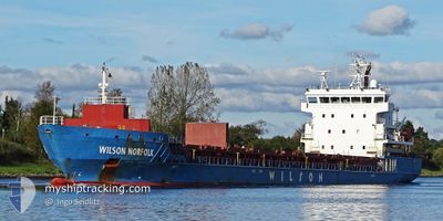
WILSON NORFOLK
General Cargo

Current Trip
| Time Travelled | 1 day |
|---|---|
| Remaining Time | 4 days |
| Distance Travelled | 253.11 nm |
| Remaining Distance | 1387.75 nm |
| AVG Speed | 12.8 Knots |
| MAX Speed | 13.3 Knots |
| AVG Wind | 5.8 knots |
| MAX Wind | 9 knots |
| MIN Temp | 5.3°C / 41.54°F |
| MAX Temp | 10.1°C / 50.18°F |
| Draught | 5.1 m |
| Position Received | 4 h, 16 m ago |
Current Position
| Longitude | --- |
|---|---|
| Latitude | --- |
| Status | Under way using engine |
| Speed | 12.9 Knots |
| Course | 132.6° |
| Area | Adriatic Sea |
| Station | T-AIS |
| Position Received | 4 h, 16 m ago |
Information
The current position of WILSON NORFOLK is in Adriatic Sea with coordinates 41.83004° / 16.69495° as reported on 2025-02-20 12:28 by AIS to our vessel tracker app. The vessel's current speed is 12.9 Knots and is heading at the port of CEUTA. The estimated time of arrival as calculated by MyShipTracking vessel tracking app is 2025-02-24 23:16 LT
The vessel WILSON NORFOLK (IMO: 9430997, MMSI: 259030000) is a General Cargo that was built in 2011 ( 14 years old ). It's sailing under the flag of [NO] Norway.
In this page you can find informations about the vessels current position, last detected port calls, and current voyage information. If the vessels is not in coverage by AIS you will find the latest position.
The current position of WILSON NORFOLK is detected by our AIS receivers and we are not responsible for the reliability of the data. The last position was recorded while the vessel was in Coverage by the Ais receivers of our vessel tracking app.
The current draught of WILSON NORFOLK as reported by AIS is 5.1 meters
Weather
| Temperature | 10°C / 50°F |
|---|---|
| Wind Speed | 7 knots |
| Direction | 7° N |
| Pressure | 1029.1 hPa |
| Humidity | 58.9 % |
| Cloud Coverage | 100 % |


Featured Company
Last Port Calls
| Port | Arrival | Departure | Time In Port |
|---|---|---|---|
| 2025-02-18 11:51 | 2025-02-19 16:31 | 1 d | |
| 2025-01-23 18:15 | 2025-01-31 05:43 | 7 d | |
| 2025-01-19 14:11 | 2025-01-21 14:58 | 2 d | |
| 2025-01-16 21:53 | 2025-01-16 22:30 | 36 m | |
| 2025-01-15 10:17 | 2025-01-16 21:12 | 1 d | |
| 2025-01-15 08:43 | 2025-01-15 09:18 | 35 m | |
| 2025-01-10 23:10 | 2025-01-11 20:16 | 21 h | |
| 2025-01-07 22:38 | 2025-01-08 14:37 | 15 h | |
| 2025-01-04 17:15 | 2025-01-07 22:33 | 3 d | |
| 2024-12-24 19:04 | 2025-01-02 02:59 | 8 d |
Last Trips
| Origin | Departure | Destination | Arrival | Distance | |
|---|---|---|---|---|---|
| 2025-01-31 06:43 | 2025-02-18 12:51 | 2518.12 nm | |||
| 2025-01-21 14:58 | 2025-01-23 19:15 | 641.08 nm | |||
| 2025-01-16 23:30 | 2025-01-19 14:11 | 509.85 nm | |||
| 2025-01-16 22:12 | 2025-01-16 22:53 | 3.10 nm | |||
| 2025-01-15 10:18 | 2025-01-15 11:17 | 4.04 nm | |||
| 2025-01-11 21:16 | 2025-01-15 09:43 | 500.30 nm | |||
| 2025-01-08 15:37 | 2025-01-11 00:10 | 268.84 nm | |||
| 2025-01-07 23:33 | 2025-01-07 23:38 | 0.78 nm | |||
| 2025-01-02 03:59 | 2025-01-04 18:15 | 304.10 nm | |||
| 2024-12-20 08:22 | 2024-12-24 20:04 | 755.31 nm |
Events
| Time | Event | Details | Position / Dest | Info |
|---|---|---|---|---|
| 2025-02-20 12:28 | OUT of Coverage |
41.83004 / 16.69495
Adriatic Sea
CEUTA
|
Speed: 12.9 kn Course: 132.6° |
|
| 2025-02-20 10:07 | Change Sea Area | Italian part of the Adriatic Sea Croatian part of the Adriatic Sea |
42.18529 / 16.20438
Adriatic Sea
CEUTA
|
Speed: 12.8 kn Course: 135.3° |
| 2025-02-20 09:04 | Change Sea Area | Croatian part of the Adriatic Sea Italian part of the Adriatic Sea |
42.34486 / 15.98466
Adriatic Sea
CEUTA
|
Speed: 13.2 kn Course: 135.8° |
| 2025-02-20 08:16 | Change Sea Area | Italian part of the Adriatic Sea Croatian part of the Adriatic Sea |
42.46914 / 15.82255
Adriatic Sea
CEUTA
|
Speed: 12.7 kn Course: 135.5° |
| 2025-02-20 07:17 | Draught Changed | 5.1 7 |
42.61502 / 15.62002
CEUTA
|
Speed: 12.9 kn Course: 135.3° |
| 2025-02-20 07:17 | Destination Changed | CEUTA RAVENNA |
42.61502 / 15.62002
CEUTA
|
Speed: 12.9 kn Course: 135.3° |
| 2025-02-20 07:17 | ETA Changed | 2025/02/25 07:30 2025/02/08 20:00 |
42.61502 / 15.62002
CEUTA
|
Speed: 12.9 kn Course: 135.3° |
| 2025-02-20 07:01 | Change Sea Area | Croatian part of the Adriatic Sea Italian part of the Adriatic Sea |
42.65591 / 15.56362
Adriatic Sea
|
Speed: 12.9 kn Course: 134.7° |
| 2025-02-20 07:00 | IN Coverage |
42.65591 / 15.56362
Adriatic Sea
|
Speed: 12.9 kn Course: 134.7° |
|
| 2025-02-19 20:26 | OUT of Coverage |
44.13428 / 13.33177
Adriatic Sea
|
Speed: 12.6 kn Course: 127° |