
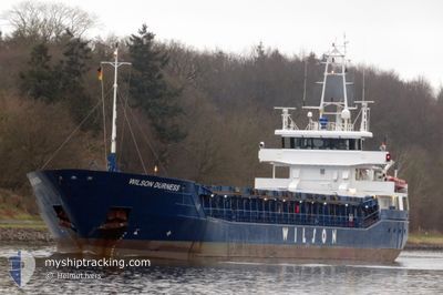
WILSON DURNESS
General Cargo
Current Trip
| Trip Time | 5 days |
|---|---|
| Trip Distance | 1032.26 nm |
| AVG Speed | 9.2 Knots |
| MAX Speed | 12.8 Knots |
| Draught | 3.5 m |
| AVG Wind | 9.5 knots |
| MAX Wind | 25 knots |
| MIN Temp | -5.5°C / 22.1°F |
| MAX Temp | 9.4°C / 48.92°F |
| Position Received | 7 d ago |
Current Position
| Longitude | --- |
|---|---|
| Latitude | --- |
| Status | Under way using engine |
| Speed | 9.5 Knots |
| Course | 330.2° |
| Area | Inner Seas off the West Coast of Scotland |
| Station | T-AIS |
| Position Received | 7 d ago |
Info
Information
The current position of WILSON DURNESS is in Inner Seas off the West Coast of Scotland with coordinates 54.84989° / -5.45462° as reported on 2025-12-31 05:24 by AIS to our vessel tracker app. The vessel's current speed is 9.5 Knots and is currently inside the port of NESKAUPSTADUR.
The vessel WILSON DURNESS (IMO: 9390135, MMSI: 314632000) is a General Cargo that was built in 2008 ( 18 years old ). It's sailing under the flag of [BB] Barbados.
In this page you can find informations about the vessels current position, last detected port calls, and current voyage information. If the vessels is not in coverage by AIS you will find the latest position.
The current position of WILSON DURNESS is detected by our AIS receivers and we are not responsible for the reliability of the data. The last position was recorded while the vessel was in Coverage by the Ais receivers of our vessel tracking app.
The current draught of WILSON DURNESS as reported by AIS is 3.5 meters
Weather
| Temperature | -10.7°C / 12.74°F |
|---|---|
| Wind Speed | 12 knots |
| Direction | 288° WNW |
| Pressure | 1018.7 hPa |
| Humidity | 91.5 % |
| Cloud Coverage | 73 % |
Featured Company
Last Port Calls
| Port | Arrival | Departure | Time In Port |
|---|---|---|---|
| 2026-01-05 09:25 | |||
| 2025-12-30 16:33 | 2025-12-30 17:06 | 33 m | |
| 2025-12-30 15:55 | 2025-12-30 16:14 | 19 m | |
| 2025-12-28 07:14 | 2025-12-30 15:08 | 2 d | |
| 2025-12-28 05:47 | 2025-12-28 06:04 | 17 m | |
| 2025-12-28 04:49 | 2025-12-28 05:30 | 40 m | |
| 2025-12-21 12:44 | 2025-12-23 19:49 | 2 d | |
| 2025-12-11 20:11 | 2025-12-12 21:27 | 1 d | |
| 2025-12-07 12:40 | 2025-12-11 03:07 | 3 d | |
| 2025-12-06 21:21 | 2025-12-07 09:36 | 12 h |
Most Visited Ports (Last year)
| Port | Arrivals | |
|---|---|---|
| 4 | ||
| 4 | ||
| 3 | ||
| 3 | ||
| 2 | ||
| 2 |
Last Trips
| Origin | Departure | Destination | Arrival | Distance | |
|---|---|---|---|---|---|
| 2025-12-30 17:06 | 2026-01-05 09:25 | 1032.26 nm | |||
| 2025-12-30 16:14 | 2025-12-30 16:33 | 1.89 nm | |||
| 2025-12-30 15:08 | 2025-12-30 15:55 | 4.30 nm | |||
| 2025-12-28 06:04 | 2025-12-28 07:14 | 5.68 nm | |||
| 2025-12-28 05:30 | 2025-12-28 05:47 | 2.12 nm | |||
| 2025-12-23 19:49 | 2025-12-28 04:49 | 677.49 nm | |||
| 2025-12-12 21:27 | 2025-12-21 12:44 | 1089.43 nm | |||
| 2025-12-11 03:07 | 2025-12-11 20:11 | 163.26 nm | |||
| 2025-11-23 13:34 | 2025-12-07 12:40 | 2176.59 nm | |||
| 2025-11-23 13:34 | 2025-12-06 21:21 | 2148.44 nm |
Events
| Time | Event | Details | Position / Dest | Info |
|---|---|---|---|---|
| 2026-01-05 09:25 | PORT ARRIVAL |
|
65.14055 / -13.66380
[IS] NESKAUPSTADUR
|
Speed: 11 kn Course: 240° |
| 2025-12-31 05:31 | Status Changed | Default Under way using engine |
54.86628 / -5.47079
ISNES
|
Speed: 9.5 kn Course: 330.2° |
| 2025-12-31 05:24 | OUT of Coverage |
54.84989 / -5.45462
Inner Seas off the West Coast of Scotland
ISNES
|
Speed: 9.5 kn Course: 330.2° |
|
| 2025-12-31 03:04 | Change Sea Area | United Kingdom part of the Inner Seas off the West Coast of Scotland United Kingdom part of the Irish Sea and St. George's Channel |
54.49910 / -5.20334
Inner Seas off the West Coast of Scotland
ISNES
|
Speed: 10.6 kn Course: 338.7° |
| 2025-12-31 01:28 | Status Changed | Under way using engine Default |
54.22169 / -5.02053
ISNES
|
Speed: 11.6 kn Course: 341° |
| 2025-12-31 01:22 | IN Coverage |
54.22169 / -5.02053
Irish Sea and St. George's Channel
ISNES
|
Speed: 11.6 kn Course: 341.7° |
|
| 2025-12-30 20:27 | Status Changed | Default Under way using engine |
53.57851 / -3.73365
ISNES
|
Speed: 12 kn Course: 299° |
| 2025-12-30 20:21 | OUT of Coverage |
53.56952 / -3.70630
Irish Sea and St. George's Channel
ISNES
|
Speed: 12 kn Course: 299° |
|
| 2025-12-30 20:17 | Status Changed | Under way using engine Default |
53.56421 / -3.68695
ISNES
|
Speed: 12.1 kn Course: 274° |
| 2025-12-30 20:15 | Status Changed | Default Under way using engine |
53.56361 / -3.67230
ISNES
|
Speed: 12 kn Course: 274.7° |