

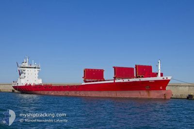
WEGA
Container Ship

Current Trip
| Time Travelled | 5 days |
|---|---|
| Remaining Time | 1 h, 56 mins |
| Distance Travelled | 1608.94 nm |
| Remaining Distance | 34.64 nm |
| AVG Speed | 13.9 Knots |
| MAX Speed | 16.2 Knots |
| AVG Wind | 9.3 knots |
| MAX Wind | 20.2 knots |
| MIN Temp | 4.1°C / 39.38°F |
| MAX Temp | 16.8°C / 62.24°F |
| Draught | 7.1 m |
| Position Received | 1 h, 17 m ago |
Current Position
| Longitude | --- |
|---|---|
| Latitude | --- |
| Status | Under way using engine |
| Speed | 14.7 Knots |
| Course | 274° |
| Area | Mediterranean Sea - Western Basin |
| Station | T-AIS |
| Position Received | 1 h, 17 m ago |
Information
The current position of WEGA is in Mediterranean Sea - Western Basin with coordinates 38.24055° / 0.50856° as reported on 2025-02-19 07:54 by AIS to our vessel tracker app. The vessel's current speed is 14.7 Knots and is heading at the port of ALICANTE. The estimated time of arrival as calculated by MyShipTracking vessel tracking app is 2025-02-19 11:07 LT
The vessel WEGA (IMO: 9141118, MMSI: 211235880) is a Container Ship that was built in 1996 ( 29 years old ). It's sailing under the flag of [DE] Germany.
In this page you can find informations about the vessels current position, last detected port calls, and current voyage information. If the vessels is not in coverage by AIS you will find the latest position.
The current position of WEGA is detected by our AIS receivers and we are not responsible for the reliability of the data. The last position was recorded while the vessel was in Coverage by the Ais receivers of our vessel tracking app.
The current draught of WEGA as reported by AIS is 7.1 meters
Weather
| Temperature | 14.7°C / 58.46°F |
|---|---|
| Wind Speed | 18 knots |
| Direction | 13° NNE |
| Pressure | 1017.9 hPa |
| Humidity | 84.2 % |
| Cloud Coverage | 100 % |


Featured Company
Last Port Calls
| Port | Arrival | Departure | Time In Port |
|---|---|---|---|
| 2025-02-13 17:26 | 2025-02-14 00:17 | 6 h | |
| 2025-02-09 12:01 | 2025-02-09 22:13 | 10 h | |
| 2025-02-06 05:59 | 2025-02-06 17:07 | 11 h | |
| 2025-02-04 23:15 | 2025-02-05 20:38 | 21 h | |
| 2025-02-04 13:07 | 2025-02-04 19:45 | 6 h | |
| 2025-01-31 11:14 | 2025-02-01 08:21 | 21 h | |
| 2025-01-29 12:37 | 2025-01-30 19:03 | 1 d | |
| 2025-01-19 15:37 | 2025-01-20 11:40 | 20 h | |
| 2025-01-16 06:44 | 2025-01-16 17:29 | 10 h | |
| 2025-01-15 12:13 | 2025-01-15 21:07 | 8 h |
Last Trips
| Origin | Departure | Destination | Arrival | Distance | |
|---|---|---|---|---|---|
| 2025-02-09 23:13 | 2025-02-13 20:26 | 1466.99 nm | |||
| 2025-02-06 17:07 | 2025-02-09 13:01 | 1121.55 nm | |||
| 2025-02-05 20:38 | 2025-02-06 05:59 | 112.85 nm | |||
| 2025-02-04 19:45 | 2025-02-04 23:15 | 53.92 nm | |||
| 2025-02-01 09:21 | 2025-02-04 13:07 | 1237.51 nm | |||
| 2025-01-30 20:03 | 2025-01-31 12:14 | 227.90 nm | |||
| 2025-01-20 12:40 | 2025-01-29 13:37 | 3082.94 nm | |||
| 2025-01-16 17:29 | 2025-01-19 16:37 | 1123.55 nm | |||
| 2025-01-15 21:07 | 2025-01-16 06:44 | 112.99 nm | |||
| 2025-01-15 08:32 | 2025-01-15 12:13 | 56.25 nm |
Events
| Time | Event | Details | Position / Dest | Info |
|---|---|---|---|---|
| 2025-02-19 08:01 | Status Changed | Default Under way using engine |
38.24302 / .46778
ESALC
|
Speed: 14.7 kn Course: 274° |
| 2025-02-19 07:54 | Status Changed | Under way using engine Default |
38.24055 / .50856
ESALC
|
Speed: 14.7 kn Course: 274° |
| 2025-02-19 07:54 | OUT of Coverage |
38.24055 / .50856
Mediterranean Sea - Western Basin
ESALC
|
Speed: 14.7 kn Course: 274° |
|
| 2025-02-19 07:40 | IN Coverage |
38.24055 / .50856
Mediterranean Sea - Western Basin
ESALC
|
Speed: 14.7 kn Course: 274° |
|
| 2025-02-19 05:27 | Status Changed | Default Under way using engine |
38.21178 / 1.27597
ESALC
|
Speed: 14.5 kn Course: 271.5° |
| 2025-02-19 05:21 | OUT of Coverage |
38.21118 / 1.30807
Mediterranean Sea - Western Basin
ESALC
|
Speed: 14.5 kn Course: 271.5° |
|
| 2025-02-19 05:02 | Status Changed | Under way using engine Default |
38.21027 / 1.40304
ESALC
|
Speed: 14.3 kn Course: 271° |
| 2025-02-19 05:02 | IN Coverage |
38.21026 / 1.39044
Mediterranean Sea - Western Basin
ESALC
|
Speed: 14.2 kn Course: 270.1° |
|
| 2025-02-19 00:26 | Status Changed | Default Under way using engine |
38.12645 / 2.82216
ESALC
|
Speed: 14.8 kn Course: 275° |
| 2025-02-19 00:19 | OUT of Coverage |
38.12393 / 2.85484
Mediterranean Sea - Western Basin
ESALC
|
Speed: 14.8 kn Course: 275° |