
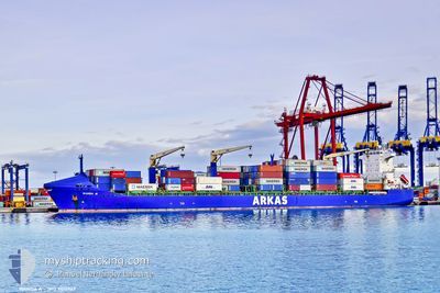
WANDA A
Container Ship
Current Trip
| Time Travelled | 1 day |
|---|---|
| Remaining Time | 2 days |
| Distance Travelled | 663.60 nm |
| Remaining Distance | 819.03 nm |
| AVG Speed | 14.9 Knots |
| MAX Speed | 16.1 Knots |
| AVG Wind | 9.2 knots |
| MAX Wind | 17 knots |
| MIN Temp | 10.2°C / 50.36°F |
| MAX Temp | 17.2°C / 62.96°F |
| Draught | 9.4 m |
| Position Received | 4 m ago |
Current Position
| Longitude | --- |
|---|---|
| Latitude | --- |
| Status | Under way using engine |
| Speed | 16 Knots |
| Course | 110.9° |
| Area | Mediterranean Sea - Eastern Basin |
| Station | T-AIS |
| Position Received | 4 m ago |
Info
Information
The current position of WANDA A is in Mediterranean Sea - Eastern Basin with coordinates 36.23454° / 14.70288° as reported on 2025-03-15 18:24 by AIS to our vessel tracker app. The vessel's current speed is 16 Knots and is heading at the port of ALEXANDRIA. The estimated time of arrival as calculated by MyShipTracking vessel tracking app is 2025-03-18 00:54 LT
The vessel WANDA A (IMO: 9415947, MMSI: 229111000) is a Container Ship that was built in 2009 ( 16 years old ). It's sailing under the flag of [MT] Malta.
In this page you can find informations about the vessels current position, last detected port calls, and current voyage information. If the vessels is not in coverage by AIS you will find the latest position.
The current position of WANDA A is detected by our AIS receivers and we are not responsible for the reliability of the data. The last position was recorded while the vessel was in Coverage by the Ais receivers of our vessel tracking app.
The current draught of WANDA A as reported by AIS is 9.4 meters
Weather
| Temperature | 17.1°C / 62.78°F |
|---|---|
| Wind Speed | 11 knots |
| Direction | 278° W |
| Pressure | 1010.8 hPa |
| Humidity | 83.3 % |
| Cloud Coverage | 26 % |
Featured Company
Last Port Calls
| Port | Arrival | Departure | Time In Port |
|---|---|---|---|
| 2025-03-13 11:49 | 2025-03-13 23:28 | 11 h | |
| 2025-03-12 00:48 | 2025-03-12 12:49 | 12 h | |
| 2025-03-10 09:22 | 2025-03-11 08:17 | 22 h | |
| 2025-03-06 13:31 | 2025-03-07 15:32 | 1 d | |
| 2025-02-23 14:38 | 2025-02-24 03:27 | 12 h | |
| 2025-02-21 01:40 | 2025-02-21 20:43 | 19 h | |
| 2025-02-18 10:44 | 2025-02-19 09:35 | 22 h | |
| 2025-02-17 14:34 | 2025-02-18 01:02 | 10 h | |
| 2025-02-15 03:09 | 2025-02-16 14:33 | 1 d | |
| 2025-02-08 16:19 | 2025-02-09 10:44 | 18 h |
Most Visited Ports (Last year)
| Port | Arrivals | |
|---|---|---|
| 26 | ||
| 15 | ||
| 14 | ||
| 13 | ||
| 13 | ||
| 8 |
Last Trips
| Origin | Departure | Destination | Arrival | Distance | |
|---|---|---|---|---|---|
| 2025-03-12 12:49 | 2025-03-13 11:49 | 205.94 nm | |||
| 2025-03-11 08:17 | 2025-03-12 00:48 | 178.52 nm | |||
| 2025-03-07 15:32 | 2025-03-10 09:22 | 603.60 nm | |||
| 2025-02-24 03:27 | 2025-03-06 13:31 | 1970.12 nm | |||
| 2025-02-21 20:43 | 2025-02-23 14:38 | 611.77 nm | |||
| 2025-02-19 09:35 | 2025-02-21 01:40 | 90.54 nm | |||
| 2025-02-18 01:02 | 2025-02-18 10:44 | 135.09 nm | |||
| 2025-02-16 14:33 | 2025-02-17 14:34 | 369.35 nm | |||
| 2025-02-09 10:44 | 2025-02-15 03:09 | 860.53 nm | |||
| 2025-02-02 09:53 | 2025-02-08 16:19 | 1547.69 nm |
Events
| Time | Event | Details | Position / Dest | Info |
|---|---|---|---|---|
| 2025-03-15 17:46 | Status Changed | Under way using engine Default |
36.29621 / 14.51060
EGALY
|
Speed: 15.4 kn Course: 109° |
| 2025-03-15 16:56 | Status Changed | Default Under way using engine |
36.36561 / 14.25836
EGALY
|
Speed: 15.5 kn Course: 108.8° |
| 2025-03-15 16:17 | Status Changed | Under way using engine Default |
36.43578 / 14.07142
EGALY
|
Speed: 15.5 kn Course: 118° |
| 2025-03-15 15:42 | Status Changed | Default Under way using engine |
36.50822 / 13.90362
EGALY
|
Speed: 15.9 kn Course: 117.9° |
| 2025-03-15 15:28 | Detected in Sea | Maltese part of the Mediterranean Sea - Eastern Basin |
36.53720 / 13.83588
Mediterranean Sea - Eastern Basin
EGALY
|
Speed: 16.1 kn Course: 118.6° |
| 2025-03-15 15:28 | Status Changed | Under way using engine Default |
36.53720 / 13.83588
EGALY
|
Speed: 16 kn Course: 119° |
| 2025-03-15 15:12 | IN Coverage |
36.53720 / 13.83588
Mediterranean Sea - Eastern Basin
EGALY
|
Speed: 16.1 kn Course: 118.6° |
|
| 2025-03-15 12:11 | Status Changed | Default Under way using engine |
36.96491 / 12.89100
EGALY
|
Speed: 15.6 kn Course: 117° |
| 2025-03-15 12:09 | OUT of Coverage |
36.96877 / 12.88176
Mediterranean Sea - Eastern Basin
EGALY
|
Speed: 15.6 kn Course: 117° |
|
| 2025-03-15 12:01 | Status Changed | Under way using engine Default |
36.98417 / 12.84461
EGALY
|
Speed: 15.6 kn Course: 118° |