
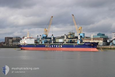
WADOWICE II
Bulk Carrier
Current Trip
| Time Travelled | 2 days |
|---|---|
| Remaining Time | 13 days |
| Distance Travelled | 191.33 nm |
| Remaining Distance | 3484.50 nm |
| AVG Speed | 10.8 Knots |
| MAX Speed | 11.8 Knots |
| AVG Wind | 7.5 knots |
| MAX Wind | 17.8 knots |
| MIN Temp | 21°C / 69.8°F |
| MAX Temp | 24.2°C / 75.56°F |
| Draught | 8.7 m |
| Position Received | 2 m ago |
Current Position
| Longitude | --- |
|---|---|
| Latitude | --- |
| Status | Under way using engine |
| Speed | 10.7 Knots |
| Course | 80.4° |
| Area | South Atlantic Ocean |
| Station | T-AIS |
| Position Received | 2 m ago |
Info
Information
The current position of WADOWICE II is in South Atlantic Ocean with coordinates -23.55688° / -42.29141° as reported on 2024-10-18 07:46 by AIS to our vessel tracker app. The vessel's current speed is 10.7 Knots and is heading at the port of LAS PALMAS. The estimated time of arrival as calculated by MyShipTracking vessel tracking app is 2024-11-01 02:32 LT
The vessel WADOWICE II (IMO: 9488102, MMSI: 311024300) is a Bulk Carrier that was built in 2010 ( 14 years old ). It's sailing under the flag of [BS] Bahamas.
In this page you can find informations about the vessels current position, last detected port calls, and current voyage information. If the vessels is not in coverage by AIS you will find the latest position.
The current position of WADOWICE II is detected by our AIS receivers and we are not responsible for the reliability of the data. The last position was recorded while the vessel was in Coverage by the Ais receivers of our vessel tracking app.
The current draught of WADOWICE II as reported by AIS is 8.7 meters
Weather
| Temperature | 22.2°C / 71.96°F |
|---|---|
| Wind Speed | 7 knots |
| Direction | 185° S |
| Pressure | 1013.1 hPa |
| Humidity | 85.9 % |
| Cloud Coverage | 100 % |
Featured Company
Last Port Calls
| Port | Arrival | Departure | Time In Port |
|---|---|---|---|
| 2024-10-11 18:22 | 2024-10-15 12:09 | 3 d | |
| 2024-08-24 01:50 | 2024-08-25 14:26 | 1 d | |
| 2024-08-05 10:34 |
Last Trips
| Origin | Departure | Destination | Arrival | Distance | |
|---|---|---|---|---|---|
| 2024-08-25 14:26 | 2024-10-11 18:22 | 747.99 nm | |||
| 2024-08-05 10:34 | 2024-08-24 01:50 | 4628.77 nm |
Events
| Time | Event | Details | Position / Dest | Info |
|---|---|---|---|---|
| 2024-10-18 07:40 | Status Changed | Under way using engine Default |
-23.56037 / -42.30926
ES LPA
|
Speed: 10.6 kn Course: 80° |
| 2024-10-18 07:40 | IN Coverage |
-23.55905 / -42.30244
South Atlantic Ocean
ES LPA
|
Speed: 10.7 kn Course: 79.4° |
|
| 2024-10-18 03:52 | Status Changed | Default Under way using engine |
-23.70746 / -43.01380
ES LPA
|
Speed: 10.8 kn Course: 80.8° |
| 2024-10-18 03:49 | OUT of Coverage |
-23.70901 / -43.02405
South Atlantic Ocean
ES LPA
|
Speed: 10.8 kn Course: 80.8° |
|
| 2024-10-18 03:40 | Status Changed | Under way using engine Default |
-23.71333 / -43.05367
ES LPA
|
Speed: 10.8 kn Course: 80° |
| 2024-10-18 03:32 | Status Changed | Default Under way using engine |
-23.71728 / -43.08092
ES LPA
|
Speed: 10.8 kn Course: 80.6° |
| 2024-10-18 02:18 | Draught Changed | 8.7 6.4 |
-23.75391 / -43.31793
ES LPA
|
Speed: 10.6 kn Course: 77.6° |
| 2024-10-18 02:18 | Destination Changed | ES LPA BR SSO |
-23.75391 / -43.31793
ES LPA
|
Speed: 10.6 kn Course: 77.6° |
| 2024-10-18 02:18 | ETA Changed | 2024/10/30 12:00 2024/10/10 23:00 |
-23.75391 / -43.31793
ES LPA
|
Speed: 10.6 kn Course: 77.6° |
| 2024-10-18 02:11 | Status Changed | Under way using engine Default |
-23.75832 / -43.33949
BR SSO
|
Speed: 10.7 kn Course: 79° |