

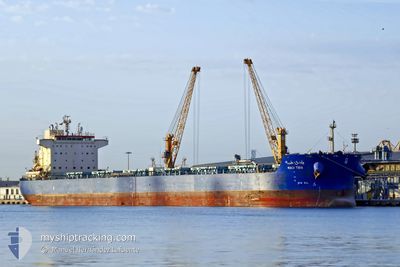
WADI TIBA
Bulk Carrier

Current Trip
| Time Travelled | 15 days |
|---|---|
| Remaining Time | --- |
| Distance Travelled | 2702.72 nm |
| Remaining Distance | --- |
| AVG Speed | 9.7 Knots |
| MAX Speed | 12.4 Knots |
| AVG Wind | 12.8 knots |
| MAX Wind | 41 knots |
| MIN Temp | 11.5°C / 52.7°F |
| MAX Temp | 31.7°C / 89.06°F |
| Draught | 6.7 m |
| Position Received | 3 m ago |
Current Position
| Longitude | --- |
|---|---|
| Latitude | --- |
| Status | At anchor |
| Speed | 0.4 Knots |
| Course | 231° |
| Area | Strait of Gibraltar |
| Station | T-AIS |
| Position Received | 3 m ago |
Information
The current position of WADI TIBA is in Strait of Gibraltar with coordinates 36.09024° / -5.41002° as reported on 2025-03-28 02:41 by AIS to our vessel tracker app. The vessel's current speed is 0.4 Knots
The vessel WADI TIBA (IMO: 9460746, MMSI: 622121409) is a Bulk Carrier that was built in 2011 ( 14 years old ). It's sailing under the flag of [EG] Egypt.
In this page you can find informations about the vessels current position, last detected port calls, and current voyage information. If the vessels is not in coverage by AIS you will find the latest position.
The current position of WADI TIBA is detected by our AIS receivers and we are not responsible for the reliability of the data. The last position was recorded while the vessel was in Coverage by the Ais receivers of our vessel tracking app.
The current draught of WADI TIBA as reported by AIS is 6.7 meters
Weather
| Temperature | 11.6°C / 52.88°F |
|---|---|
| Wind Speed | 7 knots |
| Direction | 272° W |
| Pressure | 1016 hPa |
| Humidity | 82.8 % |
| Cloud Coverage | 5 % |


Featured Company
Last Port Calls
| Port | Arrival | Departure | Time In Port |
|---|---|---|---|
| 2025-03-16 06:20 | 2025-03-16 15:36 | 9 h | |
| 2025-03-08 17:46 | 2025-03-13 04:30 | 4 d | |
| 2025-02-28 07:28 | 2025-02-28 16:38 | 9 h | |
| 2025-01-28 15:07 | 2025-01-28 15:27 | 20 m | |
| 2025-01-27 00:19 | 2025-01-28 14:11 | 1 d |
Most Visited Ports (Last year)
| Port | Arrivals | |
|---|---|---|
| 5 | ||
| 4 | ||
| 3 | ||
| 2 | ||
| 2 | ||
| 1 |
Last Trips
| Origin | Departure | Destination | Arrival | Distance | |
|---|---|---|---|---|---|
| 2025-03-13 04:30 | 2025-03-16 06:20 | 605.44 nm | |||
| 2025-01-28 15:27 | 2025-03-08 17:46 | 7315.58 nm | |||
| 2025-01-28 15:27 | 2025-02-28 07:28 | 6717.96 nm | |||
| 2025-01-28 14:11 | 2025-01-28 15:07 | 8.49 nm | |||
| 2024-12-27 20:01 | 2025-01-27 00:19 | 6790.43 nm |
Events
| Time | Event | Details | Position / Dest | Info |
|---|---|---|---|---|
| 2025-03-27 23:53 | Status Changed | At anchor Under way using engine |
36.08965 / -5.41033
ALGECIRAS
|
Speed: 0.8 kn Course: 227° |
| 2025-03-27 23:43 | Status Changed | Under way using engine At anchor |
36.09062 / -5.40977
ALGECIRAS
|
Speed: 1.9 kn Course: 208° |
| 2025-03-27 22:15 | Status Changed | At anchor Under way using engine |
36.09101 / -5.41397
ALGECIRAS
|
Speed: 0.1 kn Course: 15° |
| 2025-03-27 22:11 | STOP Moving | 2.75 nm, South of ALGECIRAS |
36.09096 / -5.41385
ALGECIRAS
|
Speed: 0.3 kn Course: 27° |
| 2025-03-27 21:46 | Change Sea Area | Spanish part of the Strait of Gibraltar Gibraltarian part of the Strait of Gibraltar |
36.08940 / -5.38941
Strait of Gibraltar
|
Speed: 6.3 kn Course: 263° |
| 2025-03-27 21:31 | Change Sea Area | Gibraltarian part of the Strait of Gibraltar Gibraltarian part of the Alboran Sea |
36.08697 / -5.34407
Strait of Gibraltar
|
Speed: 9.8 kn Course: 276.2° |
| 2025-03-27 20:40 | Change Sea Area | Gibraltarian part of the Alboran Sea Spanish part of the Alboran Sea |
36.14509 / -5.19638
Alboran Sea
|
Speed: 12.2 kn Course: 232.7° |
| 2025-03-27 13:15 | Change Sea Area | Spanish part of the Alboran Sea Gibraltarian part of the Alboran Sea |
36.14821 / -5.20643
Alboran Sea
ALGECIRAS
|
Speed: 8.1 kn Course: 56.7° |
| 2025-03-27 12:26 | Destination Changed | ALGECIRAS GIB |
36.07144 / -5.29879
ALGECIRAS
|
Speed: 10.1 kn Course: 277.1° |
| 2025-03-27 10:55 | Change Sea Area | Gibraltarian part of the Alboran Sea Spanish part of the Alboran Sea |
36.10393 / -4.97728
Alboran Sea
GIB
|
Speed: 9.9 kn Course: 258.7° |