
W M F EXPRESS
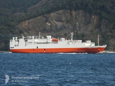
Livestock Carrier
Current Trip
| Time Travelled | 8 days |
|---|---|
| Remaining Time | --- |
| Distance Travelled | 2804.49 nm |
| Remaining Distance | --- |
| AVG Speed | 13.7 Knots |
| MAX Speed | 15.2 Knots |
| AVG Wind | 11.8 knots |
| MAX Wind | 18 knots |
| MIN Temp | 19.3°C / 66.74°F |
| MAX Temp | 27.1°C / 80.78°F |
| Draught | 6.7 m |
| Position Received | 3 h, 37 m ago |
Current Position
| Longitude | --- |
|---|---|
| Latitude | --- |
| Status | Under way using engine |
| Speed | 13.8 Knots |
| Course | 42.7° |
| Area | North Atlantic Ocean |
| Station | T-AIS |
| Position Received | 3 h, 37 m ago |
Info
Information
The current position of W M F EXPRESS is in North Atlantic Ocean with coordinates 10.78458° / -19.40250° as reported on 2025-12-12 07:38 by AIS to our vessel tracker app. The vessel's current speed is 13.8 Knots
The vessel W M F EXPRESS (IMO: 9004413, MMSI: 630001083) is a Livestock Carrier that was built in 1991 ( 34 years old ). It's sailing under the flag of [GW] Guinea-Bissau.
In this page you can find informations about the vessels current position, last detected port calls, and current voyage information. If the vessels is not in coverage by AIS you will find the latest position.
The current position of W M F EXPRESS is detected by our AIS receivers and we are not responsible for the reliability of the data. The last position was recorded while the vessel was in Coverage by the Ais receivers of our vessel tracking app.
The current draught of W M F EXPRESS as reported by AIS is 6.7 meters
Weather
| Temperature | 25.7°C / 78.26°F |
|---|---|
| Wind Speed | 14 knots |
| Direction | 16° NNE |
| Pressure | 1013.2 hPa |
| Humidity | 65.5 % |
| Cloud Coverage | 59 % |
Featured Company
Last Port Calls
| Port | Arrival | Departure | Time In Port |
|---|---|---|---|
| 2025-12-02 10:36 | 2025-12-03 21:16 | 1 d | |
| 2025-10-31 08:14 | 2025-11-02 08:52 | 2 d | |
| 2025-10-20 08:18 | 2025-10-22 19:31 | 2 d | |
| 2025-10-02 18:22 | 2025-10-05 06:48 | 2 d |
Most Visited Ports (Last year)
| Port | Arrivals | |
|---|---|---|
| 3 | ||
| 3 | ||
| 3 | ||
| 1 | ||
| 1 | ||
| 1 |
Last Trips
| Origin | Departure | Destination | Arrival | Distance | |
|---|---|---|---|---|---|
| 2025-11-02 08:52 | 2025-12-02 10:36 | 4867.38 nm | |||
| 2025-10-22 19:31 | 2025-10-31 08:14 | 1785.22 nm | |||
| 2025-10-05 06:48 | 2025-10-20 08:18 | 5239.67 nm | |||
| 2025-08-26 22:18 | 2025-10-02 18:22 | 1156.19 nm |
Events
| Time | Event | Details | Position / Dest | Info |
|---|---|---|---|---|
| 2025-12-12 07:42 | Status Changed | Default Under way using engine |
10.79476 / -19.39184
DZ ALG
|
Speed: 13.8 kn Course: 42.7° |
| 2025-12-12 07:38 | OUT of Coverage |
10.78458 / -19.40250
North Atlantic Ocean
DZ ALG
|
Speed: 13.8 kn Course: 42.7° |
|
| 2025-12-12 07:37 | Status Changed | Under way using engine Default |
10.78275 / -19.40422
DZ ALG
|
Speed: 13 kn Course: 42° |
| 2025-12-12 06:54 | Status Changed | Default Under way using engine |
10.67076 / -19.52759
DZ ALG
|
Speed: 13.4 kn Course: 50.2° |
| 2025-12-12 06:38 | Destination Changed | DZ ALG BR RIO |
10.62822 / -19.57286
DZ ALG
|
Speed: 13.6 kn Course: 44.4° |
| 2025-12-12 06:38 | ETA Changed | 2025/12/18 12:00 2025/11/16 16:00 |
10.62822 / -19.57286
DZ ALG
|
Speed: 13.6 kn Course: 44.4° |
| 2025-12-12 06:34 | Change Sea Area | Guinea Bissau part of the North Atlantic Ocean High seas of the North Atlantic Ocean |
10.61791 / -19.58387
North Atlantic Ocean
|
Speed: 13.6 kn Course: 45.4° |
| 2025-12-12 06:32 | Status Changed | Under way using engine Default |
10.61311 / -19.58890
BR RIO
|
Speed: 13 kn Course: 50° |
| 2025-12-12 06:29 | IN Coverage |
10.61791 / -19.58387
North Atlantic Ocean
|
Speed: 13.6 kn Course: 45.4° |
|
| 2025-12-12 04:24 | OUT of Coverage |
10.27802 / -19.95109
North Atlantic Ocean
|
Speed: 13.7 kn Course: 49.6° |