

VIVARIUM-L
Cargo

Current Trip
| Time Travelled | 2 days |
|---|---|
| Remaining Time | 15 h, 8 mins |
| Distance Travelled | 118.46 nm |
| Remaining Distance | 91.92 nm |
| AVG Speed | 5.1 Knots |
| MAX Speed | 6 Knots |
| AVG Wind | 5.3 knots |
| MAX Wind | 10.2 knots |
| MIN Temp | 2.5°C / 36.5°F |
| MAX Temp | 12.1°C / 53.78°F |
| Draught | 2.3 m |
| Position Received | 1 m ago |
Current Position
| Longitude | --- |
|---|---|
| Latitude | --- |
| Status | Under way using engine |
| Speed | 5.1 Knots |
| Course | 234.2° |
| Area | North Sea |
| Station | T-AIS |
| Position Received | 1 m ago |
Information
The current position of VIVARIUM-L is in North Sea with coordinates 52.30045° / 9.02926° as reported on 2025-03-29 12:30 by AIS to our vessel tracker app. The vessel's current speed is 5.1 Knots and is heading at the port of VAHLDORF. The estimated time of arrival as calculated by MyShipTracking vessel tracking app is 2025-03-30 05:40 LT
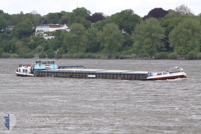
The vessel VIVARIUM-L (MMSI: 211581910) is a Cargo It's sailing under the flag of [DE] Germany.
In this page you can find informations about the vessels current position, last detected port calls, and current voyage information. If the vessels is not in coverage by AIS you will find the latest position.
The current position of VIVARIUM-L is detected by our AIS receivers and we are not responsible for the reliability of the data. The last position was recorded while the vessel was in Coverage by the Ais receivers of our vessel tracking app.
The current draught of VIVARIUM-L as reported by AIS is 2.3 meters
Weather
| Temperature | 12°C / 53.6°F |
|---|---|
| Wind Speed | 10 knots |
| Direction | 328° NNW |
| Pressure | 1017.9 hPa |
| Humidity | 44.2 % |
| Cloud Coverage | 69 % |


Featured Company
Last Port Calls
| Port | Arrival | Departure | Time In Port |
|---|---|---|---|
| 2025-03-26 17:20 | 2025-03-27 06:07 | 12 h | |
| 2025-03-24 17:52 | 2025-03-26 11:53 | 1 d | |
| 2025-03-23 10:40 | 2025-03-24 14:31 | 1 d | |
| 2025-03-22 16:59 | 2025-03-23 09:26 | 16 h | |
| 2025-03-12 16:04 | 2025-03-16 23:27 | 4 d | |
| 2025-03-08 14:31 | 2025-03-08 15:20 | 48 m | |
| 2025-03-07 11:51 | 2025-03-07 13:00 | 1 h | |
| 2025-03-06 14:35 | 2025-03-07 06:40 | 16 h | |
| 2025-02-19 19:33 | 2025-02-20 06:59 | 11 h | |
| 2025-02-18 19:59 | 2025-02-19 08:15 | 12 h |
Most Visited Ports (Last year)
| Port | Arrivals | |
|---|---|---|
| 24 | ||
| 17 | ||
| 17 | ||
| 12 | ||
| 11 | ||
| 6 |
Last Trips
| Origin | Departure | Destination | Arrival | Distance | |
|---|---|---|---|---|---|
| 2025-03-26 11:53 | 2025-03-26 17:20 | 38.38 nm | |||
| 2025-03-24 14:31 | 2025-03-24 17:52 | 27.51 nm | |||
| 2025-03-23 09:26 | 2025-03-23 10:40 | 10.85 nm | |||
| 2025-03-16 23:27 | 2025-03-22 16:59 | 76.85 nm | |||
| 2025-03-08 15:20 | 2025-03-12 16:04 | 164.29 nm | |||
| 2025-03-07 13:00 | 2025-03-08 14:31 | 43.46 nm | |||
| 2025-03-07 06:40 | 2025-03-07 11:51 | 48.06 nm | |||
| 2025-02-20 06:59 | 2025-03-06 14:35 | 81.36 nm | |||
| 2025-02-19 08:15 | 2025-02-19 19:33 | 42.54 nm | |||
| 2025-02-12 11:18 | 2025-02-18 19:59 | 253.21 nm |
Events
| Time | Event | Details | Position / Dest | Info |
|---|---|---|---|---|
| 2025-03-29 12:23 | IN Coverage |
52.30509 / 9.03976
North Sea
|
Speed: 5 kn Course: 234.3° |
|
| 2025-03-29 09:56 | OUT of Coverage |
52.38851 / 9.33443
North Sea
|
Speed: 5 kn Course: 265.7° |
|
| 2025-03-29 06:52 | IN Coverage |
52.40952 / 9.73451
North Sea
|
Speed: 4.5 kn Course: 304.2° |
|
| 2025-03-28 05:49 | OUT of Coverage |
52.52553 / 10.65816
North Sea
|
Speed: 5 kn Course: 168.2° |
|
| 2025-03-28 04:52 | Status Changed | Under way using engine Moored |
52.60241 / 10.67990
VAHLDORF
|
Speed: 0.6 kn Course: 511° |
| 2025-03-28 04:49 | IN Coverage |
52.60318 / 10.68015
North Sea
|
Speed: 0.6 kn Course: 350.3° |
|
| 2025-03-27 17:32 | OUT of Coverage |
52.60317 / 10.68028
North Sea
|
Speed: 0.2 kn Course: 511° |
|
| 2025-03-27 17:31 | Status Changed | Moored Under way using engine |
52.60318 / 10.68034
VAHLDORF
|
Speed: 0.4 kn Course: 511° |
| 2025-03-27 17:31 | STOP Moving | 7.29 nm, South of WITTINGEN |
52.60318 / 10.68034
VAHLDORF
|
Speed: 0.3 kn Course: 511° |
| 2025-03-27 17:20 | IN Coverage |
52.61161 / 10.68023
North Sea
|
Speed: 5.1 kn Course: 171.6° |