
VIVARE
Cargo
Current Trip
| Time Travelled | 1 day |
|---|---|
| Remaining Time | -6 mins |
| Distance Travelled | 156.38 nm |
| Remaining Distance | 1.73 nm |
| AVG Speed | 9.6 Knots |
| MAX Speed | 11.3 Knots |
| AVG Wind | 3.2 knots |
| MAX Wind | 7 knots |
| MIN Temp | -0.2°C / 31.64°F |
| MAX Temp | 5.3°C / 41.54°F |
| Draught | 0 m |
| Position Received | 1 m ago |
Current Position
| Longitude | --- |
|---|---|
| Latitude | --- |
| Status | Under way using engine |
| Speed | 0.1 Knots |
| Course | 112° |
| Area | North Sea |
| Station | T-AIS |
| Position Received | 1 m ago |
Info
Information
The current position of VIVARE is in North Sea with coordinates 50.82266° / 7.01784° as reported on 2025-12-05 19:31 by AIS to our vessel tracker app. The vessel's current speed is 0.1 Knots and is heading at the port of LULSDORF. The estimated time of arrival as calculated by MyShipTracking vessel tracking app is 2025-12-05 20:26 LT
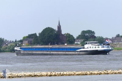
The vessel VIVARE (MMSI: 244615424) is a Cargo It's sailing under the flag of [NL] Netherlands.
In this page you can find informations about the vessels current position, last detected port calls, and current voyage information. If the vessels is not in coverage by AIS you will find the latest position.
The current position of VIVARE is detected by our AIS receivers and we are not responsible for the reliability of the data. The last position was recorded while the vessel was in Coverage by the Ais receivers of our vessel tracking app.
Weather
| Temperature | 4.8°C / 40.64°F |
|---|---|
| Wind Speed | 6 knots |
| Direction | 163° SSE |
| Pressure | 1012.4 hPa |
| Humidity | 76.4 % |
| Cloud Coverage | 49 % |
Featured Company
Last Port Calls
| Port | Arrival | Departure | Time In Port |
|---|---|---|---|
| 2025-12-03 21:37 | 2025-12-04 11:18 | 13 h | |
| 2025-11-29 19:53 | 2025-12-02 04:04 | 2 d | |
| 2025-11-26 18:31 | 2025-11-27 05:58 | 11 h | |
| 2025-11-20 14:45 | 2025-11-24 09:27 | 3 d | |
| 2025-11-13 21:03 | 2025-11-13 21:36 | 32 m | |
| 2025-11-13 09:32 | 2025-11-13 17:02 | 7 h | |
| 2025-10-17 16:15 | 2025-11-12 13:13 | 25 d | |
| 2025-10-16 15:09 | 2025-10-16 19:52 | 4 h | |
| 2025-10-15 14:00 | 2025-10-16 14:48 | 1 d | |
| 2025-10-15 06:44 | 2025-10-15 10:41 | 3 h |
Last Trips
| Origin | Departure | Destination | Arrival | Distance | |
|---|---|---|---|---|---|
| 2025-12-02 04:04 | 2025-12-03 21:37 | 162.89 nm | |||
| 2025-11-27 05:58 | 2025-11-29 19:53 | 157.94 nm | |||
| 2025-11-24 09:27 | 2025-11-26 18:31 | 92.17 nm | |||
| 2025-11-13 21:36 | 2025-11-20 14:45 | 313.04 nm | |||
| 2025-11-13 17:02 | 2025-11-13 21:03 | 30.96 nm | |||
| 2025-11-12 13:13 | 2025-11-13 09:32 | 70.00 nm | |||
| 2025-10-16 19:52 | 2025-10-17 16:15 | 92.74 nm | |||
| 2025-10-16 14:48 | 2025-10-16 15:09 | 1.25 nm | |||
| 2025-10-15 10:41 | 2025-10-15 14:00 | 20.57 nm | |||
| 2025-10-14 13:28 | 2025-10-15 06:44 | 67.43 nm |
Events
| Time | Event | Details | Position / Dest | Info |
|---|---|---|---|---|
| 2025-12-05 19:31 | STOP Moving | 0.06 nm, South of LULSDORF |
50.82266 / 7.01784
|
Speed: 0.1 kn Course: 112° |
| 2025-12-05 17:09 | IN Coverage |
50.49953 / 7.31654
North Sea
|
Speed: 10.8 kn Course: 320.3° |
|
| 2025-12-05 14:54 | Status Changed | Default Under way using engine |
50.25167 / 7.65167
|
Speed: 9.9 kn Course: 356.8° |
| 2025-12-05 14:05 | OUT of Coverage |
50.18240 / 7.64401
North Sea
|
Speed: 9.9 kn Course: 356.8° |
|
| 2025-12-05 08:10 | IN Coverage |
49.72571 / 8.44328
North Sea
|
Speed: 10 kn Course: 33.3° |
|
| 2025-12-04 21:39 | Status Changed | Default Under way using engine |
49.48333 / 8.51500
|
Speed: 2.4 kn Course: 299° |
| 2025-12-04 21:39 | STOP Moving | 2.54 nm, East of MANNHEIM |
49.48333 / 8.51500
|
Speed: Course: -1° |
| 2025-12-04 21:33 | OUT of Coverage |
49.48296 / 8.51638
North Sea
|
Speed: 2.4 kn Course: 302.6° |
|
| 2025-12-04 21:13 | Status Changed | Under way using engine Default |
49.47895 / 8.56112
|
Speed: 6 kn Course: 353° |
| 2025-12-04 21:13 | IN Coverage |
49.47895 / 8.56112
North Sea
|
Speed: 6.2 kn Course: 256.2° |