

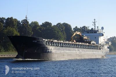
VITIN
General Cargo

Current Trip
| Trip Time | 12 mins |
|---|---|
| Trip Distance | 0.29 nm |
| AVG Speed | --- |
| MAX Speed | --- |
| Draught | 5.5 m |
| AVG Wind | 6 knots |
| MAX Wind | 6 knots |
| MIN Temp | 5.9°C / 42.62°F |
| MAX Temp | 6°C / 42.8°F |
| Position Received | 1 d ago |
Current Position
| Longitude | --- |
|---|---|
| Latitude | --- |
| Status | Under way using engine |
| Speed | 8 Knots |
| Course | 265° |
| Area | Norwegian Sea |
| Station | T-AIS |
| Position Received | 1 d ago |
Information
The current position of VITIN is in Norwegian Sea with coordinates 62.24358° / 2.30544° as reported on 2025-04-13 09:36 by AIS to our vessel tracker app. The vessel's current speed is 8 Knots and is currently inside the port of SOLDARFJORDUR.
The vessel VITIN (IMO: 9006289, MMSI: 231114000) is a General Cargo that was built in 1992 ( 33 years old ). It's sailing under the flag of [FO] Faroe Is.
In this page you can find informations about the vessels current position, last detected port calls, and current voyage information. If the vessels is not in coverage by AIS you will find the latest position.
The current position of VITIN is detected by our AIS receivers and we are not responsible for the reliability of the data. The last position was recorded while the vessel was in Coverage by the Ais receivers of our vessel tracking app.
The current draught of VITIN as reported by AIS is 5.5 meters
Weather
| Temperature | 5.3°C / 41.54°F |
|---|---|
| Wind Speed | 6 knots |
| Direction | 194° SSW |
| Pressure | 995.2 hPa |
| Humidity | 77 % |
| Cloud Coverage | 8 % |


Featured Company
Last Port Calls
| Port | Arrival | Departure | Time In Port |
|---|---|---|---|
| 2025-04-14 20:20 | |||
| 2025-04-14 18:04 | 2025-04-14 20:08 | 2 h | |
| 2025-04-12 20:40 | 2025-04-12 23:42 | 3 h | |
| 2025-04-07 18:05 | 2025-04-10 13:09 | 2 d | |
| 2025-04-01 17:52 | 2025-04-02 14:20 | 20 h | |
| 2025-03-30 13:11 | 2025-03-30 17:43 | 4 h | |
| 2025-03-28 00:20 | 2025-03-28 15:58 | 15 h | |
| 2025-03-25 19:09 | 2025-03-26 01:25 | 6 h | |
| 2025-03-23 11:12 | 2025-03-24 04:17 | 17 h | |
| 2025-03-19 17:00 | 2025-03-20 11:24 | 18 h |
Last Trips
| Origin | Departure | Destination | Arrival | Distance | |
|---|---|---|---|---|---|
| 2025-04-14 20:08 | 2025-04-14 20:20 | 0.29 nm | |||
| 2025-04-12 23:42 | 2025-04-14 18:04 | 356.19 nm | |||
| 2025-04-10 13:09 | 2025-04-12 20:40 | 510.81 nm | |||
| 2025-04-02 14:20 | 2025-04-07 18:05 | 1118.86 nm | |||
| 2025-03-30 17:43 | 2025-04-01 17:52 | 421.94 nm | |||
| 2025-03-28 15:58 | 2025-03-30 13:11 | 441.03 nm | |||
| 2025-03-26 01:25 | 2025-03-28 00:20 | 353.57 nm | |||
| 2025-03-24 04:17 | 2025-03-25 19:09 | 118.18 nm | |||
| 2025-03-20 11:24 | 2025-03-23 11:12 | 415.79 nm | |||
| 2025-03-18 19:34 | 2025-03-19 17:00 | 212.61 nm |
Events
| Time | Event | Details | Position / Dest | Info |
|---|---|---|---|---|
| 2025-04-14 19:20 | STOP Moving |
62.15635 / -6.75467
[FO] SOLDARFJORDUR
|
Speed: Course: 149° |
|
| 2025-04-14 19:20 | PORT ARRIVAL |
|
62.15635 / -6.75467
[FO] SOLDARFJORDUR
|
Speed: 1.9 kn Course: 120° |
| 2025-04-14 19:08 | START Moving | 0.34 nm, North West of SOLDARFJORDUR |
62.15860 / -6.76383
RUNAVIK
|
Speed: 3.5 kn Course: 116° |
| 2025-04-14 19:08 | PORT DEPARTURE |
|
62.15860 / -6.76383
RUNAVIK
|
Speed: 0.5 kn Course: 191° |
| 2025-04-14 17:04 | STOP Moving |
62.16067 / -6.78013
[FO] SKALI
|
Speed: Course: 239° |
|
| 2025-04-14 17:04 | PORT ARRIVAL |
|
62.16067 / -6.78013
[FO] SKALI
|
Speed: 0.6 kn Course: 254° |
| 2025-04-13 09:36 | OUT of Coverage |
62.24358 / 2.30544
Norwegian Sea
RUNAVIK
|
Speed: 8 kn Course: 265° |
|
| 2025-04-13 04:01 | Destination Changed | RUNAVIK SKALA |
62.26463 / 3.75925
RUNAVIK
|
Speed: 8 kn Course: 263.4° |
| 2025-04-12 21:42 | PORT DEPARTURE |
|
62.31918 / 5.66728
SKALA
|
Speed: 4 kn Course: 237° |
| 2025-04-12 21:41 | START Moving |
62.31990 / 5.66968
[NO] MJOLSTADNESET
|
Speed: 4 kn Course: 237° |